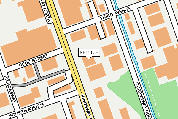
NE11 0JH is located in the Lobley Hill and Bensham electoral ward, within the metropolitan district of Gateshead and the English Parliamentary constituency of Gateshead. The Sub Integrated Care Board (ICB) Location is NHS North East and North Cumbria ICB - 13T and the police force is Northumbria. This postcode has been in use since December 1995.


GetTheData
Source: OS OpenMap – Local (Ordnance Survey)
Source: OS VectorMap District (Ordnance Survey)
Licence: Open Government Licence (requires attribution)
| Easting | 424372 |
| Northing | 560402 |
| Latitude | 54.937697 |
| Longitude | -1.621130 |
GetTheData
Source: Open Postcode Geo
Licence: Open Government Licence
| Country | England |
| Postcode District | NE11 |
➜ See where NE11 is on a map ➜ Where is Gateshead? | |
GetTheData
Source: Land Registry Price Paid Data
Licence: Open Government Licence
Elevation or altitude of NE11 0JH as distance above sea level:
| Metres | Feet | |
|---|---|---|
| Elevation | 10m | 33ft |
Elevation is measured from the approximate centre of the postcode, to the nearest point on an OS contour line from OS Terrain 50, which has contour spacing of ten vertical metres.
➜ How high above sea level am I? Find the elevation of your current position using your device's GPS.
GetTheData
Source: Open Postcode Elevation
Licence: Open Government Licence
| Ward | Lobley Hill And Bensham |
| Constituency | Gateshead |
GetTheData
Source: ONS Postcode Database
Licence: Open Government Licence
| Kingsway-fourth Avenue (Kingsway North) | Team Valley | 52m |
| Kingsway-fourth Avenue (Kingsway North) | Team Valley | 89m |
| Third Avenue-queensway North (Third Avenue) | Team Valley | 162m |
| Kingsway-fifth Avenue (Kingsway North) | Team Valley | 233m |
| Kingsway-second Avenue (Kingsway North) | Team Valley | 241m |
| Dunston Station | 1.9km |
| Newcastle Station | 3.4km |
| Metrocentre Station | 3.7km |
GetTheData
Source: NaPTAN
Licence: Open Government Licence
Estimated total energy consumption in NE11 0JH by fuel type, 2015.
| Consumption (kWh) | 187,123 |
|---|---|
| Meter count | 8 |
| Mean (kWh/meter) | 23,390 |
| Median (kWh/meter) | 21,113 |
GetTheData
Source: Postcode level gas estimates: 2015 (experimental)
Source: Postcode level electricity estimates: 2015 (experimental)
Licence: Open Government Licence
GetTheData
Source: ONS Postcode Database
Licence: Open Government Licence


➜ Get more ratings from the Food Standards Agency
GetTheData
Source: Food Standards Agency
Licence: FSA terms & conditions
| Last Collection | |||
|---|---|---|---|
| Location | Mon-Fri | Sat | Distance |
| Third Avenue | 17:30 | 12:15 | 133m |
| Fourth Avenue | 18:30 | 475m | |
| Team Valley Shopping Village | 496m | ||
GetTheData
Source: Dracos
Licence: Creative Commons Attribution-ShareAlike
The below table lists the International Territorial Level (ITL) codes (formerly Nomenclature of Territorial Units for Statistics (NUTS) codes) and Local Administrative Units (LAU) codes for NE11 0JH:
| ITL 1 Code | Name |
|---|---|
| TLC | North East (England) |
| ITL 2 Code | Name |
| TLC2 | Northumberland, and Tyne and Wear |
| ITL 3 Code | Name |
| TLC22 | Tyneside |
| LAU 1 Code | Name |
| E08000037 | Gateshead |
GetTheData
Source: ONS Postcode Directory
Licence: Open Government Licence
The below table lists the Census Output Area (OA), Lower Layer Super Output Area (LSOA), and Middle Layer Super Output Area (MSOA) for NE11 0JH:
| Code | Name | |
|---|---|---|
| OA | E00041888 | |
| LSOA | E01008259 | Gateshead 007D |
| MSOA | E02001688 | Gateshead 007 |
GetTheData
Source: ONS Postcode Directory
Licence: Open Government Licence
| NE11 0JQ | Kingsway | 201m |
| NE11 0NY | Queensway North | 238m |
| NE11 0LQ | Princes Park | 257m |
| NE11 0QY | North East Fruit & Vegetable Market | 524m |
| NE11 0HF | Fifth Avenue | 577m |
| NE11 0RH | First Avenue | 583m |
| NE11 0NB | Fifth Avenue | 586m |
| NE11 0TX | Bamburgh Court | 598m |
| NE11 0XA | Fifth Avenue | 606m |
| NE11 0DY | Coach Road | 609m |
GetTheData
Source: Open Postcode Geo; Land Registry Price Paid Data
Licence: Open Government Licence