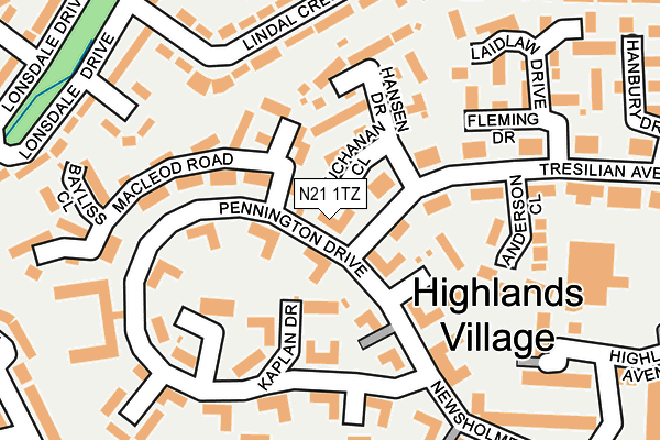
N21 1TZ lies on Pennington Drive in London. N21 1TZ is located in the Oakwood electoral ward, within the London borough of Enfield and the English Parliamentary constituency of Enfield, Southgate. The Sub Integrated Care Board (ICB) Location is NHS North Central London ICB - 93C and the police force is Metropolitan Police. This postcode has been in use since June 1998.


GetTheData
Source: OS OpenMap – Local (Ordnance Survey)
Source: OS VectorMap District (Ordnance Survey)
Licence: Open Government Licence (requires attribution)
| Easting | 530553 |
| Northing | 195840 |
| Latitude | 51.646209 |
| Longitude | -0.114509 |
GetTheData
Source: Open Postcode Geo
Licence: Open Government Licence
| Street | Pennington Drive |
| Town/City | London |
| Country | England |
| Postcode District | N21 |
| ➜ N21 open data dashboard ➜ See where N21 is on a map ➜ Where is London? | |
GetTheData
Source: Land Registry Price Paid Data
Licence: Open Government Licence
Elevation or altitude of N21 1TZ as distance above sea level:
| Metres | Feet | |
|---|---|---|
| Elevation | 60m | 197ft |
Elevation is measured from the approximate centre of the postcode, to the nearest point on an OS contour line from OS Terrain 50, which has contour spacing of ten vertical metres.
➜ How high above sea level am I? Find the elevation of your current position using your device's GPS.
GetTheData
Source: Open Postcode Elevation
Licence: Open Government Licence
| Ward | Oakwood |
| Constituency | Enfield, Southgate |
GetTheData
Source: ONS Postcode Database
Licence: Open Government Licence
| January 2024 | Other theft | On or near Fothergill Drive | 187m |
| January 2024 | Vehicle crime | On or near Park/Open Space | 383m |
| November 2023 | Vehicle crime | On or near Fothergill Drive | 187m |
| ➜ Pennington Drive crime map and outcomes | |||
GetTheData
Source: data.police.uk
Licence: Open Government Licence
| Pennington Drive | Grange Park | 16m |
| Blackwell Close (Pennington Drive) | Oakwood | 159m |
| Highlands Village Elizabeth Lodge (Pennington Drive) | Oakwood | 200m |
| Rutherford Court (Newsholme Avenue) | Grange Park | 262m |
| Tambank | Grange Park | 269m |
| Oakwood Underground Station | Oakwood | 1,234m |
| Grange Park Station | 1.3km |
| Winchmore Hill Station | 1.7km |
| Enfield Chase Station | 1.8km |
GetTheData
Source: NaPTAN
Licence: Open Government Licence
| Percentage of properties with Next Generation Access | 100.0% |
| Percentage of properties with Superfast Broadband | 100.0% |
| Percentage of properties with Ultrafast Broadband | 100.0% |
| Percentage of properties with Full Fibre Broadband | 0.0% |
Superfast Broadband is between 30Mbps and 300Mbps
Ultrafast Broadband is > 300Mbps
| Percentage of properties unable to receive 2Mbps | 0.0% |
| Percentage of properties unable to receive 5Mbps | 0.0% |
| Percentage of properties unable to receive 10Mbps | 0.0% |
| Percentage of properties unable to receive 30Mbps | 0.0% |
GetTheData
Source: Ofcom
Licence: Ofcom Terms of Use (requires attribution)
GetTheData
Source: ONS Postcode Database
Licence: Open Government Licence


➜ Get more ratings from the Food Standards Agency
GetTheData
Source: Food Standards Agency
Licence: FSA terms & conditions
| Last Collection | |||
|---|---|---|---|
| Location | Mon-Fri | Sat | Distance |
| 8 Chaseville Park Road | 17:30 | 12:00 | 283m |
| Worlds End Lane | 17:30 | 12:00 | 358m |
| Merryhills Drive | 17:30 | 12:00 | 395m |
GetTheData
Source: Dracos
Licence: Creative Commons Attribution-ShareAlike
| Facility | Distance |
|---|---|
| World Ends Lane Sports Ground Green Dragon Lane, London Grass Pitches | 454m |
| Highlands School Worlds End Lane, London Sports Hall, Artificial Grass Pitch, Grass Pitches, Studio | 649m |
| St Thomas's Oakwood Church Hall Prince George Avenue, London Sports Hall | 812m |
GetTheData
Source: Active Places
Licence: Open Government Licence
| School | Phase of Education | Distance |
|---|---|---|
| Eversley Primary School Chaseville Park Road, London, N21 1PD | Primary | 314m |
| Grange Park Primary School World's End Lane, Winchmore Hill, London, N21 1PP | Primary | 450m |
| Highlands School 148 Worlds End Lane, London, N21 1QQ | Secondary | 521m |
GetTheData
Source: Edubase
Licence: Open Government Licence
The below table lists the International Territorial Level (ITL) codes (formerly Nomenclature of Territorial Units for Statistics (NUTS) codes) and Local Administrative Units (LAU) codes for N21 1TZ:
| ITL 1 Code | Name |
|---|---|
| TLI | London |
| ITL 2 Code | Name |
| TLI5 | Outer London - East and North East |
| ITL 3 Code | Name |
| TLI54 | Enfield |
| LAU 1 Code | Name |
| E09000010 | Enfield |
GetTheData
Source: ONS Postcode Directory
Licence: Open Government Licence
The below table lists the Census Output Area (OA), Lower Layer Super Output Area (LSOA), and Middle Layer Super Output Area (MSOA) for N21 1TZ:
| Code | Name | |
|---|---|---|
| OA | E00007541 | |
| LSOA | E01001522 | Enfield 019B |
| MSOA | E02000295 | Enfield 019 |
GetTheData
Source: ONS Postcode Directory
Licence: Open Government Licence
| N21 1TR | Pennington Drive | 41m |
| N21 1TL | Pennington Drive | 53m |
| N21 1SG | Buchanan Close | 56m |
| N21 1TJ | Tresilian Avenue | 64m |
| N21 1AF | Pennington Drive | 81m |
| N21 1TP | Pennington Drive | 94m |
| N21 1SB | Hansen Drive | 104m |
| N21 1SR | Simpson Close | 108m |
| N21 1SY | Pennington Drive | 112m |
| N21 1TN | Pennington Drive | 122m |
GetTheData
Source: Open Postcode Geo; Land Registry Price Paid Data
Licence: Open Government Licence