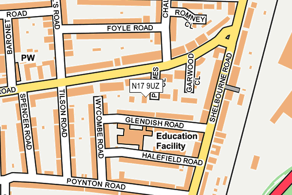
N17 9UZ is located in the Northumberland Park electoral ward, within the London borough of Haringey and the English Parliamentary constituency of Tottenham. The Sub Integrated Care Board (ICB) Location is NHS North Central London ICB - 93C and the police force is Metropolitan Police. This postcode has been in use since August 2005.


GetTheData
Source: OS OpenMap – Local (Ordnance Survey)
Source: OS VectorMap District (Ordnance Survey)
Licence: Open Government Licence (requires attribution)
| Easting | 534556 |
| Northing | 190664 |
| Latitude | 51.598756 |
| Longitude | -0.058650 |
GetTheData
Source: Open Postcode Geo
Licence: Open Government Licence
| Country | England |
| Postcode District | N17 |
➜ See where N17 is on a map | |
GetTheData
Source: Land Registry Price Paid Data
Licence: Open Government Licence
Elevation or altitude of N17 9UZ as distance above sea level:
| Metres | Feet | |
|---|---|---|
| Elevation | 10m | 33ft |
Elevation is measured from the approximate centre of the postcode, to the nearest point on an OS contour line from OS Terrain 50, which has contour spacing of ten vertical metres.
➜ How high above sea level am I? Find the elevation of your current position using your device's GPS.
GetTheData
Source: Open Postcode Elevation
Licence: Open Government Licence
| Ward | Northumberland Park |
| Constituency | Tottenham |
GetTheData
Source: ONS Postcode Database
Licence: Open Government Licence
| Chalgrove Road (Lansdowne Road) | Northumberland Park | 52m |
| Chalgrove Road (Lansdowne Road) | Northumberland Park | 78m |
| Halefield Road (Selborne Road) | Northumberland Park | 193m |
| Spencer Road Lansdowne Road | Northumberland Park | 211m |
| Halefield Road (Selborne Road) | Northumberland Park | 211m |
| Tottenham Hale Underground Station | Tottenham Hale | 1,189m |
| Blackhorse Road Underground Station | Blackhorse Road | 1,791m |
| Northumberland Park Station | 0.5km |
| Bruce Grove Station | 0.9km |
| White Hart Lane Station | 1.1km |
GetTheData
Source: NaPTAN
Licence: Open Government Licence
| Percentage of properties with Next Generation Access | 100.0% |
| Percentage of properties with Superfast Broadband | 100.0% |
| Percentage of properties with Ultrafast Broadband | 0.0% |
| Percentage of properties with Full Fibre Broadband | 0.0% |
Superfast Broadband is between 30Mbps and 300Mbps
Ultrafast Broadband is > 300Mbps
| Percentage of properties unable to receive 2Mbps | 0.0% |
| Percentage of properties unable to receive 5Mbps | 0.0% |
| Percentage of properties unable to receive 10Mbps | 0.0% |
| Percentage of properties unable to receive 30Mbps | 0.0% |
GetTheData
Source: Ofcom
Licence: Ofcom Terms of Use (requires attribution)
GetTheData
Source: ONS Postcode Database
Licence: Open Government Licence


➜ Get more ratings from the Food Standards Agency
GetTheData
Source: Food Standards Agency
Licence: FSA terms & conditions
| Last Collection | |||
|---|---|---|---|
| Location | Mon-Fri | Sat | Distance |
| Halefield Road/Wycombe Road | 17:30 | 12:00 | 132m |
| Shelbourne Road/Poynton Road | 17:30 | 12:00 | 222m |
| Lansdowne Road/Spencer Road | 17:30 | 12:00 | 249m |
GetTheData
Source: Dracos
Licence: Creative Commons Attribution-ShareAlike
| Risk of N17 9UZ flooding from rivers and sea | Low |
| ➜ N17 9UZ flood map | |
GetTheData
Source: Open Flood Risk by Postcode
Licence: Open Government Licence
The below table lists the International Territorial Level (ITL) codes (formerly Nomenclature of Territorial Units for Statistics (NUTS) codes) and Local Administrative Units (LAU) codes for N17 9UZ:
| ITL 1 Code | Name |
|---|---|
| TLI | London |
| ITL 2 Code | Name |
| TLI4 | Inner London - East |
| ITL 3 Code | Name |
| TLI43 | Haringey and Islington |
| LAU 1 Code | Name |
| E09000014 | Haringey |
GetTheData
Source: ONS Postcode Directory
Licence: Open Government Licence
The below table lists the Census Output Area (OA), Lower Layer Super Output Area (LSOA), and Middle Layer Super Output Area (MSOA) for N17 9UZ:
| Code | Name | |
|---|---|---|
| OA | E00010427 | |
| LSOA | E01002075 | Haringey 015A |
| MSOA | E02000411 | Haringey 015 |
GetTheData
Source: ONS Postcode Directory
Licence: Open Government Licence
| N17 9XX | Lansdowne Road | 34m |
| N17 9XT | Glendish Road | 50m |
| N17 0NN | Lansdowne Road | 92m |
| N17 9XZ | Lansdowne Road | 97m |
| N17 9XS | Wycombe Road | 98m |
| N17 9XL | Lansdowne Road | 136m |
| N17 9XR | Halefield Road | 138m |
| N17 9XN | Wycombe Road | 139m |
| N17 9XY | Shelbourne Road | 140m |
| N17 0NL | Foyle Road | 145m |
GetTheData
Source: Open Postcode Geo; Land Registry Price Paid Data
Licence: Open Government Licence