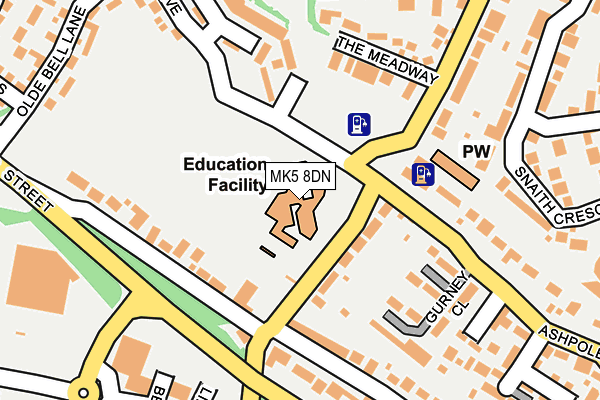
MK5 8DN is located in the Loughton & Shenley electoral ward, within the unitary authority of Milton Keynes and the English Parliamentary constituency of Milton Keynes South. The Sub Integrated Care Board (ICB) Location is NHS Bedfordshire, Luton and Milton Keynes ICB - M1J4Y and the police force is Thames Valley. This postcode has been in use since March 1988.


GetTheData
Source: OS OpenMap – Local (Ordnance Survey)
Source: OS VectorMap District (Ordnance Survey)
Licence: Open Government Licence (requires attribution)
| Easting | 483365 |
| Northing | 237322 |
| Latitude | 52.028056 |
| Longitude | -0.786327 |
GetTheData
Source: Open Postcode Geo
Licence: Open Government Licence
| Country | England |
| Postcode District | MK5 |
| ➜ MK5 open data dashboard ➜ See where MK5 is on a map ➜ Where is Milton Keynes? | |
GetTheData
Source: Land Registry Price Paid Data
Licence: Open Government Licence
Elevation or altitude of MK5 8DN as distance above sea level:
| Metres | Feet | |
|---|---|---|
| Elevation | 80m | 262ft |
Elevation is measured from the approximate centre of the postcode, to the nearest point on an OS contour line from OS Terrain 50, which has contour spacing of ten vertical metres.
➜ How high above sea level am I? Find the elevation of your current position using your device's GPS.
GetTheData
Source: Open Postcode Elevation
Licence: Open Government Licence
| Ward | Loughton & Shenley |
| Constituency | Milton Keynes South |
GetTheData
Source: ONS Postcode Database
Licence: Open Government Licence
| October 2023 | Violence and sexual offences | On or near Lowndes Grove | 383m |
| October 2023 | Violence and sexual offences | On or near Lowndes Grove | 383m |
| October 2023 | Violence and sexual offences | On or near Lowndes Grove | 383m |
| ➜ Get more crime data in our Crime section | |||
GetTheData
Source: data.police.uk
Licence: Open Government Licence
| Loughton School (Bradwell Road) | Loughton | 55m |
| Loughton School (Bradwell Road) | Loughton | 107m |
| Lipscombe Lane (Shenley Road) | Shenley Church End | 194m |
| Paynes Drive | Loughton | 225m |
| Paynes Drive | Loughton | 228m |
| Milton Keynes Central Station | 1.1km |
| Wolverton Station | 4.4km |
| Bletchley Station | 5km |
GetTheData
Source: NaPTAN
Licence: Open Government Licence
GetTheData
Source: ONS Postcode Database
Licence: Open Government Licence


➜ Get more ratings from the Food Standards Agency
GetTheData
Source: Food Standards Agency
Licence: FSA terms & conditions
| Last Collection | |||
|---|---|---|---|
| Location | Mon-Fri | Sat | Distance |
| London Road | 16:45 | 09:35 | 128m |
| Benbow Court | 17:30 | 12:00 | 270m |
| Paynes Drive | 17:30 | 12:00 | 428m |
GetTheData
Source: Dracos
Licence: Creative Commons Attribution-ShareAlike
| Facility | Distance |
|---|---|
| Loughton School Bradwell Road, Loughton, Milton Keynes Grass Pitches, Sports Hall | 0m |
| Anytime Fitness (Milton Keynes) Benbow Court, Benbow Court, Shenley Church End, Milton Keynes Health and Fitness Gym | 236m |
| Bourton Mill Health & Leisure Club (Milton Keynes) (Closed) Engaine Drive, Shenley Church End, Milton Keynes Swimming Pool, Health and Fitness Gym, Studio | 275m |
GetTheData
Source: Active Places
Licence: Open Government Licence
| School | Phase of Education | Distance |
|---|---|---|
| Loughton School Bradwell Road, Loughton, Milton Keynes, MK5 8DN | Primary | 0m |
| Denbigh School Burchard Crescent, Shenley Church End, Milton Keynes, MK5 6EX | Secondary | 424m |
| Loughton Manor First School Paynes Drive, Loughton, Milton Keynes, MK5 8FA | Primary | 467m |
GetTheData
Source: Edubase
Licence: Open Government Licence
The below table lists the International Territorial Level (ITL) codes (formerly Nomenclature of Territorial Units for Statistics (NUTS) codes) and Local Administrative Units (LAU) codes for MK5 8DN:
| ITL 1 Code | Name |
|---|---|
| TLJ | South East (England) |
| ITL 2 Code | Name |
| TLJ1 | Berkshire, Buckinghamshire and Oxfordshire |
| ITL 3 Code | Name |
| TLJ12 | Milton Keynes |
| LAU 1 Code | Name |
| E06000042 | Milton Keynes |
GetTheData
Source: ONS Postcode Directory
Licence: Open Government Licence
The below table lists the Census Output Area (OA), Lower Layer Super Output Area (LSOA), and Middle Layer Super Output Area (MSOA) for MK5 8DN:
| Code | Name | |
|---|---|---|
| OA | E00084645 | |
| LSOA | E01016778 | Milton Keynes 020D |
| MSOA | E02003478 | Milton Keynes 020 |
GetTheData
Source: ONS Postcode Directory
Licence: Open Government Licence
| MK5 8AB | London Road | 124m |
| MK5 8AJ | Bradwell Road | 154m |
| MK5 8AR | Shenley Road | 162m |
| MK5 8AN | The Meadway | 178m |
| MK5 8HG | Snaith Crescent | 221m |
| MK5 8AF | London Road | 225m |
| MK5 8EY | Paynes Drive | 231m |
| MK5 8ET | Homeward Court | 231m |
| MK5 8EE | Ashpole Furlong | 256m |
| MK5 8HQ | Snaith Crescent | 260m |
GetTheData
Source: Open Postcode Geo; Land Registry Price Paid Data
Licence: Open Government Licence