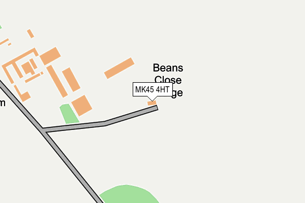
MK45 4HT lies on Wrest Park in Silsoe, Bedford. MK45 4HT is located in the Barton-le-Clay & Silsoe electoral ward, within the unitary authority of Central Bedfordshire and the English Parliamentary constituency of Mid Bedfordshire. The Sub Integrated Care Board (ICB) Location is NHS Bedfordshire, Luton and Milton Keynes ICB - M1J4Y and the police force is Bedfordshire. This postcode has been in use since January 1980.


GetTheData
Source: OS OpenMap – Local (Ordnance Survey)
Source: OS VectorMap District (Ordnance Survey)
Licence: Open Government Licence (requires attribution)
| Easting | 509148 |
| Northing | 236386 |
| Latitude | 52.015175 |
| Longitude | -0.410964 |
GetTheData
Source: Open Postcode Geo
Licence: Open Government Licence
| Street | Wrest Park |
| Locality | Silsoe |
| Town/City | Bedford |
| Country | England |
| Postcode District | MK45 |
| ➜ MK45 open data dashboard ➜ See where MK45 is on a map | |
GetTheData
Source: Land Registry Price Paid Data
Licence: Open Government Licence
Elevation or altitude of MK45 4HT as distance above sea level:
| Metres | Feet | |
|---|---|---|
| Elevation | 60m | 197ft |
Elevation is measured from the approximate centre of the postcode, to the nearest point on an OS contour line from OS Terrain 50, which has contour spacing of ten vertical metres.
➜ How high above sea level am I? Find the elevation of your current position using your device's GPS.
GetTheData
Source: Open Postcode Elevation
Licence: Open Government Licence
| Ward | Barton-le-clay & Silsoe |
| Constituency | Mid Bedfordshire |
GetTheData
Source: ONS Postcode Database
Licence: Open Government Licence
| The Lord Nelson (High Street) | Silsoe | 1,070m |
| The Lord Nelson (High Street) | Silsoe | 1,083m |
| The George Hotel (High Street) | Silsoe | 1,112m |
| The George Hotel (High Street) | Silsoe | 1,118m |
| The Post Office (Newbury Lane) | Silsoe | 1,155m |
GetTheData
Source: NaPTAN
Licence: Open Government Licence
| Percentage of properties with Next Generation Access | 33.3% |
| Percentage of properties with Superfast Broadband | 0.0% |
| Percentage of properties with Ultrafast Broadband | 0.0% |
| Percentage of properties with Full Fibre Broadband | 0.0% |
Superfast Broadband is between 30Mbps and 300Mbps
Ultrafast Broadband is > 300Mbps
| Percentage of properties unable to receive 2Mbps | 0.0% |
| Percentage of properties unable to receive 5Mbps | 33.3% |
| Percentage of properties unable to receive 10Mbps | 33.3% |
| Percentage of properties unable to receive 30Mbps | 100.0% |
GetTheData
Source: Ofcom
Licence: Ofcom Terms of Use (requires attribution)
GetTheData
Source: ONS Postcode Database
Licence: Open Government Licence


➜ Get more ratings from the Food Standards Agency
GetTheData
Source: Food Standards Agency
Licence: FSA terms & conditions
| Last Collection | |||
|---|---|---|---|
| Location | Mon-Fri | Sat | Distance |
| Post Office Newbury Lane | 18:05 | 10:15 | 1,152m |
| The Green | 18:10 | 10:20 | 1,569m |
| Post Office High Street | 18:10 | 10:30 | 1,756m |
GetTheData
Source: Dracos
Licence: Creative Commons Attribution-ShareAlike
| Facility | Distance |
|---|---|
| Wrest Park Wrest Park, Silsoe Grass Pitches | 895m |
| Cranfield University (Silsoe Campus) (Closed) Barton Road, Silsoe, Bedford Sports Hall, Health and Fitness Gym, Squash Courts | 1.5km |
| Clophill St Mary's Lower School High Street, Clophill, Bedford Grass Pitches | 1.7km |
GetTheData
Source: Active Places
Licence: Open Government Licence
| School | Phase of Education | Distance |
|---|---|---|
| Esland Bedford School Unit 54, Wrest Park, Silsoe, MK45 4HS | Not applicable | 803m |
| St Mary's VA CofE Lower School High Street, Clophill, MK45 4BE | Primary | 1.7km |
| Silsoe CofE VC Lower School Chestnut Avenue, Silsoe, Bedford, MK45 4GP | Primary | 1.8km |
GetTheData
Source: Edubase
Licence: Open Government Licence
The below table lists the International Territorial Level (ITL) codes (formerly Nomenclature of Territorial Units for Statistics (NUTS) codes) and Local Administrative Units (LAU) codes for MK45 4HT:
| ITL 1 Code | Name |
|---|---|
| TLH | East |
| ITL 2 Code | Name |
| TLH2 | Bedfordshire and Hertfordshire |
| ITL 3 Code | Name |
| TLH25 | Central Bedfordshire |
| LAU 1 Code | Name |
| E06000056 | Central Bedfordshire |
GetTheData
Source: ONS Postcode Directory
Licence: Open Government Licence
The below table lists the Census Output Area (OA), Lower Layer Super Output Area (LSOA), and Middle Layer Super Output Area (MSOA) for MK45 4HT:
| Code | Name | |
|---|---|---|
| OA | E00088094 | |
| LSOA | E01017445 | Central Bedfordshire 017D |
| MSOA | E02003615 | Central Bedfordshire 017 |
GetTheData
Source: ONS Postcode Directory
Licence: Open Government Licence
| MK45 4AS | Warren Lane | 850m |
| MK45 4ER | Bedford Avenue | 1033m |
| MK45 4EG | Juniper Close | 1037m |
| MK45 4DG | The Rowans | 1082m |
| MK45 4ES | High Street | 1108m |
| MK45 4DY | School House Mews | 1117m |
| MK45 4HA | Clophill Road | 1125m |
| MK45 4EP | High Street | 1130m |
| MK45 4SR | Apple Tree Close | 1167m |
| MK45 4EL | The Oaks | 1187m |
GetTheData
Source: Open Postcode Geo; Land Registry Price Paid Data
Licence: Open Government Licence