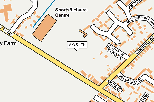
MK45 1TH is located in the Flitwick electoral ward, within the unitary authority of Central Bedfordshire and the English Parliamentary constituency of Mid Bedfordshire. The Sub Integrated Care Board (ICB) Location is NHS Bedfordshire, Luton and Milton Keynes ICB - M1J4Y and the police force is Bedfordshire. This postcode has been in use since July 1986.


GetTheData
Source: OS OpenMap – Local (Ordnance Survey)
Source: OS VectorMap District (Ordnance Survey)
Licence: Open Government Licence (requires attribution)
| Easting | 502614 |
| Northing | 235511 |
| Latitude | 52.008557 |
| Longitude | -0.506399 |
GetTheData
Source: Open Postcode Geo
Licence: Open Government Licence
| Country | England |
| Postcode District | MK45 |
| ➜ MK45 open data dashboard ➜ See where MK45 is on a map ➜ Where is Flitwick? | |
GetTheData
Source: Land Registry Price Paid Data
Licence: Open Government Licence
Elevation or altitude of MK45 1TH as distance above sea level:
| Metres | Feet | |
|---|---|---|
| Elevation | 80m | 262ft |
Elevation is measured from the approximate centre of the postcode, to the nearest point on an OS contour line from OS Terrain 50, which has contour spacing of ten vertical metres.
➜ How high above sea level am I? Find the elevation of your current position using your device's GPS.
GetTheData
Source: Open Postcode Elevation
Licence: Open Government Licence
| Ward | Flitwick |
| Constituency | Mid Bedfordshire |
GetTheData
Source: ONS Postcode Database
Licence: Open Government Licence
| November 2023 | Vehicle crime | On or near Rosebay Close | 453m |
| August 2023 | Anti-social behaviour | On or near Fern Gardens | 490m |
| July 2023 | Violence and sexual offences | On or near Aston Gate | 462m |
| ➜ Get more crime data in our Crime section | |||
GetTheData
Source: data.police.uk
Licence: Open Government Licence
| Leisure Centre (Steppingley Road) | Flitwick | 78m |
| Leisure Centre (Steppingley Road) | Flitwick | 88m |
| Bluebell Close (Manor Way) | Flitwick | 292m |
| Bluebell Close (Manor Way) | Flitwick | 297m |
| The Rufus Centre (Steppingley Road) | Flitwick | 402m |
| Flitwick Station | 0.9km |
| Lidlington Station | 5.1km |
| Millbrook (Beds) Station | 5.4km |
GetTheData
Source: NaPTAN
Licence: Open Government Licence
GetTheData
Source: ONS Postcode Database
Licence: Open Government Licence


➜ Get more ratings from the Food Standards Agency
GetTheData
Source: Food Standards Agency
Licence: FSA terms & conditions
| Last Collection | |||
|---|---|---|---|
| Location | Mon-Fri | Sat | Distance |
| Manor Way | 16:25 | 10:45 | 340m |
| Corner Green Chapel | 16:40 | 10:50 | 342m |
| Hospital | 16:30 | 09:00 | 403m |
GetTheData
Source: Dracos
Licence: Creative Commons Attribution-ShareAlike
| Facility | Distance |
|---|---|
| Flitwick Leisure Centre (Closed) Steppingley Road, Flitwick, Bedford Sports Hall, Swimming Pool, Health and Fitness Gym, Grass Pitches, Studio, Squash Courts | 11m |
| Flitwick Leisure Centre Steppingley Road, Flitwick, Bedford Swimming Pool, Artificial Grass Pitch, Health and Fitness Gym, Sports Hall, Squash Courts, Studio | 160m |
| Rufus Centre Steppingley Road, Flitwick Grass Pitches | 341m |
GetTheData
Source: Active Places
Licence: Open Government Licence
| School | Phase of Education | Distance |
|---|---|---|
| Templefield Lower School Malham Close, Flitwick, Bedford, MK45 1AJ | Primary | 595m |
| Woodland Middle School Academy Malham Close, Flitwick, Bedford, MK45 1NP | Middle deemed secondary | 602m |
| Flitwick Lower School Temple Way, Flitwick, Bedford, MK45 1LU | Primary | 1.1km |
GetTheData
Source: Edubase
Licence: Open Government Licence
The below table lists the International Territorial Level (ITL) codes (formerly Nomenclature of Territorial Units for Statistics (NUTS) codes) and Local Administrative Units (LAU) codes for MK45 1TH:
| ITL 1 Code | Name |
|---|---|
| TLH | East |
| ITL 2 Code | Name |
| TLH2 | Bedfordshire and Hertfordshire |
| ITL 3 Code | Name |
| TLH25 | Central Bedfordshire |
| LAU 1 Code | Name |
| E06000056 | Central Bedfordshire |
GetTheData
Source: ONS Postcode Directory
Licence: Open Government Licence
The below table lists the Census Output Area (OA), Lower Layer Super Output Area (LSOA), and Middle Layer Super Output Area (MSOA) for MK45 1TH:
| Code | Name | |
|---|---|---|
| OA | E00087909 | |
| LSOA | E01017406 | Central Bedfordshire 016D |
| MSOA | E02003614 | Central Bedfordshire 016 |
GetTheData
Source: ONS Postcode Directory
Licence: Open Government Licence
| MK45 1AR | Steppingley Road | 106m |
| MK45 1BB | Common Farm Lane | 126m |
| MK45 1BQ | Millwright Way | 134m |
| MK45 1AX | Windmill Road | 149m |
| MK45 1BL | Millwright Way | 196m |
| MK45 1AF | Abbis Close | 215m |
| MK45 1AU | Windmill Road | 226m |
| MK45 1QD | Keats Road | 234m |
| MK45 1BZ | Millwright Way | 236m |
| MK45 1AP | Steppingley Road | 240m |
GetTheData
Source: Open Postcode Geo; Land Registry Price Paid Data
Licence: Open Government Licence