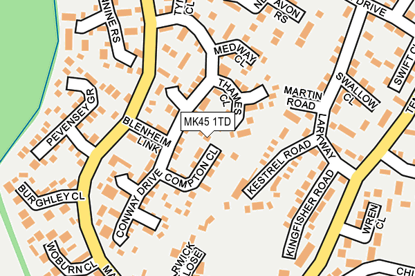
MK45 1TD lies on Syon Path in Flitwick, Bedford. MK45 1TD is located in the Flitwick electoral ward, within the unitary authority of Central Bedfordshire and the English Parliamentary constituency of Mid Bedfordshire. The Sub Integrated Care Board (ICB) Location is NHS Bedfordshire, Luton and Milton Keynes ICB - M1J4Y and the police force is Bedfordshire. This postcode has been in use since June 1981.


GetTheData
Source: OS OpenMap – Local (Ordnance Survey)
Source: OS VectorMap District (Ordnance Survey)
Licence: Open Government Licence (requires attribution)
| Easting | 502691 |
| Northing | 234445 |
| Latitude | 51.998962 |
| Longitude | -0.505597 |
GetTheData
Source: Open Postcode Geo
Licence: Open Government Licence
| Street | Syon Path |
| Locality | Flitwick |
| Town/City | Bedford |
| Country | England |
| Postcode District | MK45 |
| ➜ MK45 open data dashboard ➜ See where MK45 is on a map ➜ Where is Flitwick? | |
GetTheData
Source: Land Registry Price Paid Data
Licence: Open Government Licence
Elevation or altitude of MK45 1TD as distance above sea level:
| Metres | Feet | |
|---|---|---|
| Elevation | 90m | 295ft |
Elevation is measured from the approximate centre of the postcode, to the nearest point on an OS contour line from OS Terrain 50, which has contour spacing of ten vertical metres.
➜ How high above sea level am I? Find the elevation of your current position using your device's GPS.
GetTheData
Source: Open Postcode Elevation
Licence: Open Government Licence
| Ward | Flitwick |
| Constituency | Mid Bedfordshire |
GetTheData
Source: ONS Postcode Database
Licence: Open Government Licence
| January 2024 | Violence and sexual offences | On or near Church Road | 286m |
| September 2023 | Anti-social behaviour | On or near Church Road | 286m |
| July 2022 | Anti-social behaviour | On or near Church Road | 286m |
| ➜ Get more crime data in our Crime section | |||
GetTheData
Source: data.police.uk
Licence: Open Government Licence
| Blenheim Link (Manor Way) | Flitwick | 110m |
| Conway Drive (Manor Way) | Flitwick | 171m |
| Woburn Close (Manor Way) | Flitwick | 215m |
| Larkway (Temple Way) | Flitwick | 225m |
| Larkway (Temple Way) | Flitwick | 229m |
| Flitwick Station | 0.9km |
| Harlington (Beds) Station | 4.2km |
| Lidlington Station | 6km |
GetTheData
Source: NaPTAN
Licence: Open Government Licence
| Percentage of properties with Next Generation Access | 100.0% |
| Percentage of properties with Superfast Broadband | 100.0% |
| Percentage of properties with Ultrafast Broadband | 100.0% |
| Percentage of properties with Full Fibre Broadband | 0.0% |
Superfast Broadband is between 30Mbps and 300Mbps
Ultrafast Broadband is > 300Mbps
| Percentage of properties unable to receive 2Mbps | 0.0% |
| Percentage of properties unable to receive 5Mbps | 0.0% |
| Percentage of properties unable to receive 10Mbps | 0.0% |
| Percentage of properties unable to receive 30Mbps | 0.0% |
GetTheData
Source: Ofcom
Licence: Ofcom Terms of Use (requires attribution)
GetTheData
Source: ONS Postcode Database
Licence: Open Government Licence


➜ Get more ratings from the Food Standards Agency
GetTheData
Source: Food Standards Agency
Licence: FSA terms & conditions
| Last Collection | |||
|---|---|---|---|
| Location | Mon-Fri | Sat | Distance |
| Manor Way | 16:25 | 10:45 | 234m |
| Temple Way | 16:20 | 10:45 | 331m |
| Vicarage Hill | 16:20 | 10:45 | 594m |
GetTheData
Source: Dracos
Licence: Creative Commons Attribution-ShareAlike
| Facility | Distance |
|---|---|
| Flitwick Lower School Temple Way, Flitwick, Bedford Grass Pitches | 585m |
| Woodland Middle School Academy Malham Close, Flitwick, Bedford Grass Pitches, Sports Hall | 634m |
| Templefield Lower School Steppingley Road, Flitwick, Bedford Grass Pitches | 724m |
GetTheData
Source: Active Places
Licence: Open Government Licence
| School | Phase of Education | Distance |
|---|---|---|
| Flitwick Lower School Temple Way, Flitwick, Bedford, MK45 1LU | Primary | 575m |
| Woodland Middle School Academy Malham Close, Flitwick, Bedford, MK45 1NP | Middle deemed secondary | 634m |
| Templefield Lower School Malham Close, Flitwick, Bedford, MK45 1AJ | Primary | 703m |
GetTheData
Source: Edubase
Licence: Open Government Licence
The below table lists the International Territorial Level (ITL) codes (formerly Nomenclature of Territorial Units for Statistics (NUTS) codes) and Local Administrative Units (LAU) codes for MK45 1TD:
| ITL 1 Code | Name |
|---|---|
| TLH | East |
| ITL 2 Code | Name |
| TLH2 | Bedfordshire and Hertfordshire |
| ITL 3 Code | Name |
| TLH25 | Central Bedfordshire |
| LAU 1 Code | Name |
| E06000056 | Central Bedfordshire |
GetTheData
Source: ONS Postcode Directory
Licence: Open Government Licence
The below table lists the Census Output Area (OA), Lower Layer Super Output Area (LSOA), and Middle Layer Super Output Area (MSOA) for MK45 1TD:
| Code | Name | |
|---|---|---|
| OA | E00087899 | |
| LSOA | E01017404 | Central Bedfordshire 016B |
| MSOA | E02003614 | Central Bedfordshire 016 |
GetTheData
Source: ONS Postcode Directory
Licence: Open Government Licence
| MK45 1SR | Conway Drive | 40m |
| MK45 1TA | Compton Close | 65m |
| MK45 1EQ | Thames Close | 75m |
| MK45 1SY | Blenheim Link | 83m |
| MK45 1RB | Kestrel Road | 84m |
| MK45 1SZ | Conway Drive | 97m |
| MK45 1PX | Windrush Close | 103m |
| MK45 1DF | Conway Drive | 118m |
| MK45 1EG | Mersey Close | 129m |
| MK45 1SS | Conway Drive | 142m |
GetTheData
Source: Open Postcode Geo; Land Registry Price Paid Data
Licence: Open Government Licence