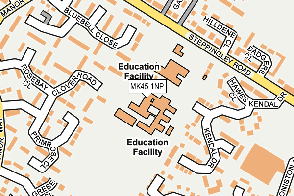
MK45 1NP is located in the Flitwick electoral ward, within the unitary authority of Central Bedfordshire and the English Parliamentary constituency of Mid Bedfordshire. The Sub Integrated Care Board (ICB) Location is NHS Bedfordshire, Luton and Milton Keynes ICB - M1J4Y and the police force is Bedfordshire. This postcode has been in use since January 1980.


GetTheData
Source: OS OpenMap – Local (Ordnance Survey)
Source: OS VectorMap District (Ordnance Survey)
Licence: Open Government Licence (requires attribution)
| Easting | 502961 |
| Northing | 235019 |
| Latitude | 52.004071 |
| Longitude | -0.501493 |
GetTheData
Source: Open Postcode Geo
Licence: Open Government Licence
| Country | England |
| Postcode District | MK45 |
| ➜ MK45 open data dashboard ➜ See where MK45 is on a map ➜ Where is Flitwick? | |
GetTheData
Source: Land Registry Price Paid Data
Licence: Open Government Licence
Elevation or altitude of MK45 1NP as distance above sea level:
| Metres | Feet | |
|---|---|---|
| Elevation | 80m | 262ft |
Elevation is measured from the approximate centre of the postcode, to the nearest point on an OS contour line from OS Terrain 50, which has contour spacing of ten vertical metres.
➜ How high above sea level am I? Find the elevation of your current position using your device's GPS.
GetTheData
Source: Open Postcode Elevation
Licence: Open Government Licence
| Ward | Flitwick |
| Constituency | Mid Bedfordshire |
GetTheData
Source: ONS Postcode Database
Licence: Open Government Licence
| December 2023 | Vehicle crime | On or near Kendal Drive | 183m |
| November 2023 | Vehicle crime | On or near Rosebay Close | 251m |
| September 2023 | Anti-social behaviour | On or near Kendal Drive | 183m |
| ➜ Get more crime data in our Crime section | |||
GetTheData
Source: data.police.uk
Licence: Open Government Licence
| Woodlands Middle School (Steppingley Road) | Flitwick | 156m |
| Woodlands Middle School (Steppingley Road) | Flitwick | 240m |
| Bluebell Close (Manor Way) | Flitwick | 308m |
| Campion Way (Manor Way) | Flitwick | 308m |
| Campion Way (Manor Way) | Flitwick | 310m |
| Flitwick Station | 0.4km |
| Harlington (Beds) Station | 4.7km |
| Lidlington Station | 5.7km |
GetTheData
Source: NaPTAN
Licence: Open Government Licence
GetTheData
Source: ONS Postcode Database
Licence: Open Government Licence


➜ Get more ratings from the Food Standards Agency
GetTheData
Source: Food Standards Agency
Licence: FSA terms & conditions
| Last Collection | |||
|---|---|---|---|
| Location | Mon-Fri | Sat | Distance |
| Corner Green Chapel | 16:40 | 10:50 | 274m |
| Coniston Way | 17:00 | 11:00 | 312m |
| Coniston Way | 17:00 | 11:00 | 314m |
GetTheData
Source: Dracos
Licence: Creative Commons Attribution-ShareAlike
| Facility | Distance |
|---|---|
| Woodland Middle School Academy Malham Close, Flitwick, Bedford Grass Pitches, Sports Hall | 0m |
| Templefield Lower School Steppingley Road, Flitwick, Bedford Grass Pitches | 90m |
| Flitwick Lower School Temple Way, Flitwick, Bedford Grass Pitches | 493m |
GetTheData
Source: Active Places
Licence: Open Government Licence
| School | Phase of Education | Distance |
|---|---|---|
| Woodland Middle School Academy Malham Close, Flitwick, Bedford, MK45 1NP | Middle deemed secondary | 0m |
| Templefield Lower School Malham Close, Flitwick, Bedford, MK45 1AJ | Primary | 73m |
| Flitwick Lower School Temple Way, Flitwick, Bedford, MK45 1LU | Primary | 477m |
GetTheData
Source: Edubase
Licence: Open Government Licence
The below table lists the International Territorial Level (ITL) codes (formerly Nomenclature of Territorial Units for Statistics (NUTS) codes) and Local Administrative Units (LAU) codes for MK45 1NP:
| ITL 1 Code | Name |
|---|---|
| TLH | East |
| ITL 2 Code | Name |
| TLH2 | Bedfordshire and Hertfordshire |
| ITL 3 Code | Name |
| TLH25 | Central Bedfordshire |
| LAU 1 Code | Name |
| E06000056 | Central Bedfordshire |
GetTheData
Source: ONS Postcode Directory
Licence: Open Government Licence
The below table lists the Census Output Area (OA), Lower Layer Super Output Area (LSOA), and Middle Layer Super Output Area (MSOA) for MK45 1NP:
| Code | Name | |
|---|---|---|
| OA | E00087910 | |
| LSOA | E01017407 | Central Bedfordshire 016E |
| MSOA | E02003614 | Central Bedfordshire 016 |
GetTheData
Source: ONS Postcode Directory
Licence: Open Government Licence
| MK45 1PU | Malham Close | 110m |
| MK45 1PH | Clover Road | 125m |
| MK45 1NW | Kendal Drive | 130m |
| MK45 1PN | Primrose Close | 133m |
| MK45 1NS | Bluebell Close | 142m |
| MK45 1NF | Hawes Close | 147m |
| MK45 1PG | Clover Road | 154m |
| MK45 1QU | Ullswater Close | 187m |
| MK45 1PL | Primrose Close | 198m |
| MK45 1NQ | Windermere Close | 205m |
GetTheData
Source: Open Postcode Geo; Land Registry Price Paid Data
Licence: Open Government Licence