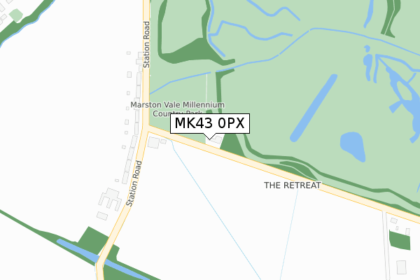
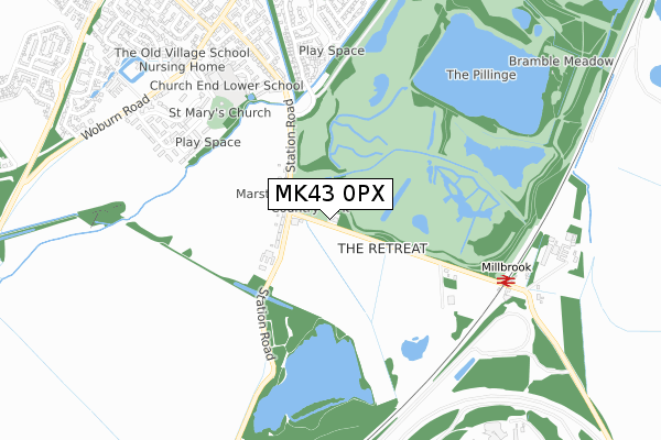
MK43 0PX is located in the Cranfield & Marston Moretaine electoral ward, within the unitary authority of Central Bedfordshire and the English Parliamentary constituency of Mid Bedfordshire. The Sub Integrated Care Board (ICB) Location is NHS Bedfordshire, Luton and Milton Keynes ICB - M1J4Y and the police force is Bedfordshire. This postcode has been in use since January 1980.


GetTheData
Source: OS Open Zoomstack (Ordnance Survey)
Licence: Open Government Licence (requires attribution)
Attribution: Contains OS data © Crown copyright and database right 2024
Source: Open Postcode Geo
Licence: Open Government Licence (requires attribution)
Attribution: Contains OS data © Crown copyright and database right 2024; Contains Royal Mail data © Royal Mail copyright and database right 2024; Source: Office for National Statistics licensed under the Open Government Licence v.3.0
| Easting | 500032 |
| Northing | 240742 |
| Latitude | 52.056053 |
| Longitude | -0.542454 |
GetTheData
Source: Open Postcode Geo
Licence: Open Government Licence
| Country | England |
| Postcode District | MK43 |
| ➜ MK43 open data dashboard ➜ See where MK43 is on a map | |
GetTheData
Source: Land Registry Price Paid Data
Licence: Open Government Licence
Elevation or altitude of MK43 0PX as distance above sea level:
| Metres | Feet | |
|---|---|---|
| Elevation | 40m | 131ft |
Elevation is measured from the approximate centre of the postcode, to the nearest point on an OS contour line from OS Terrain 50, which has contour spacing of ten vertical metres.
➜ How high above sea level am I? Find the elevation of your current position using your device's GPS.
GetTheData
Source: Open Postcode Elevation
Licence: Open Government Licence
| Ward | Cranfield & Marston Moretaine |
| Constituency | Mid Bedfordshire |
GetTheData
Source: ONS Postcode Database
Licence: Open Government Licence
| May 2022 | Anti-social behaviour | On or near Station Road | 178m |
| April 2022 | Anti-social behaviour | On or near Station Road | 178m |
| April 2022 | Violence and sexual offences | On or near Station Road | 178m |
| ➜ Get more crime data in our Crime section | |||
GetTheData
Source: data.police.uk
Licence: Open Government Licence
| Social Club (Marston Road) | Marston Moretaine | 152m |
| Social Club (Marston Road) | Marston Moretaine | 167m |
| St Mary's Close (Station Road) | Marston Moretaine | 577m |
| St Mary's Close (Station Road) | Marston Moretaine | 617m |
| Millbrook Railway Station (Millbrook Rail Station) | Millbrook | 686m |
| Millbrook (Beds) Station | 0.7km |
| Lidlington Station | 2km |
| Stewartby Station | 2.1km |
GetTheData
Source: NaPTAN
Licence: Open Government Licence
| Percentage of properties with Next Generation Access | 100.0% |
| Percentage of properties with Superfast Broadband | 100.0% |
| Percentage of properties with Ultrafast Broadband | 0.0% |
| Percentage of properties with Full Fibre Broadband | 0.0% |
Superfast Broadband is between 30Mbps and 300Mbps
Ultrafast Broadband is > 300Mbps
| Percentage of properties unable to receive 2Mbps | 0.0% |
| Percentage of properties unable to receive 5Mbps | 0.0% |
| Percentage of properties unable to receive 10Mbps | 0.0% |
| Percentage of properties unable to receive 30Mbps | 0.0% |
GetTheData
Source: Ofcom
Licence: Ofcom Terms of Use (requires attribution)
GetTheData
Source: ONS Postcode Database
Licence: Open Government Licence


➜ Get more ratings from the Food Standards Agency
GetTheData
Source: Food Standards Agency
Licence: FSA terms & conditions
| Last Collection | |||
|---|---|---|---|
| Location | Mon-Fri | Sat | Distance |
| Station Road | 17:10 | 10:50 | 160m |
| Station Road | 17:00 | 09:00 | 719m |
| Manor Road | 16:10 | 10:55 | 834m |
GetTheData
Source: Dracos
Licence: Creative Commons Attribution-ShareAlike
| Facility | Distance |
|---|---|
| Marston Moreteyne Vc School - (Church End Site) Church Walk, Marston Moretaine, Bedford Swimming Pool, Grass Pitches | 645m |
| Marston Moreteyne Vc School (Forest End Site) Great Linns, Marston Moretaine, Bedford Grass Pitches | 1.1km |
| Marston Playing Field Bedford Road, Marston Moretaine Grass Pitches | 1.4km |
GetTheData
Source: Active Places
Licence: Open Government Licence
| School | Phase of Education | Distance |
|---|---|---|
| Marston Moreteyne VC School Church Walk, Marston Moreteyne, MK43 0NE | Primary | 683m |
| Thomas Johnson Lower School Hurst Grove, Lidlington, Bedford, MK43 0SB | Primary | 2.2km |
| Kimberley 16 - 19 Stem College Green Lane, Stewartby, Bedford, MK43 9LY | 16 plus | 2.3km |
GetTheData
Source: Edubase
Licence: Open Government Licence
The below table lists the International Territorial Level (ITL) codes (formerly Nomenclature of Territorial Units for Statistics (NUTS) codes) and Local Administrative Units (LAU) codes for MK43 0PX:
| ITL 1 Code | Name |
|---|---|
| TLH | East |
| ITL 2 Code | Name |
| TLH2 | Bedfordshire and Hertfordshire |
| ITL 3 Code | Name |
| TLH25 | Central Bedfordshire |
| LAU 1 Code | Name |
| E06000056 | Central Bedfordshire |
GetTheData
Source: ONS Postcode Directory
Licence: Open Government Licence
The below table lists the Census Output Area (OA), Lower Layer Super Output Area (LSOA), and Middle Layer Super Output Area (MSOA) for MK43 0PX:
| Code | Name | |
|---|---|---|
| OA | E00087965 | |
| LSOA | E01017416 | Central Bedfordshire 009A |
| MSOA | E02003607 | Central Bedfordshire 009 |
GetTheData
Source: ONS Postcode Directory
Licence: Open Government Licence
| MK43 0PN | Jubilee Cottages | 178m |
| MK43 0PJ | Station Road | 251m |
| MK43 0QY | St Marys Close | 545m |
| MK43 0PD | Manor Road | 604m |
| MK43 0QZ | St Marys Close | 632m |
| MK43 0NR | Banks Close | 649m |
| MK43 0NT | Manor Road | 656m |
| MK43 0PS | Station Road | 659m |
| MK43 0UX | Great Beanhills | 684m |
| MK43 0NS | Brook Road | 699m |
GetTheData
Source: Open Postcode Geo; Land Registry Price Paid Data
Licence: Open Government Licence