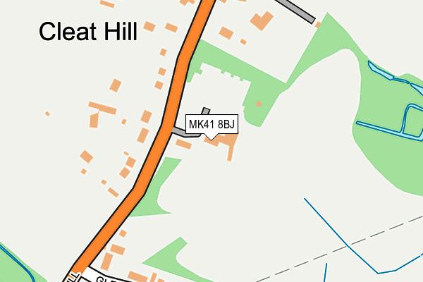
MK41 8BJ is located in the Renhold & Ravensden electoral ward, within the unitary authority of Bedford and the English Parliamentary constituency of North East Bedfordshire. The Sub Integrated Care Board (ICB) Location is NHS Bedfordshire, Luton and Milton Keynes ICB - M1J4Y and the police force is Bedfordshire. This postcode has been in use since January 1980.


GetTheData
Source: OS OpenMap – Local (Ordnance Survey)
Source: OS VectorMap District (Ordnance Survey)
Licence: Open Government Licence (requires attribution)
| Easting | 506336 |
| Northing | 253198 |
| Latitude | 52.166827 |
| Longitude | -0.446663 |
GetTheData
Source: Open Postcode Geo
Licence: Open Government Licence
| Country | England |
| Postcode District | MK41 |
| ➜ MK41 open data dashboard ➜ See where MK41 is on a map ➜ Where is Bedford? | |
GetTheData
Source: Land Registry Price Paid Data
Licence: Open Government Licence
Elevation or altitude of MK41 8BJ as distance above sea level:
| Metres | Feet | |
|---|---|---|
| Elevation | 50m | 164ft |
Elevation is measured from the approximate centre of the postcode, to the nearest point on an OS contour line from OS Terrain 50, which has contour spacing of ten vertical metres.
➜ How high above sea level am I? Find the elevation of your current position using your device's GPS.
GetTheData
Source: Open Postcode Elevation
Licence: Open Government Licence
| Ward | Renhold & Ravensden |
| Constituency | North East Bedfordshire |
GetTheData
Source: ONS Postcode Database
Licence: Open Government Licence
| January 2024 | Anti-social behaviour | On or near Parking Area | 456m |
| January 2024 | Other theft | On or near Douglas Road | 470m |
| October 2023 | Vehicle crime | On or near Parking Area | 456m |
| ➜ Get more crime data in our Crime section | |||
GetTheData
Source: data.police.uk
Licence: Open Government Licence
| Cleat Hill | Ravensden | 316m |
| Cleat Hill | Ravensden | 332m |
| Mowsbury Car Park (Kimbolton Road) | Brickhill | 647m |
| Rhineland Way (Tyne Crescent) | Brickhill | 662m |
| Mowsbury Car Park (Kimbolton Road) | Brickhill | 667m |
| Bedford Station | 4.1km |
| Bedford St Johns Station | 4.4km |
GetTheData
Source: NaPTAN
Licence: Open Government Licence
GetTheData
Source: ONS Postcode Database
Licence: Open Government Licence


➜ Get more ratings from the Food Standards Agency
GetTheData
Source: Food Standards Agency
Licence: FSA terms & conditions
| Last Collection | |||
|---|---|---|---|
| Location | Mon-Fri | Sat | Distance |
| Cleat Hill | 17:50 | 10:15 | 333m |
| Avon Drive | 17:30 | 11:30 | 772m |
| Somerton Close | 18:15 | 11:40 | 1,149m |
GetTheData
Source: Dracos
Licence: Creative Commons Attribution-ShareAlike
| Facility | Distance |
|---|---|
| Mowsbury Golf & Squash Complex Cleat Hill, Bedford Golf, Squash Courts | 4m |
| Mowsbury Park Wentworth Drive, Bedford Grass Pitches, Outdoor Tennis Courts | 740m |
| Bedford Athletic Rugby Club Wentworth Drive, Bedford Grass Pitches, Artificial Grass Pitch | 998m |
GetTheData
Source: Active Places
Licence: Open Government Licence
| School | Phase of Education | Distance |
|---|---|---|
| Mark Rutherford School Wentworth Drive, Bedford, MK41 8PX | Secondary | 1.2km |
| St Thomas More Catholic School Tyne Crescent, Bedford, MK41 7UL | Secondary | 1.3km |
| Brickhill Primary School Dove Road, Brickhill, Bedford, MK41 7AA | Primary | 1.4km |
GetTheData
Source: Edubase
Licence: Open Government Licence
The below table lists the International Territorial Level (ITL) codes (formerly Nomenclature of Territorial Units for Statistics (NUTS) codes) and Local Administrative Units (LAU) codes for MK41 8BJ:
| ITL 1 Code | Name |
|---|---|
| TLH | East |
| ITL 2 Code | Name |
| TLH2 | Bedfordshire and Hertfordshire |
| ITL 3 Code | Name |
| TLH24 | Bedford |
| LAU 1 Code | Name |
| E06000055 | Bedford |
GetTheData
Source: ONS Postcode Directory
Licence: Open Government Licence
The below table lists the Census Output Area (OA), Lower Layer Super Output Area (LSOA), and Middle Layer Super Output Area (MSOA) for MK41 8BJ:
| Code | Name | |
|---|---|---|
| OA | E00173752 | |
| LSOA | E01033431 | Bedford 004F |
| MSOA | E02003619 | Bedford 004 |
GetTheData
Source: ONS Postcode Directory
Licence: Open Government Licence
| MK41 8AN | Cleat Hill | 148m |
| MK44 2SB | Glenrose Avenue | 215m |
| MK41 8AL | Cleat Hill | 278m |
| MK41 8DY | Wagstaffe Close | 301m |
| MK41 7YF | Douglas Road | 432m |
| MK41 7YH | Douglas Road | 469m |
| MK41 7XW | Hamble Road | 482m |
| MK41 7YQ | Washburn Close | 505m |
| MK41 7XY | Gipping Close | 534m |
| MK41 7YJ | Hindburn Close | 585m |
GetTheData
Source: Open Postcode Geo; Land Registry Price Paid Data
Licence: Open Government Licence