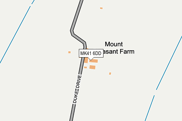
MK41 6DD is located in the Clapham & Oakley electoral ward, within the unitary authority of Bedford and the English Parliamentary constituency of North East Bedfordshire. The Sub Integrated Care Board (ICB) Location is NHS Bedfordshire, Luton and Milton Keynes ICB - M1J4Y and the police force is Bedfordshire. This postcode has been in use since January 1980.


GetTheData
Source: OS OpenMap – Local (Ordnance Survey)
Source: OS VectorMap District (Ordnance Survey)
Licence: Open Government Licence (requires attribution)
| Easting | 502917 |
| Northing | 253780 |
| Latitude | 52.172693 |
| Longitude | -0.496478 |
GetTheData
Source: Open Postcode Geo
Licence: Open Government Licence
| Country | England |
| Postcode District | MK41 |
| ➜ MK41 open data dashboard ➜ See where MK41 is on a map | |
GetTheData
Source: Land Registry Price Paid Data
Licence: Open Government Licence
Elevation or altitude of MK41 6DD as distance above sea level:
| Metres | Feet | |
|---|---|---|
| Elevation | 60m | 197ft |
Elevation is measured from the approximate centre of the postcode, to the nearest point on an OS contour line from OS Terrain 50, which has contour spacing of ten vertical metres.
➜ How high above sea level am I? Find the elevation of your current position using your device's GPS.
GetTheData
Source: Open Postcode Elevation
Licence: Open Government Licence
| Ward | Clapham & Oakley |
| Constituency | North East Bedfordshire |
GetTheData
Source: ONS Postcode Database
Licence: Open Government Licence
| Knights Avenue | Clapham | 657m |
| Twinwoods (Milton Road) | Clapham | 682m |
| Twinwoods (Milton Road) | Clapham | 696m |
| Knights Avenue (Mount Pleasant Road) | Clapham | 733m |
| Cody Road (Highbury Grove) | Clapham | 753m |
| Bedford Station | 4.2km |
| Bedford St Johns Station | 5.2km |
GetTheData
Source: NaPTAN
Licence: Open Government Licence
| Percentage of properties with Next Generation Access | 100.0% |
| Percentage of properties with Superfast Broadband | 100.0% |
| Percentage of properties with Ultrafast Broadband | 0.0% |
| Percentage of properties with Full Fibre Broadband | 0.0% |
Superfast Broadband is between 30Mbps and 300Mbps
Ultrafast Broadband is > 300Mbps
| Percentage of properties unable to receive 2Mbps | 0.0% |
| Percentage of properties unable to receive 5Mbps | 0.0% |
| Percentage of properties unable to receive 10Mbps | 0.0% |
| Percentage of properties unable to receive 30Mbps | 0.0% |
GetTheData
Source: Ofcom
Licence: Ofcom Terms of Use (requires attribution)
GetTheData
Source: ONS Postcode Database
Licence: Open Government Licence


➜ Get more ratings from the Food Standards Agency
GetTheData
Source: Food Standards Agency
Licence: FSA terms & conditions
| Last Collection | |||
|---|---|---|---|
| Location | Mon-Fri | Sat | Distance |
| Mount Pleasant Road | 17:30 | 11:00 | 782m |
| Milton Road | 17:30 | 10:45 | 835m |
| Highbury Grove | 17:30 | 11:15 | 1,012m |
GetTheData
Source: Dracos
Licence: Creative Commons Attribution-ShareAlike
| Facility | Distance |
|---|---|
| Bedford And County Golf Club Green Lane, Clapham, Bedford Golf | 1.1km |
| Clapham Sports Fc High Street, Clapham, Bedford Grass Pitches | 1.2km |
| Ursula Taylor Church Of England School High Street, Clapham, Bedford Grass Pitches, Swimming Pool | 1.4km |
GetTheData
Source: Active Places
Licence: Open Government Licence
| School | Phase of Education | Distance |
|---|---|---|
| Ursula Taylor Church of England School High Street, Clapham, Bedford, MK41 6EG | Primary | 1.4km |
| Oakley Primary Academy Station Road, Oakley, Bedford, MK43 7RE | Primary | 1.7km |
| Lincroft Academy Station Road, Oakley, Bedford, MK43 7RE | Secondary | 1.7km |
GetTheData
Source: Edubase
Licence: Open Government Licence
The below table lists the International Territorial Level (ITL) codes (formerly Nomenclature of Territorial Units for Statistics (NUTS) codes) and Local Administrative Units (LAU) codes for MK41 6DD:
| ITL 1 Code | Name |
|---|---|
| TLH | East |
| ITL 2 Code | Name |
| TLH2 | Bedfordshire and Hertfordshire |
| ITL 3 Code | Name |
| TLH24 | Bedford |
| LAU 1 Code | Name |
| E06000055 | Bedford |
GetTheData
Source: ONS Postcode Directory
Licence: Open Government Licence
The below table lists the Census Output Area (OA), Lower Layer Super Output Area (LSOA), and Middle Layer Super Output Area (MSOA) for MK41 6DD:
| Code | Name | |
|---|---|---|
| OA | E00088255 | |
| LSOA | E01017481 | Bedford 003D |
| MSOA | E02003618 | Bedford 003 |
GetTheData
Source: ONS Postcode Directory
Licence: Open Government Licence
| MK41 6HL | Twinwood Road | 575m |
| MK41 6BD | Paddock Close | 589m |
| MK41 6HJ | Tinsley Close | 619m |
| MK41 6DE | Duke Drive | 627m |
| MK41 6HG | Twinwood Road | 648m |
| MK41 6DF | Knights Avenue | 664m |
| MK41 6DG | Knights Avenue | 664m |
| MK41 6HH | Shire Road | 692m |
| MK41 6HP | Twinwood Road | 693m |
| MK41 6AS | Milton Road | 700m |
GetTheData
Source: Open Postcode Geo; Land Registry Price Paid Data
Licence: Open Government Licence