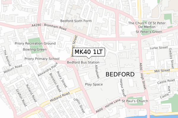
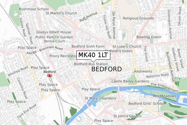
MK40 1LT is located in the Greyfriars electoral ward, within the unitary authority of Bedford and the English Parliamentary constituency of Bedford. The Sub Integrated Care Board (ICB) Location is NHS Bedfordshire, Luton and Milton Keynes ICB - M1J4Y and the police force is Bedfordshire. This postcode has been in use since January 1980.


GetTheData
Source: OS Open Zoomstack (Ordnance Survey)
Licence: Open Government Licence (requires attribution)
Attribution: Contains OS data © Crown copyright and database right 2024
Source: Open Postcode Geo
Licence: Open Government Licence (requires attribution)
Attribution: Contains OS data © Crown copyright and database right 2024; Contains Royal Mail data © Royal Mail copyright and database right 2024; Source: Office for National Statistics licensed under the Open Government Licence v.3.0
| Easting | 504740 |
| Northing | 249919 |
| Latitude | 52.137662 |
| Longitude | -0.470998 |
GetTheData
Source: Open Postcode Geo
Licence: Open Government Licence
| Country | England |
| Postcode District | MK40 |
| ➜ MK40 open data dashboard ➜ See where MK40 is on a map ➜ Where is Bedford? | |
GetTheData
Source: Land Registry Price Paid Data
Licence: Open Government Licence
Elevation or altitude of MK40 1LT as distance above sea level:
| Metres | Feet | |
|---|---|---|
| Elevation | 30m | 98ft |
Elevation is measured from the approximate centre of the postcode, to the nearest point on an OS contour line from OS Terrain 50, which has contour spacing of ten vertical metres.
➜ How high above sea level am I? Find the elevation of your current position using your device's GPS.
GetTheData
Source: Open Postcode Elevation
Licence: Open Government Licence
| Ward | Greyfriars |
| Constituency | Bedford |
GetTheData
Source: ONS Postcode Database
Licence: Open Government Licence
| January 2024 | Bicycle theft | On or near Nightclub | 344m |
| January 2024 | Other theft | On or near Nightclub | 344m |
| January 2024 | Theft from the person | On or near Nightclub | 344m |
| ➜ Get more crime data in our Crime section | |||
GetTheData
Source: data.police.uk
Licence: Open Government Licence
| Bus Station (Greyfriars) | Bedford | 80m |
| Bus Station (Greyfriars) | Bedford | 82m |
| Bus Station (Greyfriars) | Bedford | 84m |
| Harpur Street | Bedford | 170m |
| Bedford High School (The Crescent) | Bedford | 248m |
| Bedford Station | 0.6km |
| Bedford St Johns Station | 0.9km |
GetTheData
Source: NaPTAN
Licence: Open Government Licence
GetTheData
Source: ONS Postcode Database
Licence: Open Government Licence


➜ Get more ratings from the Food Standards Agency
GetTheData
Source: Food Standards Agency
Licence: FSA terms & conditions
| Last Collection | |||
|---|---|---|---|
| Location | Mon-Fri | Sat | Distance |
| Allhallows | 18:30 | 11:30 | 82m |
| Post Office Dane Street | 19:10 | 12:30 | 108m |
| St Loyes Street | 18:35 | 11:40 | 141m |
GetTheData
Source: Dracos
Licence: Creative Commons Attribution-ShareAlike
| Facility | Distance |
|---|---|
| Hmp Bedford St. Loyes Street, Bedford Artificial Grass Pitch | 194m |
| Trinity Arts & Leisure Bromham Road, Bedford Sports Hall, Swimming Pool, Health and Fitness Gym, Studio | 210m |
| Energie Fitness (Bedford) Horne Lane, Horne Lane, Bedford Health and Fitness Gym | 250m |
GetTheData
Source: Active Places
Licence: Open Government Licence
| School | Phase of Education | Distance |
|---|---|---|
| Priory Primary School Greyfriars, Bedford, MK40 1JD | Primary | 270m |
| Polam School 45 Lansdowne Road, Bedford, MK40 2BU | Not applicable | 526m |
| Bedford College Cauldwell Street, Bedford, MK42 9AH | 16 plus | 529m |
GetTheData
Source: Edubase
Licence: Open Government Licence
The below table lists the International Territorial Level (ITL) codes (formerly Nomenclature of Territorial Units for Statistics (NUTS) codes) and Local Administrative Units (LAU) codes for MK40 1LT:
| ITL 1 Code | Name |
|---|---|
| TLH | East |
| ITL 2 Code | Name |
| TLH2 | Bedfordshire and Hertfordshire |
| ITL 3 Code | Name |
| TLH24 | Bedford |
| LAU 1 Code | Name |
| E06000055 | Bedford |
GetTheData
Source: ONS Postcode Directory
Licence: Open Government Licence
The below table lists the Census Output Area (OA), Lower Layer Super Output Area (LSOA), and Middle Layer Super Output Area (MSOA) for MK40 1LT:
| Code | Name | |
|---|---|---|
| OA | E00088223 | |
| LSOA | E01017471 | Bedford 012F |
| MSOA | E02003627 | Bedford 012 |
GetTheData
Source: ONS Postcode Directory
Licence: Open Government Licence
| MK40 1LJ | Allhallows | 43m |
| MK40 1LR | Thurlow Street | 71m |
| MK40 1LN | Allhallows | 71m |
| MK40 1EZ | St Loyes Street | 98m |
| MK40 1EP | St Loyes Street | 102m |
| MK40 1JR | Beckett Court | 131m |
| MK40 1HJ | Greyfriars | 138m |
| MK40 1PL | Midland Road | 149m |
| MK40 1LA | Harpur Street | 174m |
| MK40 1JJ | Roise Court | 189m |
GetTheData
Source: Open Postcode Geo; Land Registry Price Paid Data
Licence: Open Government Licence