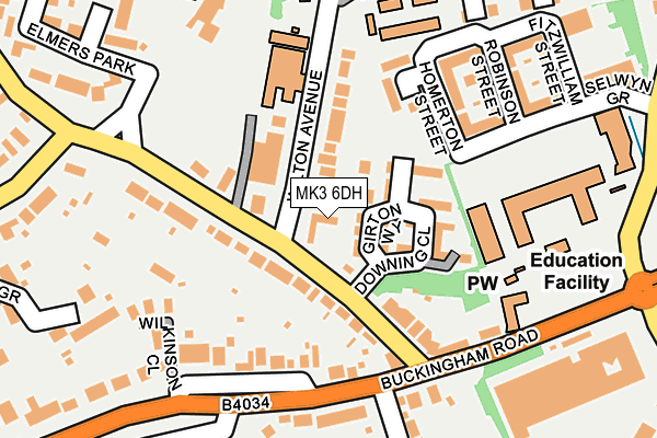
MK3 6DH is located in the Bletchley Park electoral ward, within the unitary authority of Milton Keynes and the English Parliamentary constituency of Milton Keynes South. The Sub Integrated Care Board (ICB) Location is NHS Bedfordshire, Luton and Milton Keynes ICB - M1J4Y and the police force is Thames Valley. This postcode has been in use since December 1998.


GetTheData
Source: OS OpenMap – Local (Ordnance Survey)
Source: OS VectorMap District (Ordnance Survey)
Licence: Open Government Licence (requires attribution)
| Easting | 486443 |
| Northing | 233577 |
| Latitude | 51.993923 |
| Longitude | -0.742419 |
GetTheData
Source: Open Postcode Geo
Licence: Open Government Licence
| Country | England |
| Postcode District | MK3 |
| ➜ MK3 open data dashboard ➜ See where MK3 is on a map ➜ Where is Bletchley? | |
GetTheData
Source: Land Registry Price Paid Data
Licence: Open Government Licence
Elevation or altitude of MK3 6DH as distance above sea level:
| Metres | Feet | |
|---|---|---|
| Elevation | 90m | 295ft |
Elevation is measured from the approximate centre of the postcode, to the nearest point on an OS contour line from OS Terrain 50, which has contour spacing of ten vertical metres.
➜ How high above sea level am I? Find the elevation of your current position using your device's GPS.
GetTheData
Source: Open Postcode Elevation
Licence: Open Government Licence
| Ward | Bletchley Park |
| Constituency | Milton Keynes South |
GetTheData
Source: ONS Postcode Database
Licence: Open Government Licence
| January 2024 | Vehicle crime | On or near Browning Crescent | 327m |
| January 2024 | Violence and sexual offences | On or near Corrigan Close | 368m |
| January 2024 | Burglary | On or near Corrigan Close | 368m |
| ➜ Get more crime data in our Crime section | |||
GetTheData
Source: data.police.uk
Licence: Open Government Licence
| The Eight Belles (Church Green Road) | Bletchley Park | 102m |
| Cottingham Grove (Buckingham Road) | Bletchley | 176m |
| Elmers Park (Church Green Road) | Bletchley Park | 177m |
| Cottingham Grove (Buckingham Road) | Bletchley | 177m |
| Elmers Park (Church Green Road) | Bletchley Park | 178m |
| Bletchley Station | 0.4km |
| Fenny Stratford Station | 1.9km |
| Bow Brickhill Station | 3.4km |
GetTheData
Source: NaPTAN
Licence: Open Government Licence
GetTheData
Source: ONS Postcode Database
Licence: Open Government Licence


➜ Get more ratings from the Food Standards Agency
GetTheData
Source: Food Standards Agency
Licence: FSA terms & conditions
| Last Collection | |||
|---|---|---|---|
| Location | Mon-Fri | Sat | Distance |
| Buckingham Road | 17:30 | 12:00 | 216m |
| Bletchley Park | 17:30 | 12:00 | 220m |
| Church Green Road | 17:30 | 12:00 | 410m |
GetTheData
Source: Dracos
Licence: Creative Commons Attribution-ShareAlike
| Facility | Distance |
|---|---|
| Courtside Sports & Fitness @ Milton Keynes College Sherwood Drive, Bletchley, Milton Keynes Sports Hall, Health and Fitness Gym, Studio | 197m |
| Holne Chase Primary School Buckingham Road, Bletchley, Milton Keynes Grass Pitches | 498m |
| Rickley Park Shenley Road, Bletchley Grass Pitches | 659m |
GetTheData
Source: Active Places
Licence: Open Government Licence
| School | Phase of Education | Distance |
|---|---|---|
| Holne Chase Primary School Buckingham Road, Holne Chase Primary School, Bletchley, MK3 5HP | Primary | 508m |
| Rickley Park Primary School Rickley Lane, Bletchley, MK3 6EW | Primary | 764m |
| Lord Grey Academy Rickley Lane, Bletchley, Milton Keynes, MK3 6EW | Secondary | 807m |
GetTheData
Source: Edubase
Licence: Open Government Licence
The below table lists the International Territorial Level (ITL) codes (formerly Nomenclature of Territorial Units for Statistics (NUTS) codes) and Local Administrative Units (LAU) codes for MK3 6DH:
| ITL 1 Code | Name |
|---|---|
| TLJ | South East (England) |
| ITL 2 Code | Name |
| TLJ1 | Berkshire, Buckinghamshire and Oxfordshire |
| ITL 3 Code | Name |
| TLJ12 | Milton Keynes |
| LAU 1 Code | Name |
| E06000042 | Milton Keynes |
GetTheData
Source: ONS Postcode Directory
Licence: Open Government Licence
The below table lists the Census Output Area (OA), Lower Layer Super Output Area (LSOA), and Middle Layer Super Output Area (MSOA) for MK3 6DH:
| Code | Name | |
|---|---|---|
| OA | E00175380 | |
| LSOA | E01016711 | Milton Keynes 031A |
| MSOA | E02003489 | Milton Keynes 031 |
GetTheData
Source: ONS Postcode Directory
Licence: Open Government Licence
| MK3 6EL | Girton Way | 29m |
| MK3 6BJ | Church Green Road | 49m |
| MK3 6BN | Wilton Avenue | 67m |
| MK3 6BL | Church Green Road | 76m |
| MK3 6EP | Downing Close | 89m |
| MK3 6DU | Homerton Street | 168m |
| MK3 5HH | Buckingham Road | 175m |
| MK3 5HJ | Buckingham Road | 185m |
| MK3 6DL | Robinson Street | 189m |
| MK3 5HN | Buckingham Road | 204m |
GetTheData
Source: Open Postcode Geo; Land Registry Price Paid Data
Licence: Open Government Licence