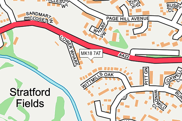
MK18 7AT lies on Stratford Road in Buckingham. MK18 7AT is located in the Buckingham East electoral ward, within the unitary authority of Buckinghamshire and the English Parliamentary constituency of Buckingham. The Sub Integrated Care Board (ICB) Location is NHS Buckinghamshire, Oxfordshire and Berkshire West ICB - 14Y and the police force is Thames Valley. This postcode has been in use since January 1983.


GetTheData
Source: OS OpenMap – Local (Ordnance Survey)
Source: OS VectorMap District (Ordnance Survey)
Licence: Open Government Licence (requires attribution)
| Easting | 470326 |
| Northing | 234228 |
| Latitude | 52.002058 |
| Longitude | -0.976957 |
GetTheData
Source: Open Postcode Geo
Licence: Open Government Licence
| Street | Stratford Road |
| Town/City | Buckingham |
| Country | England |
| Postcode District | MK18 |
| ➜ MK18 open data dashboard ➜ See where MK18 is on a map ➜ Where is Buckingham? | |
GetTheData
Source: Land Registry Price Paid Data
Licence: Open Government Licence
Elevation or altitude of MK18 7AT as distance above sea level:
| Metres | Feet | |
|---|---|---|
| Elevation | 80m | 262ft |
Elevation is measured from the approximate centre of the postcode, to the nearest point on an OS contour line from OS Terrain 50, which has contour spacing of ten vertical metres.
➜ How high above sea level am I? Find the elevation of your current position using your device's GPS.
GetTheData
Source: Open Postcode Elevation
Licence: Open Government Licence
| Ward | Buckingham East |
| Constituency | Buckingham |
GetTheData
Source: ONS Postcode Database
Licence: Open Government Licence
| January 2024 | Other theft | On or near Petrol Station | 422m |
| December 2023 | Violence and sexual offences | On or near Stratford Road | 391m |
| December 2023 | Violence and sexual offences | On or near Stratford Road | 391m |
| ➜ Stratford Road crime map and outcomes | |||
GetTheData
Source: data.police.uk
Licence: Open Government Licence
| Stratford Road | Buckingham | 184m |
| Stratford Road | Buckingham | 184m |
| Linden Village (Burleigh Piece) | Buckingham | 278m |
| Linden Village (Burleigh Piece) | Buckingham | 282m |
| Hilltop Avenue | Buckingham | 338m |
GetTheData
Source: NaPTAN
Licence: Open Government Licence
| Percentage of properties with Next Generation Access | 100.0% |
| Percentage of properties with Superfast Broadband | 100.0% |
| Percentage of properties with Ultrafast Broadband | 0.0% |
| Percentage of properties with Full Fibre Broadband | 0.0% |
Superfast Broadband is between 30Mbps and 300Mbps
Ultrafast Broadband is > 300Mbps
| Percentage of properties unable to receive 2Mbps | 0.0% |
| Percentage of properties unable to receive 5Mbps | 0.0% |
| Percentage of properties unable to receive 10Mbps | 0.0% |
| Percentage of properties unable to receive 30Mbps | 0.0% |
GetTheData
Source: Ofcom
Licence: Ofcom Terms of Use (requires attribution)
GetTheData
Source: ONS Postcode Database
Licence: Open Government Licence


➜ Get more ratings from the Food Standards Agency
GetTheData
Source: Food Standards Agency
Licence: FSA terms & conditions
| Last Collection | |||
|---|---|---|---|
| Location | Mon-Fri | Sat | Distance |
| Burleigh Piece | 17:40 | 12:00 | 157m |
| Gifford Place | 17:30 | 12:00 | 295m |
| Foscot Way | 17:30 | 12:00 | 322m |
GetTheData
Source: Dracos
Licence: Creative Commons Attribution-ShareAlike
| Facility | Distance |
|---|---|
| Buckingham Athletic Sports & Social Club Stratford Road, Buckingham Grass Pitches | 253m |
| Buckingham Town Cricket Club Bourton Road, Buckingham Grass Pitches | 575m |
| Maids Moreton Playing Fields Avenue Rd, Buckingham Grass Pitches | 599m |
GetTheData
Source: Active Places
Licence: Open Government Licence
| School | Phase of Education | Distance |
|---|---|---|
| Buckingham Primary School Foscott Way, Buckingham, MK18 1TT | Primary | 441m |
| Bourton Meadow Academy Burleigh Piece, Linden Village, Buckingham, MK18 7HX | Primary | 739m |
| George Grenville Academy Chandos Road, Buckingham, MK18 1AP | Primary | 930m |
GetTheData
Source: Edubase
Licence: Open Government Licence
The below table lists the International Territorial Level (ITL) codes (formerly Nomenclature of Territorial Units for Statistics (NUTS) codes) and Local Administrative Units (LAU) codes for MK18 7AT:
| ITL 1 Code | Name |
|---|---|
| TLJ | South East (England) |
| ITL 2 Code | Name |
| TLJ1 | Berkshire, Buckinghamshire and Oxfordshire |
| ITL 3 Code | Name |
| TLJ13 | Buckinghamshire |
| LAU 1 Code | Name |
| E06000060 | Buckinghamshire |
GetTheData
Source: ONS Postcode Directory
Licence: Open Government Licence
The below table lists the Census Output Area (OA), Lower Layer Super Output Area (LSOA), and Middle Layer Super Output Area (MSOA) for MK18 7AT:
| Code | Name | |
|---|---|---|
| OA | E00089057 | |
| LSOA | E01017644 | Aylesbury Vale 002A |
| MSOA | E02003653 | Aylesbury Vale 002 |
GetTheData
Source: ONS Postcode Directory
Licence: Open Government Licence
| MK18 7BF | Stratford Road | 36m |
| MK18 7BH | Wittmills Oak | 83m |
| MK18 1XF | Wharf View | 104m |
| MK18 1XN | Page Hill Avenue | 138m |
| MK18 1TW | Page Hill Avenue | 157m |
| MK18 7BQ | Pitt Green | 183m |
| MK18 1XR | Middlefield Close | 194m |
| MK18 7BP | March Edge | 201m |
| MK18 1UE | Hillesden Way | 204m |
| MK18 7BU | Pitchford Walk | 213m |
GetTheData
Source: Open Postcode Geo; Land Registry Price Paid Data
Licence: Open Government Licence