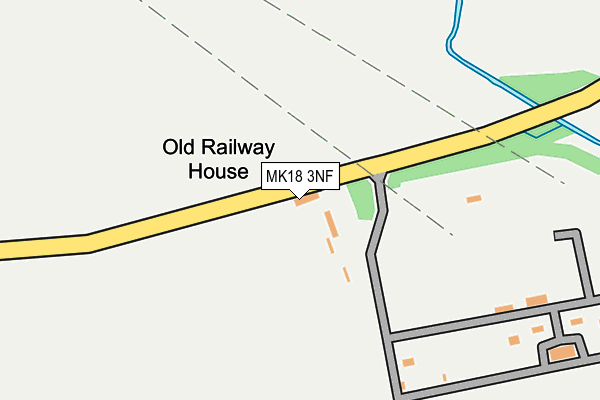
MK18 3NF is located in the Grendon Underwood electoral ward, within the unitary authority of Buckinghamshire and the English Parliamentary constituency of Buckingham. The Sub Integrated Care Board (ICB) Location is NHS Buckinghamshire, Oxfordshire and Berkshire West ICB - 14Y and the police force is Thames Valley. This postcode has been in use since January 1980.


GetTheData
Source: OS OpenMap – Local (Ordnance Survey)
Source: OS VectorMap District (Ordnance Survey)
Licence: Open Government Licence (requires attribution)
| Easting | 474979 |
| Northing | 226049 |
| Latitude | 51.927917 |
| Longitude | -0.910991 |
GetTheData
Source: Open Postcode Geo
Licence: Open Government Licence
| Country | England |
| Postcode District | MK18 |
| ➜ MK18 open data dashboard ➜ See where MK18 is on a map | |
GetTheData
Source: Land Registry Price Paid Data
Licence: Open Government Licence
Elevation or altitude of MK18 3NF as distance above sea level:
| Metres | Feet | |
|---|---|---|
| Elevation | 90m | 295ft |
Elevation is measured from the approximate centre of the postcode, to the nearest point on an OS contour line from OS Terrain 50, which has contour spacing of ten vertical metres.
➜ How high above sea level am I? Find the elevation of your current position using your device's GPS.
GetTheData
Source: Open Postcode Elevation
Licence: Open Government Licence
| Ward | Grendon Underwood |
| Constituency | Buckingham |
GetTheData
Source: ONS Postcode Database
Licence: Open Government Licence
| Dead Tree (St Mary's Road) | East Claydon | 1,313m |
| Chestnut View (St Mary's Road) | East Claydon | 1,410m |
GetTheData
Source: NaPTAN
Licence: Open Government Licence
GetTheData
Source: ONS Postcode Database
Licence: Open Government Licence


➜ Get more ratings from the Food Standards Agency
GetTheData
Source: Food Standards Agency
Licence: FSA terms & conditions
| Last Collection | |||
|---|---|---|---|
| Location | Mon-Fri | Sat | Distance |
| East Claydon | 16:00 | 10:00 | 1,274m |
| Bates Close | 16:00 | 09:00 | 1,797m |
| Sandhill | 16:00 | 10:00 | 1,944m |
GetTheData
Source: Dracos
Licence: Creative Commons Attribution-ShareAlike
| Facility | Distance |
|---|---|
| Winslow Rufc (Winslow Centre) Winslow Centre, Park Road, Winslow, Buckingham Sports Hall, Health and Fitness Gym, Grass Pitches, Outdoor Tennis Courts, Artificial Grass Pitch | 2.7km |
| Winslow Sports Club Elmfields Gate, Winslow, Buckingham Grass Pitches | 2.8km |
| Sir Thomas Fremantle School Buckingham Road, Winslow, Buckingham Sports Hall, Artificial Grass Pitch, Studio | 2.8km |
GetTheData
Source: Active Places
Licence: Open Government Licence
| School | Phase of Education | Distance |
|---|---|---|
| East Claydon Church of England School St Mary's Road, East Claydon, MK18 2LS | Primary | 1.8km |
| Furze Down School Verney Road, Winslow, Buckingham, MK18 3BL | Not applicable | 2.2km |
| Sir Thomas Fremantle School Buckingham Road, Winslow, MK18 3GH | Secondary | 2.7km |
GetTheData
Source: Edubase
Licence: Open Government Licence
The below table lists the International Territorial Level (ITL) codes (formerly Nomenclature of Territorial Units for Statistics (NUTS) codes) and Local Administrative Units (LAU) codes for MK18 3NF:
| ITL 1 Code | Name |
|---|---|
| TLJ | South East (England) |
| ITL 2 Code | Name |
| TLJ1 | Berkshire, Buckinghamshire and Oxfordshire |
| ITL 3 Code | Name |
| TLJ13 | Buckinghamshire |
| LAU 1 Code | Name |
| E06000060 | Buckinghamshire |
GetTheData
Source: ONS Postcode Directory
Licence: Open Government Licence
The below table lists the Census Output Area (OA), Lower Layer Super Output Area (LSOA), and Middle Layer Super Output Area (MSOA) for MK18 3NF:
| Code | Name | |
|---|---|---|
| OA | E00089380 | |
| LSOA | E01017714 | Aylesbury Vale 004D |
| MSOA | E02003655 | Aylesbury Vale 004 |
GetTheData
Source: ONS Postcode Directory
Licence: Open Government Licence
| MK18 2LF | 840m | |
| MK18 2ND | Church Way | 1140m |
| MK18 2NB | Church Way | 1164m |
| MK18 2NA | St Marys Road | 1277m |
| MK18 2HR | St Marys Close | 1288m |
| MK18 2FA | Lacemakers Close | 1302m |
| MK18 2LZ | Sandhill Road | 1312m |
| MK18 2LX | St Marys Road | 1330m |
| MK18 2LU | St Marys Road | 1342m |
| MK18 2NN | Verney Farm Close | 1353m |
GetTheData
Source: Open Postcode Geo; Land Registry Price Paid Data
Licence: Open Government Licence