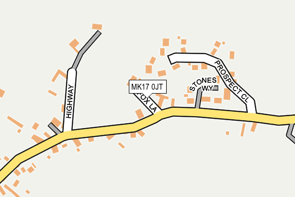
MK17 0JT is located in the Great Brickhill electoral ward, within the unitary authority of Buckinghamshire and the English Parliamentary constituency of Buckingham. The Sub Integrated Care Board (ICB) Location is NHS Bedfordshire, Luton and Milton Keynes ICB - M1J4Y and the police force is Thames Valley. This postcode has been in use since August 1992.


GetTheData
Source: OS OpenMap – Local (Ordnance Survey)
Source: OS VectorMap District (Ordnance Survey)
Licence: Open Government Licence (requires attribution)
| Easting | 484392 |
| Northing | 228835 |
| Latitude | 51.951614 |
| Longitude | -0.773448 |
GetTheData
Source: Open Postcode Geo
Licence: Open Government Licence
| Country | England |
| Postcode District | MK17 |
| ➜ MK17 open data dashboard ➜ See where MK17 is on a map ➜ Where is Drayton Parslow? | |
GetTheData
Source: Land Registry Price Paid Data
Licence: Open Government Licence
Elevation or altitude of MK17 0JT as distance above sea level:
| Metres | Feet | |
|---|---|---|
| Elevation | 120m | 394ft |
Elevation is measured from the approximate centre of the postcode, to the nearest point on an OS contour line from OS Terrain 50, which has contour spacing of ten vertical metres.
➜ How high above sea level am I? Find the elevation of your current position using your device's GPS.
GetTheData
Source: Open Postcode Elevation
Licence: Open Government Licence
| Ward | Great Brickhill |
| Constituency | Buckingham |
GetTheData
Source: ONS Postcode Database
Licence: Open Government Licence
| May 2022 | Violence and sexual offences | On or near Newmans Courtyard | 383m |
| May 2022 | Theft from the person | On or near Newmans Courtyard | 383m |
| January 2022 | Violence and sexual offences | On or near Salden Close | 448m |
| ➜ Get more crime data in our Crime section | |||
GetTheData
Source: data.police.uk
Licence: Open Government Licence
| Stones Way (Main Road) | Drayton Parslow | 89m |
| Stones Way (Main Road) | Drayton Parslow | 97m |
| Highway (Main Road) | Drayton Parslow | 166m |
| Highway (Main Road) | Drayton Parslow | 185m |
| The Three Horseshoes Ph (Main Road) | Drayton Parslow | 516m |
| Bletchley Station | 5.5km |
GetTheData
Source: NaPTAN
Licence: Open Government Licence
GetTheData
Source: ONS Postcode Database
Licence: Open Government Licence


➜ Get more ratings from the Food Standards Agency
GetTheData
Source: Food Standards Agency
Licence: FSA terms & conditions
| Last Collection | |||
|---|---|---|---|
| Location | Mon-Fri | Sat | Distance |
| Lower End | 17:15 | 09:15 | 216m |
| Church End | 16:00 | 09:15 | 607m |
| Bowles Farm | 17:00 | 10:30 | 2,041m |
GetTheData
Source: Dracos
Licence: Creative Commons Attribution-ShareAlike
| Facility | Distance |
|---|---|
| Stewkley Recreation Ground Soulbury Road, Stewkley Grass Pitches, Outdoor Tennis Courts | 2.9km |
| Hammond Park Whaddon Road, Newton Longville Grass Pitches | 3km |
| Mursley Playing Fields Station Road, Mursley Grass Pitches, Artificial Grass Pitch | 3.1km |
GetTheData
Source: Active Places
Licence: Open Government Licence
| School | Phase of Education | Distance |
|---|---|---|
| Drayton Parslow Village School Main Road, Drayton Parslow, Milton Keynes, MK17 0JR | Primary | 450m |
| Newton Longville Church of England Primary School School Drive, Newton Longville, MK17 0BZ | Primary | 2.2km |
| St Michael's Church of England Combined School Chapel Square, Stewkley, Leighton Buzzard, LU7 0HA | Primary | 2.7km |
GetTheData
Source: Edubase
Licence: Open Government Licence
The below table lists the International Territorial Level (ITL) codes (formerly Nomenclature of Territorial Units for Statistics (NUTS) codes) and Local Administrative Units (LAU) codes for MK17 0JT:
| ITL 1 Code | Name |
|---|---|
| TLJ | South East (England) |
| ITL 2 Code | Name |
| TLJ1 | Berkshire, Buckinghamshire and Oxfordshire |
| ITL 3 Code | Name |
| TLJ13 | Buckinghamshire |
| LAU 1 Code | Name |
| E06000060 | Buckinghamshire |
GetTheData
Source: ONS Postcode Directory
Licence: Open Government Licence
The below table lists the Census Output Area (OA), Lower Layer Super Output Area (LSOA), and Middle Layer Super Output Area (MSOA) for MK17 0JT:
| Code | Name | |
|---|---|---|
| OA | E00089186 | |
| LSOA | E01017669 | Aylesbury Vale 006A |
| MSOA | E02003657 | Aylesbury Vale 006 |
GetTheData
Source: ONS Postcode Directory
Licence: Open Government Licence
| MK17 0FL | Fox Lane | 33m |
| MK17 0JB | Prospect Close | 112m |
| MK17 0LF | Stones Way | 118m |
| MK17 0JW | The Highway | 173m |
| MK17 0JP | Carrington Hall Road | 196m |
| MK17 0JN | Love Row | 223m |
| MK17 0JS | Main Road | 320m |
| MK17 0JR | Main Road | 419m |
| MK17 0JY | Salden Close | 445m |
| MK17 0JU | Bates Gardens | 479m |
GetTheData
Source: Open Postcode Geo; Land Registry Price Paid Data
Licence: Open Government Licence