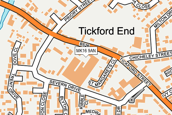
MK16 9AN is located in the Newport Pagnell South electoral ward, within the unitary authority of Milton Keynes and the English Parliamentary constituency of Milton Keynes North. The Sub Integrated Care Board (ICB) Location is NHS Bedfordshire, Luton and Milton Keynes ICB - M1J4Y and the police force is Thames Valley. This postcode has been in use since January 1980.


GetTheData
Source: OS OpenMap – Local (Ordnance Survey)
Source: OS VectorMap District (Ordnance Survey)
Licence: Open Government Licence (requires attribution)
| Easting | 488058 |
| Northing | 243625 |
| Latitude | 52.083996 |
| Longitude | -0.716299 |
GetTheData
Source: Open Postcode Geo
Licence: Open Government Licence
| Country | England |
| Postcode District | MK16 |
| ➜ MK16 open data dashboard ➜ See where MK16 is on a map ➜ Where is Newport Pagnell? | |
GetTheData
Source: Land Registry Price Paid Data
Licence: Open Government Licence
Elevation or altitude of MK16 9AN as distance above sea level:
| Metres | Feet | |
|---|---|---|
| Elevation | 60m | 197ft |
Elevation is measured from the approximate centre of the postcode, to the nearest point on an OS contour line from OS Terrain 50, which has contour spacing of ten vertical metres.
➜ How high above sea level am I? Find the elevation of your current position using your device's GPS.
GetTheData
Source: Open Postcode Elevation
Licence: Open Government Licence
| Ward | Newport Pagnell South |
| Constituency | Milton Keynes North |
GetTheData
Source: ONS Postcode Database
Licence: Open Government Licence
| January 2024 | Violence and sexual offences | On or near Parking Area | 414m |
| December 2023 | Violence and sexual offences | On or near Parking Area | 414m |
| November 2023 | Vehicle crime | On or near Parking Area | 414m |
| ➜ Get more crime data in our Crime section | |||
GetTheData
Source: data.police.uk
Licence: Open Government Licence
| Tickford End Works (Tickford Street) | Tickford End | 74m |
| Tickford End Works (Tickford Street) | Tickford End | 78m |
| Severn Drive (Tickford Street) | Tickford End | 194m |
| Chicheley Street (Tickford Street) | Tickford End | 209m |
| The Canons (Tickford Street) | Tickford End | 379m |
GetTheData
Source: NaPTAN
Licence: Open Government Licence
GetTheData
Source: ONS Postcode Database
Licence: Open Government Licence


➜ Get more ratings from the Food Standards Agency
GetTheData
Source: Food Standards Agency
Licence: FSA terms & conditions
| Last Collection | |||
|---|---|---|---|
| Location | Mon-Fri | Sat | Distance |
| Severn Drive | 17:15 | 12:00 | 121m |
| Tickford Street | 17:15 | 12:00 | 165m |
| Chicheley Street | 17:15 | 12:00 | 180m |
GetTheData
Source: Dracos
Licence: Creative Commons Attribution-ShareAlike
| Facility | Distance |
|---|---|
| Harben House Severn Drive, Newport Pagnell Health and Fitness Gym | 169m |
| Tickford Park Primary School Avon Close, Newport Pagnell Grass Pitches | 265m |
| Middleton Pool And Fitness Centre Tickford Street, Newport Pagnell Swimming Pool, Health and Fitness Gym | 433m |
GetTheData
Source: Active Places
Licence: Open Government Licence
| School | Phase of Education | Distance |
|---|---|---|
| Tickford Park Primary School Avon Close, Newport Pagnell, MK16 9DH | Primary | 202m |
| Cedars Primary School Bury Street, Newport Pagnell, MK16 0DT | Primary | 600m |
| Green Park School Green Park Drive, Newport Pagnell, MK16 0NH | Primary | 1.3km |
GetTheData
Source: Edubase
Licence: Open Government Licence
The below table lists the International Territorial Level (ITL) codes (formerly Nomenclature of Territorial Units for Statistics (NUTS) codes) and Local Administrative Units (LAU) codes for MK16 9AN:
| ITL 1 Code | Name |
|---|---|
| TLJ | South East (England) |
| ITL 2 Code | Name |
| TLJ1 | Berkshire, Buckinghamshire and Oxfordshire |
| ITL 3 Code | Name |
| TLJ12 | Milton Keynes |
| LAU 1 Code | Name |
| E06000042 | Milton Keynes |
GetTheData
Source: ONS Postcode Directory
Licence: Open Government Licence
The below table lists the Census Output Area (OA), Lower Layer Super Output Area (LSOA), and Middle Layer Super Output Area (MSOA) for MK16 9AN:
| Code | Name | |
|---|---|---|
| OA | E00084736 | |
| LSOA | E01016793 | Milton Keynes 004C |
| MSOA | E02003462 | Milton Keynes 004 |
GetTheData
Source: ONS Postcode Directory
Licence: Open Government Licence
| MK16 9BJ | Tickford Street | 77m |
| MK16 9EF | St Margarets Close | 81m |
| MK16 9AW | Tickford Street | 91m |
| MK16 9DW | Severn Drive | 108m |
| MK16 9BU | Severn Drive | 116m |
| MK16 9DL | Severn Drive | 124m |
| MK16 9DP | Ribble Close | 142m |
| MK16 9DR | Severn Drive | 157m |
| MK16 9DT | Medway Close | 170m |
| MK16 9BX | Severn Drive | 178m |
GetTheData
Source: Open Postcode Geo; Land Registry Price Paid Data
Licence: Open Government Licence