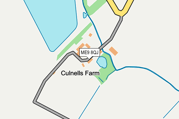
ME9 8QJ lies on School Lane in Iwade, Sittingbourne. ME9 8QJ is located in the Bobbing, Iwade and Lower Halstow electoral ward, within the local authority district of Swale and the English Parliamentary constituency of Sittingbourne and Sheppey. The Sub Integrated Care Board (ICB) Location is NHS Kent and Medway ICB - 91Q and the police force is Kent. This postcode has been in use since January 1980.


GetTheData
Source: OS OpenMap – Local (Ordnance Survey)
Source: OS VectorMap District (Ordnance Survey)
Licence: Open Government Licence (requires attribution)
| Easting | 588977 |
| Northing | 166923 |
| Latitude | 51.369916 |
| Longitude | 0.713546 |
GetTheData
Source: Open Postcode Geo
Licence: Open Government Licence
| Street | School Lane |
| Locality | Iwade |
| Town/City | Sittingbourne |
| Country | England |
| Postcode District | ME9 |
➜ See where ME9 is on a map | |
GetTheData
Source: Land Registry Price Paid Data
Licence: Open Government Licence
Elevation or altitude of ME9 8QJ as distance above sea level:
| Metres | Feet | |
|---|---|---|
| Elevation | 20m | 66ft |
Elevation is measured from the approximate centre of the postcode, to the nearest point on an OS contour line from OS Terrain 50, which has contour spacing of ten vertical metres.
➜ How high above sea level am I? Find the elevation of your current position using your device's GPS.
GetTheData
Source: Open Postcode Elevation
Licence: Open Government Licence
| Ward | Bobbing, Iwade And Lower Halstow |
| Constituency | Sittingbourne And Sheppey |
GetTheData
Source: ONS Postcode Database
Licence: Open Government Licence
| Chetney View (School Lane) | Iwade | 989m |
| Chetney View (School Lane) | Iwade | 1,005m |
| Featherbed Farm Yard (Sheppey Way) | Iwade | 1,016m |
| Featherbed Farm Yard (Sheppey Way) | Iwade | 1,044m |
| Dancing Dog Saloon (Sheppey Way) | Howt Green | 1,145m |
| Kemsley Station | 1.7km |
| Swale Station | 3.2km |
| Sittingbourne Station | 3.4km |
GetTheData
Source: NaPTAN
Licence: Open Government Licence
| Percentage of properties with Next Generation Access | 100.0% |
| Percentage of properties with Superfast Broadband | 0.0% |
| Percentage of properties with Ultrafast Broadband | 0.0% |
| Percentage of properties with Full Fibre Broadband | 0.0% |
Superfast Broadband is between 30Mbps and 300Mbps
Ultrafast Broadband is > 300Mbps
| Percentage of properties unable to receive 2Mbps | 0.0% |
| Percentage of properties unable to receive 5Mbps | 100.0% |
| Percentage of properties unable to receive 10Mbps | 100.0% |
| Percentage of properties unable to receive 30Mbps | 100.0% |
GetTheData
Source: Ofcom
Licence: Ofcom Terms of Use (requires attribution)
GetTheData
Source: ONS Postcode Database
Licence: Open Government Licence


➜ Get more ratings from the Food Standards Agency
GetTheData
Source: Food Standards Agency
Licence: FSA terms & conditions
| Last Collection | |||
|---|---|---|---|
| Location | Mon-Fri | Sat | Distance |
| Iwade Post Office | 16:45 | 09:00 | 1,339m |
| Kemsley Post Office | 17:15 | 09:00 | 1,611m |
| Bobbing Church | 16:30 | 09:00 | 1,810m |
GetTheData
Source: Dracos
Licence: Creative Commons Attribution-ShareAlike
| Risk of ME9 8QJ flooding from rivers and sea | Medium |
| ➜ ME9 8QJ flood map | |
GetTheData
Source: Open Flood Risk by Postcode
Licence: Open Government Licence
The below table lists the International Territorial Level (ITL) codes (formerly Nomenclature of Territorial Units for Statistics (NUTS) codes) and Local Administrative Units (LAU) codes for ME9 8QJ:
| ITL 1 Code | Name |
|---|---|
| TLJ | South East (England) |
| ITL 2 Code | Name |
| TLJ4 | Kent |
| ITL 3 Code | Name |
| TLJ43 | Kent Thames Gateway |
| LAU 1 Code | Name |
| E07000113 | Swale |
GetTheData
Source: ONS Postcode Directory
Licence: Open Government Licence
The below table lists the Census Output Area (OA), Lower Layer Super Output Area (LSOA), and Middle Layer Super Output Area (MSOA) for ME9 8QJ:
| Code | Name | |
|---|---|---|
| OA | E00166877 | |
| LSOA | E01032656 | Swale 007H |
| MSOA | E02005121 | Swale 007 |
GetTheData
Source: ONS Postcode Directory
Licence: Open Government Licence
| ME9 8QL | Stickfast Lane | 795m |
| ME9 8QY | Sheppey Way | 820m |
| ME9 8XB | Meadow Brown View | 825m |
| ME9 8XA | White Admiral Grove | 842m |
| ME9 8SG | School Lane | 847m |
| ME9 8XD | Purple Emperor Grove | 852m |
| ME9 8XE | Ringlet Grove | 871m |
| ME9 8QH | School Lane | 880m |
| ME9 8WL | Holly Blue Drive | 898m |
| ME9 8WN | Holly Blue Drive | 921m |
GetTheData
Source: Open Postcode Geo; Land Registry Price Paid Data
Licence: Open Government Licence