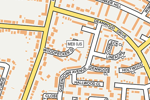
ME8 0JS is located in the Rainham South East electoral ward, within the unitary authority of Medway and the English Parliamentary constituency of Gillingham and Rainham. The Sub Integrated Care Board (ICB) Location is NHS Kent and Medway ICB - 91Q and the police force is Kent. This postcode has been in use since March 2003.


GetTheData
Source: OS OpenMap – Local (Ordnance Survey)
Source: OS VectorMap District (Ordnance Survey)
Licence: Open Government Licence (requires attribution)
| Easting | 580613 |
| Northing | 164577 |
| Latitude | 51.351563 |
| Longitude | 0.592330 |
GetTheData
Source: Open Postcode Geo
Licence: Open Government Licence
| Country | England |
| Postcode District | ME8 |
| ➜ ME8 open data dashboard ➜ See where ME8 is on a map | |
GetTheData
Source: Land Registry Price Paid Data
Licence: Open Government Licence
Elevation or altitude of ME8 0JS as distance above sea level:
| Metres | Feet | |
|---|---|---|
| Elevation | 90m | 295ft |
Elevation is measured from the approximate centre of the postcode, to the nearest point on an OS contour line from OS Terrain 50, which has contour spacing of ten vertical metres.
➜ How high above sea level am I? Find the elevation of your current position using your device's GPS.
GetTheData
Source: Open Postcode Elevation
Licence: Open Government Licence
| Ward | Rainham South East |
| Constituency | Gillingham And Rainham |
GetTheData
Source: ONS Postcode Database
Licence: Open Government Licence
| January 2024 | Other theft | On or near Parking Area | 458m |
| January 2024 | Criminal damage and arson | On or near Parking Area | 458m |
| January 2024 | Other theft | On or near Parking Area | 458m |
| ➜ Get more crime data in our Crime section | |||
GetTheData
Source: data.police.uk
Licence: Open Government Licence
| Wigmore Harvester (Maidstone Road) | Parkwood | 127m |
| Deanwood Drive Top (Deanwood Drive) | Parkwood | 160m |
| Deanwood Drive Top (Deanwood Drive) | Parkwood | 161m |
| Wigmore Harvester (Maidstone Road) | Parkwood | 163m |
| Wigmore Harvester (Woodside) | Parkwood | 185m |
| Rainham (Kent) Station | 2.1km |
| Gillingham (Kent) Station | 4.9km |
GetTheData
Source: NaPTAN
Licence: Open Government Licence
GetTheData
Source: ONS Postcode Database
Licence: Open Government Licence

➜ Get more ratings from the Food Standards Agency
GetTheData
Source: Food Standards Agency
Licence: FSA terms & conditions
| Last Collection | |||
|---|---|---|---|
| Location | Mon-Fri | Sat | Distance |
| Tanker Hill | 17:15 | 12:00 | 316m |
| Deanswood Post Office | 17:30 | 12:00 | 368m |
| Maidstone Road | 17:30 | 12:00 | 456m |
GetTheData
Source: Dracos
Licence: Creative Commons Attribution-ShareAlike
| Facility | Distance |
|---|---|
| Fairview School Drewery Drive, Gillingham Grass Pitches | 559m |
| Ryetop Playing Fields Beacon Close, Gillingham Grass Pitches | 858m |
| Deanwood Primary School Long Catlis Road, Gillingham Grass Pitches | 1km |
GetTheData
Source: Active Places
Licence: Open Government Licence
| School | Phase of Education | Distance |
|---|---|---|
| Fairview Community Primary School Drewery Drive, Wigmore, Gillingham, ME8 0NU | Primary | 520m |
| Parkwood Primary School Deanwood Drive, Rainham, Gillingham, ME8 9LP | Primary | 567m |
| Bryony School 157 Marshall Road, Rainham, Marshall Road, Rainham, ME8 0AJ | Not applicable | 830m |
GetTheData
Source: Edubase
Licence: Open Government Licence
The below table lists the International Territorial Level (ITL) codes (formerly Nomenclature of Territorial Units for Statistics (NUTS) codes) and Local Administrative Units (LAU) codes for ME8 0JS:
| ITL 1 Code | Name |
|---|---|
| TLJ | South East (England) |
| ITL 2 Code | Name |
| TLJ4 | Kent |
| ITL 3 Code | Name |
| TLJ41 | Medway |
| LAU 1 Code | Name |
| E06000035 | Medway |
GetTheData
Source: ONS Postcode Directory
Licence: Open Government Licence
The below table lists the Census Output Area (OA), Lower Layer Super Output Area (LSOA), and Middle Layer Super Output Area (MSOA) for ME8 0JS:
| Code | Name | |
|---|---|---|
| OA | E00081400 | |
| LSOA | E01016105 | Medway 036D |
| MSOA | E02003349 | Medway 036 |
GetTheData
Source: ONS Postcode Directory
Licence: Open Government Licence
| ME8 0JR | Woodpecker Glade | 23m |
| ME8 9NL | Queendown Avenue | 62m |
| ME8 9NU | Queendown Avenue | 97m |
| ME8 9NS | Idenwood Close | 110m |
| ME8 0HX | Maidstone Road | 118m |
| ME8 9NJ | Napwood Close | 119m |
| ME8 9NT | Hallwood Close | 126m |
| ME8 9NN | Cowbeck Close | 130m |
| ME8 0JA | Maidstone Road | 163m |
| ME8 9NH | Deanwood Drive | 163m |
GetTheData
Source: Open Postcode Geo; Land Registry Price Paid Data
Licence: Open Government Licence