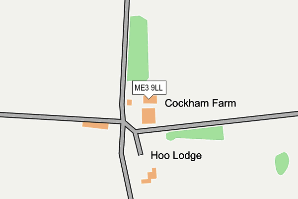
ME3 9LL is located in the Hoo St Werburgh & High Halstow electoral ward, within the unitary authority of Medway and the English Parliamentary constituency of Rochester and Strood. The Sub Integrated Care Board (ICB) Location is NHS Kent and Medway ICB - 91Q and the police force is Kent. This postcode has been in use since January 1980.


GetTheData
Source: OS OpenMap – Local (Ordnance Survey)
Source: OS VectorMap District (Ordnance Survey)
Licence: Open Government Licence (requires attribution)
| Easting | 577262 |
| Northing | 171683 |
| Latitude | 51.416449 |
| Longitude | 0.547802 |
GetTheData
Source: Open Postcode Geo
Licence: Open Government Licence
| Country | England |
| Postcode District | ME3 |
| ➜ ME3 open data dashboard ➜ See where ME3 is on a map | |
GetTheData
Source: Land Registry Price Paid Data
Licence: Open Government Licence
Elevation or altitude of ME3 9LL as distance above sea level:
| Metres | Feet | |
|---|---|---|
| Elevation | 40m | 131ft |
Elevation is measured from the approximate centre of the postcode, to the nearest point on an OS contour line from OS Terrain 50, which has contour spacing of ten vertical metres.
➜ How high above sea level am I? Find the elevation of your current position using your device's GPS.
GetTheData
Source: Open Postcode Elevation
Licence: Open Government Licence
| Ward | Hoo St Werburgh & High Halstow |
| Constituency | Rochester And Strood |
GetTheData
Source: ONS Postcode Database
Licence: Open Government Licence
| Hundred Of Hoo Academy (Main Road) | Hoo St Werburgh | 444m |
| Swimming Pool (Main Road) | Hoo St Werburgh | 451m |
| Hundred Of Hoo Academy Grounds (School Grounds) | Hoo St Werburgh | 517m |
| Broad Street (Main Road) | Hoo St Werburgh | 533m |
| St Werburgh Crescent (Main Road) | Hoo St Werburgh | 568m |
| Gillingham (Kent) Station | 3.3km |
| Strood Station | 4km |
| Rochester Station | 4.3km |
GetTheData
Source: NaPTAN
Licence: Open Government Licence
GetTheData
Source: ONS Postcode Database
Licence: Open Government Licence


➜ Get more ratings from the Food Standards Agency
GetTheData
Source: Food Standards Agency
Licence: FSA terms & conditions
| Last Collection | |||
|---|---|---|---|
| Location | Mon-Fri | Sat | Distance |
| Moremont Road | 16:45 | 10:30 | 1,049m |
| Chattenden (Ex P O) | 16:45 | 11:15 | 1,070m |
| Hoo Post Office | 17:15 | 11:15 | 1,093m |
GetTheData
Source: Dracos
Licence: Creative Commons Attribution-ShareAlike
| Facility | Distance |
|---|---|
| Hoo Sports Centre Main Road, Hoo, Rochester Swimming Pool, Health and Fitness Gym, Squash Courts, Studio | 424m |
| The Hundred Of Hoo Academy Main Road, Hoo St Werburgh, Rochester Grass Pitches, Sports Hall, Artificial Grass Pitch, Studio | 611m |
| Hoo Village Institute Main Road, Hoo, Rochester Grass Pitches | 1km |
GetTheData
Source: Active Places
Licence: Open Government Licence
| School | Phase of Education | Distance |
|---|---|---|
| The Hundred of Hoo Academy Main Road, Hoo, Rochester, ME3 9HH | All-through | 611m |
| Hoo St Werburgh Primary School and the Marlborough Pottery Road, Hoo St Werburgh, Rochester, ME3 9BS | Primary | 710m |
| St Mary's Island Church of England (Aided) Primary School Island Way West, St Mary's Island, Chatham, ME4 3ST | Primary | 1.2km |
GetTheData
Source: Edubase
Licence: Open Government Licence
The below table lists the International Territorial Level (ITL) codes (formerly Nomenclature of Territorial Units for Statistics (NUTS) codes) and Local Administrative Units (LAU) codes for ME3 9LL:
| ITL 1 Code | Name |
|---|---|
| TLJ | South East (England) |
| ITL 2 Code | Name |
| TLJ4 | Kent |
| ITL 3 Code | Name |
| TLJ41 | Medway |
| LAU 1 Code | Name |
| E06000035 | Medway |
GetTheData
Source: ONS Postcode Directory
Licence: Open Government Licence
The below table lists the Census Output Area (OA), Lower Layer Super Output Area (LSOA), and Middle Layer Super Output Area (MSOA) for ME3 9LL:
| Code | Name | |
|---|---|---|
| OA | E00081264 | |
| LSOA | E01016077 | Medway 003D |
| MSOA | E02003316 | Medway 003 |
GetTheData
Source: ONS Postcode Directory
Licence: Open Government Licence
| ME3 9EY | Main Road | 495m |
| ME3 9HG | Main Road | 516m |
| ME3 9HP | Main Road | 563m |
| ME3 9HL | St Werburgh Crescent | 568m |
| ME3 9HB | Main Road | 626m |
| ME3 9EX | Main Road | 635m |
| ME3 9HN | Herdsdown | 637m |
| ME3 9HJ | St Werburgh Crescent | 664m |
| ME3 9ET | Gordon Road | 668m |
| ME3 9HS | Willow Grange | 699m |
GetTheData
Source: Open Postcode Geo; Land Registry Price Paid Data
Licence: Open Government Licence