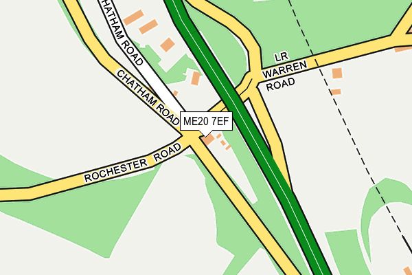
ME20 7EF is located in the Aylesford North & North Downs electoral ward, within the local authority district of Tonbridge and Malling and the English Parliamentary constituency of Chatham and Aylesford. The Sub Integrated Care Board (ICB) Location is NHS Kent and Medway ICB - 91Q and the police force is Kent. This postcode has been in use since January 1980.


GetTheData
Source: OS OpenMap – Local (Ordnance Survey)
Source: OS VectorMap District (Ordnance Survey)
Licence: Open Government Licence (requires attribution)
| Easting | 574851 |
| Northing | 160648 |
| Latitude | 51.318069 |
| Longitude | 0.507743 |
GetTheData
Source: Open Postcode Geo
Licence: Open Government Licence
| Country | England |
| Postcode District | ME20 |
| ➜ ME20 open data dashboard ➜ See where ME20 is on a map ➜ Where is Kit's Coty? | |
GetTheData
Source: Land Registry Price Paid Data
Licence: Open Government Licence
Elevation or altitude of ME20 7EF as distance above sea level:
| Metres | Feet | |
|---|---|---|
| Elevation | 90m | 295ft |
Elevation is measured from the approximate centre of the postcode, to the nearest point on an OS contour line from OS Terrain 50, which has contour spacing of ten vertical metres.
➜ How high above sea level am I? Find the elevation of your current position using your device's GPS.
GetTheData
Source: Open Postcode Elevation
Licence: Open Government Licence
| Ward | Aylesford North & North Downs |
| Constituency | Chatham And Aylesford |
GetTheData
Source: ONS Postcode Database
Licence: Open Government Licence
| June 2022 | Public order | On or near Petrol Station | 182m |
| May 2022 | Anti-social behaviour | On or near Petrol Station | 182m |
| May 2022 | Public order | On or near Pedestrian Subway | 432m |
| ➜ Get more crime data in our Crime section | |||
GetTheData
Source: data.police.uk
Licence: Open Government Licence
| Lower Bell (Chatham Road) | Kits Coty | 42m |
| Lower Bell (Old Chatham Road) | Kits Coty | 94m |
| Old Chatham Road | Kits Coty | 292m |
| Salisbury Road (Chatham Road) | Kits Coty | 513m |
| Service Station (Old Chatham Road) | Kits Coty | 603m |
| Aylesford Station | 3.4km |
| New Hythe Station | 3.7km |
| Barming Station | 4.2km |
GetTheData
Source: NaPTAN
Licence: Open Government Licence
GetTheData
Source: ONS Postcode Database
Licence: Open Government Licence


➜ Get more ratings from the Food Standards Agency
GetTheData
Source: Food Standards Agency
Licence: FSA terms & conditions
| Last Collection | |||
|---|---|---|---|
| Location | Mon-Fri | Sat | Distance |
| Lower Bell | 16:00 | 09:00 | 11m |
| Kits Coty Estate | 16:00 | 09:00 | 783m |
| Tyland Lane | 17:45 | 09:00 | 1,502m |
GetTheData
Source: Dracos
Licence: Creative Commons Attribution-ShareAlike
| Facility | Distance |
|---|---|
| Cobtree Manor Park Golf Club Chatham Road, Sandling, Maidstone Golf | 1.5km |
| Holcombe & Blue Bell Hill Cricket Club Common Road, Chatham Grass Pitches | 1.7km |
| Blue Bell Village Hall Robin Hood Lane, Blue Bell Hill, Chatham Sports Hall | 1.7km |
GetTheData
Source: Active Places
Licence: Open Government Licence
| School | Phase of Education | Distance |
|---|---|---|
| St Mark's Church of England Primary School, Eccles Eccles Row, Eccles, Aylesford, ME20 7HS | Primary | 2km |
| Tunbury Primary School Tunbury Avenue, Walderslade, Chatham, ME5 9HY | Primary | 2km |
| Burham Church of England Primary School Bell Lane, Burham, Rochester, ME1 3SY | Primary | 2.3km |
GetTheData
Source: Edubase
Licence: Open Government Licence
The below table lists the International Territorial Level (ITL) codes (formerly Nomenclature of Territorial Units for Statistics (NUTS) codes) and Local Administrative Units (LAU) codes for ME20 7EF:
| ITL 1 Code | Name |
|---|---|
| TLJ | South East (England) |
| ITL 2 Code | Name |
| TLJ4 | Kent |
| ITL 3 Code | Name |
| TLJ46 | West Kent |
| LAU 1 Code | Name |
| E07000115 | Tonbridge and Malling |
GetTheData
Source: ONS Postcode Directory
Licence: Open Government Licence
The below table lists the Census Output Area (OA), Lower Layer Super Output Area (LSOA), and Middle Layer Super Output Area (MSOA) for ME20 7EF:
| Code | Name | |
|---|---|---|
| OA | E00125486 | |
| LSOA | E01024721 | Tonbridge and Malling 001C |
| MSOA | E02005149 | Tonbridge and Malling 001 |
GetTheData
Source: ONS Postcode Directory
Licence: Open Government Licence
| ME5 9RF | Warren Road | 296m |
| ME20 7EH | Lower Warren Road | 439m |
| ME20 7EX | Queenswood Road | 519m |
| ME20 7EG | Chatham Road | 587m |
| ME20 7ES | Collingwood Road | 622m |
| ME20 7EY | Russell Road | 633m |
| ME20 7EU | Queenswood Road | 654m |
| ME5 9RE | Warren Road | 691m |
| ME20 7EP | Beresford Road | 713m |
| ME20 7HA | Vincent Road | 811m |
GetTheData
Source: Open Postcode Geo; Land Registry Price Paid Data
Licence: Open Government Licence