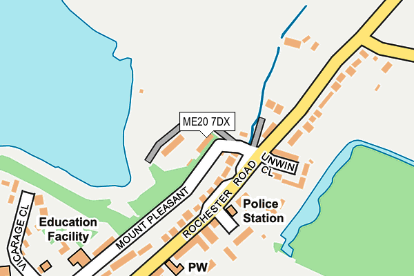
ME20 7DX is located in the Aylesford North & North Downs electoral ward, within the local authority district of Tonbridge and Malling and the English Parliamentary constituency of Chatham and Aylesford. The Sub Integrated Care Board (ICB) Location is NHS Kent and Medway ICB - 91Q and the police force is Kent. This postcode has been in use since January 1980.


GetTheData
Source: OS OpenMap – Local (Ordnance Survey)
Source: OS VectorMap District (Ordnance Survey)
Licence: Open Government Licence (requires attribution)
| Easting | 573243 |
| Northing | 159225 |
| Latitude | 51.305778 |
| Longitude | 0.484001 |
GetTheData
Source: Open Postcode Geo
Licence: Open Government Licence
| Country | England |
| Postcode District | ME20 |
| ➜ ME20 open data dashboard ➜ See where ME20 is on a map ➜ Where is Aylesford? | |
GetTheData
Source: Land Registry Price Paid Data
Licence: Open Government Licence
Elevation or altitude of ME20 7DX as distance above sea level:
| Metres | Feet | |
|---|---|---|
| Elevation | 10m | 33ft |
Elevation is measured from the approximate centre of the postcode, to the nearest point on an OS contour line from OS Terrain 50, which has contour spacing of ten vertical metres.
➜ How high above sea level am I? Find the elevation of your current position using your device's GPS.
GetTheData
Source: Open Postcode Elevation
Licence: Open Government Licence
| Ward | Aylesford North & North Downs |
| Constituency | Chatham And Aylesford |
GetTheData
Source: ONS Postcode Database
Licence: Open Government Licence
| September 2023 | Criminal damage and arson | On or near Parking Area | 368m |
| July 2023 | Anti-social behaviour | On or near Parking Area | 368m |
| July 2023 | Violence and sexual offences | On or near Parking Area | 368m |
| ➜ Get more crime data in our Crime section | |||
GetTheData
Source: data.police.uk
Licence: Open Government Licence
| High Street | Aylesford | 315m |
| High Street | Aylesford | 345m |
| Deacon Trading Estate (Forstal Road) | Aylesford | 450m |
| Deacon Trading Estate (Forstal Road) | Aylesford | 507m |
| The Friars (Bull Lane) | Aylesford | 733m |
| Aylesford Station | 1.3km |
| New Hythe Station | 2.2km |
| Barming Station | 2.3km |
GetTheData
Source: NaPTAN
Licence: Open Government Licence
GetTheData
Source: ONS Postcode Database
Licence: Open Government Licence


➜ Get more ratings from the Food Standards Agency
GetTheData
Source: Food Standards Agency
Licence: FSA terms & conditions
| Last Collection | |||
|---|---|---|---|
| Location | Mon-Fri | Sat | Distance |
| Aylesford Post Office | 17:15 | 11:15 | 351m |
| Forstall Road | 17:30 | 09:00 | 800m |
| Pratling Street | 16:45 | 09:00 | 855m |
GetTheData
Source: Dracos
Licence: Creative Commons Attribution-ShareAlike
| Facility | Distance |
|---|---|
| Aylesford Recreation Ground Forstal Road, Aylesford Grass Pitches | 188m |
| Ministry Of Muscle (Closed) Old Summerfield Warehouse, Station Road, Aylesford Health and Fitness Gym | 527m |
| Ferryfield Recreation Ground Medway Court, Aylesford Grass Pitches | 664m |
GetTheData
Source: Active Places
Licence: Open Government Licence
| School | Phase of Education | Distance |
|---|---|---|
| St Peter's Church of England Primary School Mount Pleasant, Aylesford, ME20 7BE | Primary | 250m |
| Valley Invicta Primary School At Aylesford Teapot Lane, Aylesford, ME20 7JU | Primary | 1.5km |
| Aylesford School Teapot Lane, Aylesford, ME20 7JU | Secondary | 1.6km |
GetTheData
Source: Edubase
Licence: Open Government Licence
The below table lists the International Territorial Level (ITL) codes (formerly Nomenclature of Territorial Units for Statistics (NUTS) codes) and Local Administrative Units (LAU) codes for ME20 7DX:
| ITL 1 Code | Name |
|---|---|
| TLJ | South East (England) |
| ITL 2 Code | Name |
| TLJ4 | Kent |
| ITL 3 Code | Name |
| TLJ46 | West Kent |
| LAU 1 Code | Name |
| E07000115 | Tonbridge and Malling |
GetTheData
Source: ONS Postcode Directory
Licence: Open Government Licence
The below table lists the Census Output Area (OA), Lower Layer Super Output Area (LSOA), and Middle Layer Super Output Area (MSOA) for ME20 7DX:
| Code | Name | |
|---|---|---|
| OA | E00125466 | |
| LSOA | E01024719 | Tonbridge and Malling 001A |
| MSOA | E02005149 | Tonbridge and Malling 001 |
GetTheData
Source: ONS Postcode Directory
Licence: Open Government Licence
| ME20 7BJ | Rochester Road | 89m |
| ME20 7BD | Unwin Close | 114m |
| ME20 7BN | Rochester Road | 123m |
| ME20 7BW | Powell Close | 158m |
| ME20 7BL | Rochester Road | 165m |
| ME20 7BS | Rochester Road | 176m |
| ME20 7BQ | Trinity Court | 211m |
| ME20 7BE | Mount Pleasant | 234m |
| ME20 7AU | Forstal Road | 239m |
| ME20 7BP | Bush Row | 245m |
GetTheData
Source: Open Postcode Geo; Land Registry Price Paid Data
Licence: Open Government Licence