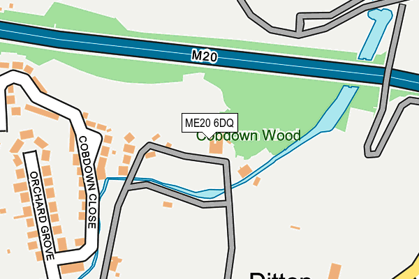
ME20 6DQ is located in the Aylesford South & Ditton electoral ward, within the local authority district of Tonbridge and Malling and the English Parliamentary constituency of Chatham and Aylesford. The Sub Integrated Care Board (ICB) Location is NHS Kent and Medway ICB - 91Q and the police force is Kent. This postcode has been in use since September 1981.


GetTheData
Source: OS OpenMap – Local (Ordnance Survey)
Source: OS VectorMap District (Ordnance Survey)
Licence: Open Government Licence (requires attribution)
| Easting | 571220 |
| Northing | 158722 |
| Latitude | 51.301870 |
| Longitude | 0.454795 |
GetTheData
Source: Open Postcode Geo
Licence: Open Government Licence
| Country | England |
| Postcode District | ME20 |
| ➜ ME20 open data dashboard ➜ See where ME20 is on a map | |
GetTheData
Source: Land Registry Price Paid Data
Licence: Open Government Licence
Elevation or altitude of ME20 6DQ as distance above sea level:
| Metres | Feet | |
|---|---|---|
| Elevation | 10m | 33ft |
Elevation is measured from the approximate centre of the postcode, to the nearest point on an OS contour line from OS Terrain 50, which has contour spacing of ten vertical metres.
➜ How high above sea level am I? Find the elevation of your current position using your device's GPS.
GetTheData
Source: Open Postcode Elevation
Licence: Open Government Licence
| Ward | Aylesford South & Ditton |
| Constituency | Chatham And Aylesford |
GetTheData
Source: ONS Postcode Database
Licence: Open Government Licence
| January 2024 | Violence and sexual offences | On or near Station Road | 348m |
| January 2024 | Anti-social behaviour | On or near Station Road | 348m |
| January 2024 | Bicycle theft | On or near Petrol Station | 388m |
| ➜ Get more crime data in our Crime section | |||
GetTheData
Source: data.police.uk
Licence: Open Government Licence
| Ditton Corner (London Road) | Ditton | 303m |
| Ditton Corner (London Road) | Ditton | 303m |
| Bell Lane (London Road) | Ditton | 463m |
| Bell Lane (London Road) | Ditton | 516m |
| Ta Centre (London Road) | Ditton | 532m |
| Aylesford Station | 0.8km |
| New Hythe Station | 1.2km |
| East Malling Station | 2.1km |
GetTheData
Source: NaPTAN
Licence: Open Government Licence
GetTheData
Source: ONS Postcode Database
Licence: Open Government Licence


➜ Get more ratings from the Food Standards Agency
GetTheData
Source: Food Standards Agency
Licence: FSA terms & conditions
| Last Collection | |||
|---|---|---|---|
| Location | Mon-Fri | Sat | Distance |
| Ditton Post Office | 17:00 | 11:00 | 502m |
| St Peters Road | 16:15 | 09:00 | 724m |
| Primrose Drive | 17:30 | 09:00 | 730m |
GetTheData
Source: Dracos
Licence: Creative Commons Attribution-ShareAlike
| Facility | Distance |
|---|---|
| K Sports Cobdown Station Road, Ditton, Aylesford Grass Pitches, Squash Courts, Artificial Grass Pitch, Health and Fitness Gym | 296m |
| New Road Recreation Ground New Road, Ditton, Aylesford Grass Pitches | 463m |
| Ministry Of Muscle (Closed) Mill Hall Business Estate, Mill Hall, Aylesford Health and Fitness Gym | 579m |
GetTheData
Source: Active Places
Licence: Open Government Licence
| School | Phase of Education | Distance |
|---|---|---|
| Ditton Church of England Junior School New Road, Ditton, Aylesford, ME20 6AE | Primary | 652m |
| Ditton Infant School Pear Tree Avenue, Ditton, Aylesford, ME20 6EB | Primary | 702m |
| Aylesford School Teapot Lane, Aylesford, ME20 7JU | Secondary | 747m |
GetTheData
Source: Edubase
Licence: Open Government Licence
The below table lists the International Territorial Level (ITL) codes (formerly Nomenclature of Territorial Units for Statistics (NUTS) codes) and Local Administrative Units (LAU) codes for ME20 6DQ:
| ITL 1 Code | Name |
|---|---|
| TLJ | South East (England) |
| ITL 2 Code | Name |
| TLJ4 | Kent |
| ITL 3 Code | Name |
| TLJ46 | West Kent |
| LAU 1 Code | Name |
| E07000115 | Tonbridge and Malling |
GetTheData
Source: ONS Postcode Directory
Licence: Open Government Licence
The below table lists the Census Output Area (OA), Lower Layer Super Output Area (LSOA), and Middle Layer Super Output Area (MSOA) for ME20 6DQ:
| Code | Name | |
|---|---|---|
| OA | E00125562 | |
| LSOA | E01024737 | Tonbridge and Malling 005E |
| MSOA | E02005153 | Tonbridge and Malling 005 |
GetTheData
Source: ONS Postcode Directory
Licence: Open Government Licence
| ME20 6DD | Cobdown Park | 135m |
| ME20 6SZ | Cobdown Close | 238m |
| ME20 6AL | Sheldon Court | 268m |
| ME20 6BY | Orchard Grove | 292m |
| ME20 6AU | Station Road | 312m |
| ME20 6BX | London Road | 325m |
| ME20 6DL | London Road | 333m |
| ME20 6AX | Station Road | 357m |
| ME20 6BU | Bell Lane | 370m |
| ME20 6BT | Bell Lane | 370m |
GetTheData
Source: Open Postcode Geo; Land Registry Price Paid Data
Licence: Open Government Licence