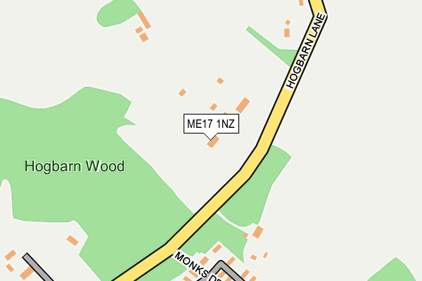
ME17 1NZ lies on Hogbarn Lane in Harrietsham, Maidstone. ME17 1NZ is located in the North Downs electoral ward, within the local authority district of Maidstone and the English Parliamentary constituency of Faversham and Mid Kent. The Sub Integrated Care Board (ICB) Location is NHS Kent and Medway ICB - 91Q and the police force is Kent. This postcode has been in use since January 1980.


GetTheData
Source: OS OpenMap – Local (Ordnance Survey)
Source: OS VectorMap District (Ordnance Survey)
Licence: Open Government Licence (requires attribution)
| Easting | 588369 |
| Northing | 155279 |
| Latitude | 51.265535 |
| Longitude | 0.698675 |
GetTheData
Source: Open Postcode Geo
Licence: Open Government Licence
| Street | Hogbarn Lane |
| Locality | Harrietsham |
| Town/City | Maidstone |
| Country | England |
| Postcode District | ME17 |
| ➜ ME17 open data dashboard ➜ See where ME17 is on a map | |
GetTheData
Source: Land Registry Price Paid Data
Licence: Open Government Licence
Elevation or altitude of ME17 1NZ as distance above sea level:
| Metres | Feet | |
|---|---|---|
| Elevation | 180m | 591ft |
Elevation is measured from the approximate centre of the postcode, to the nearest point on an OS contour line from OS Terrain 50, which has contour spacing of ten vertical metres.
➜ How high above sea level am I? Find the elevation of your current position using your device's GPS.
GetTheData
Source: Open Postcode Elevation
Licence: Open Government Licence
| Ward | North Downs |
| Constituency | Faversham And Mid Kent |
GetTheData
Source: ONS Postcode Database
Licence: Open Government Licence
| June 2022 | Other theft | On or near Pilgrims Close | 226m |
| May 2022 | Anti-social behaviour | On or near Pilgrims Close | 226m |
| March 2022 | Violence and sexual offences | On or near Pilgrims Close | 226m |
| ➜ Hogbarn Lane crime map and outcomes | |||
GetTheData
Source: data.police.uk
Licence: Open Government Licence
| Harrietsham Station | 2.9km |
| Lenham Station | 3.5km |
| Hollingbourne Station | 4.9km |
GetTheData
Source: NaPTAN
Licence: Open Government Licence
➜ Broadband speed and availability dashboard for ME17 1NZ
| Percentage of properties with Next Generation Access | 100.0% |
| Percentage of properties with Superfast Broadband | 90.0% |
| Percentage of properties with Ultrafast Broadband | 0.0% |
| Percentage of properties with Full Fibre Broadband | 0.0% |
Superfast Broadband is between 30Mbps and 300Mbps
Ultrafast Broadband is > 300Mbps
| Median download speed | 79.4Mbps |
| Average download speed | 66.5Mbps |
| Maximum download speed | 80.00Mbps |
| Median upload speed | 18.3Mbps |
| Average upload speed | 15.6Mbps |
| Maximum upload speed | 20.00Mbps |
| Percentage of properties unable to receive 2Mbps | 0.0% |
| Percentage of properties unable to receive 5Mbps | 0.0% |
| Percentage of properties unable to receive 10Mbps | 10.0% |
| Percentage of properties unable to receive 30Mbps | 10.0% |
➜ Broadband speed and availability dashboard for ME17 1NZ
GetTheData
Source: Ofcom
Licence: Ofcom Terms of Use (requires attribution)
GetTheData
Source: ONS Postcode Database
Licence: Open Government Licence


➜ Get more ratings from the Food Standards Agency
GetTheData
Source: Food Standards Agency
Licence: FSA terms & conditions
| Last Collection | |||
|---|---|---|---|
| Location | Mon-Fri | Sat | Distance |
| Hogs Barn | 17:00 | 09:00 | 168m |
| Ringlestone | 17:00 | 09:00 | 659m |
| Stede Court | 17:00 | 09:00 | 1,477m |
GetTheData
Source: Dracos
Licence: Creative Commons Attribution-ShareAlike
| Facility | Distance |
|---|---|
| The Lenham School Ham Lane, Lenham, Maidstone Swimming Pool, Health and Fitness Gym, Grass Pitches, Sports Hall, Studio, Artificial Grass Pitch | 3.1km |
| William Pitt Field Old Ham Lane, Lenham, Maidstone Grass Pitches | 3.1km |
| Hollingbourne Cricket Club Pilgrim's Way, Hollingbourne, Maidstone Grass Pitches | 3.7km |
GetTheData
Source: Active Places
Licence: Open Government Licence
| School | Phase of Education | Distance |
|---|---|---|
| The Lenham School Ham Lane, Lenham, Maidstone, ME17 2LL | Secondary | 3.1km |
| Lenham Primary School Ham Lane, Lenham, Maidstone, ME17 2LL | Primary | 3.3km |
| Harrietsham Church of England Primary School West Street, Harrietsham, Maidstone, ME17 1JZ | Primary | 3.4km |
GetTheData
Source: Edubase
Licence: Open Government Licence
The below table lists the International Territorial Level (ITL) codes (formerly Nomenclature of Territorial Units for Statistics (NUTS) codes) and Local Administrative Units (LAU) codes for ME17 1NZ:
| ITL 1 Code | Name |
|---|---|
| TLJ | South East (England) |
| ITL 2 Code | Name |
| TLJ4 | Kent |
| ITL 3 Code | Name |
| TLJ45 | Mid Kent |
| LAU 1 Code | Name |
| E07000110 | Maidstone |
GetTheData
Source: ONS Postcode Directory
Licence: Open Government Licence
The below table lists the Census Output Area (OA), Lower Layer Super Output Area (LSOA), and Middle Layer Super Output Area (MSOA) for ME17 1NZ:
| Code | Name | |
|---|---|---|
| OA | E00123800 | |
| LSOA | E01024387 | Maidstone 011D |
| MSOA | E02005078 | Maidstone 011 |
GetTheData
Source: ONS Postcode Directory
Licence: Open Government Licence
| ME17 1NX | Ringlestone Road | 734m |
| ME17 1NS | Dean Hill | 1173m |
| ME17 1NU | Stede Hill | 1210m |
| ME9 0UA | Park Farm Lane | 1227m |
| ME17 1NR | Stede Hill | 1261m |
| ME9 0EA | 1281m | |
| ME17 2EN | Flint Lane | 1416m |
| ME9 0SY | 1464m | |
| ME9 0UB | The Street | 1496m |
| ME17 1NP | Stede Hill | 1721m |
GetTheData
Source: Open Postcode Geo; Land Registry Price Paid Data
Licence: Open Government Licence