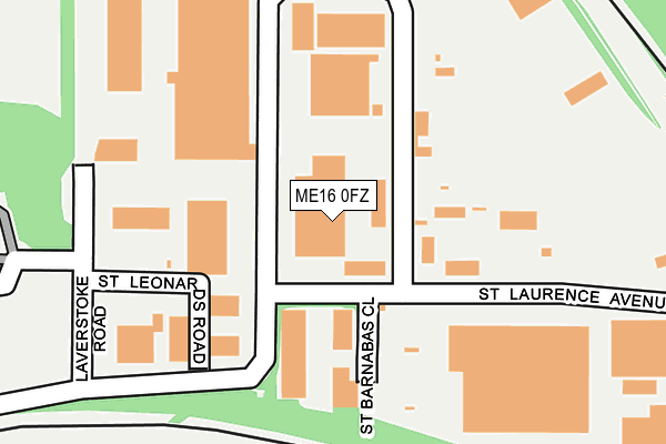
ME16 0FZ is located in the Allington electoral ward, within the local authority district of Maidstone and the English Parliamentary constituency of Maidstone and The Weald. The Sub Integrated Care Board (ICB) Location is NHS Kent and Medway ICB - 91Q and the police force is Kent. This postcode has been in use since January 2008.


GetTheData
Source: OS OpenMap – Local (Ordnance Survey)
Source: OS VectorMap District (Ordnance Survey)
Licence: Open Government Licence (requires attribution)
| Easting | 574281 |
| Northing | 157793 |
| Latitude | 51.292597 |
| Longitude | 0.498178 |
GetTheData
Source: Open Postcode Geo
Licence: Open Government Licence
| Country | England |
| Postcode District | ME16 |
| ➜ ME16 open data dashboard ➜ See where ME16 is on a map ➜ Where is Maidstone? | |
GetTheData
Source: Land Registry Price Paid Data
Licence: Open Government Licence
Elevation or altitude of ME16 0FZ as distance above sea level:
| Metres | Feet | |
|---|---|---|
| Elevation | 30m | 98ft |
Elevation is measured from the approximate centre of the postcode, to the nearest point on an OS contour line from OS Terrain 50, which has contour spacing of ten vertical metres.
➜ How high above sea level am I? Find the elevation of your current position using your device's GPS.
GetTheData
Source: Open Postcode Elevation
Licence: Open Government Licence
| Ward | Allington |
| Constituency | Maidstone And The Weald |
GetTheData
Source: ONS Postcode Database
Licence: Open Government Licence
| June 2022 | Other theft | On or near Eastry Close | 446m |
| June 2022 | Possession of weapons | On or near Thirlemere Close | 480m |
| June 2022 | Drugs | On or near Thirlemere Close | 480m |
| ➜ Get more crime data in our Crime section | |||
GetTheData
Source: data.police.uk
Licence: Open Government Licence
| Fordwich Close (Hildenborough Crescent) | Allington | 498m |
| Kilndown Close (Hildenborough Crescent) | Allington | 518m |
| Sir Thomas Wyatt (London Road) | Allington | 728m |
| Stansted Close (Tintern Road) | Allington | 736m |
| Stansted Close (Tintern Road) | Allington | 749m |
| Barming Station | 1.6km |
| Maidstone Barracks Station | 2km |
| Maidstone East Station | 2.3km |
GetTheData
Source: NaPTAN
Licence: Open Government Licence
GetTheData
Source: ONS Postcode Database
Licence: Open Government Licence


➜ Get more ratings from the Food Standards Agency
GetTheData
Source: Food Standards Agency
Licence: FSA terms & conditions
| Last Collection | |||
|---|---|---|---|
| Location | Mon-Fri | Sat | Distance |
| 20/20 Ind Est | 18:45 | 199m | |
| 20/20 Industrial Estate | 18:30 | 12:15 | 204m |
| Braunstone Drive | 17:30 | 12:00 | 450m |
GetTheData
Source: Dracos
Licence: Creative Commons Attribution-ShareAlike
| Facility | Distance |
|---|---|
| The Orchard Ground Castle Road, Maidstone Grass Pitches | 409m |
| Allington Primary School Hildenborough Crescent, Maidstone Grass Pitches, Sports Hall, Swimming Pool | 599m |
| Village Gym (Maidstone) Forstal Road, Sandling, Maidstone Swimming Pool, Health and Fitness Gym, Studio | 981m |
GetTheData
Source: Active Places
Licence: Open Government Licence
| School | Phase of Education | Distance |
|---|---|---|
| Allington Primary School Hildenborough Crescent, London Road, Maidstone, ME16 0PG | Primary | 632m |
| Palace Wood Primary School Ash Grove, Allington, Maidstone, ME16 0AB | Primary | 1.1km |
| The Maplesden Noakes School Buckland Road, Maidstone, ME16 0TJ | Secondary | 1.6km |
GetTheData
Source: Edubase
Licence: Open Government Licence
The below table lists the International Territorial Level (ITL) codes (formerly Nomenclature of Territorial Units for Statistics (NUTS) codes) and Local Administrative Units (LAU) codes for ME16 0FZ:
| ITL 1 Code | Name |
|---|---|
| TLJ | South East (England) |
| ITL 2 Code | Name |
| TLJ4 | Kent |
| ITL 3 Code | Name |
| TLJ45 | Mid Kent |
| LAU 1 Code | Name |
| E07000110 | Maidstone |
GetTheData
Source: ONS Postcode Directory
Licence: Open Government Licence
The below table lists the Census Output Area (OA), Lower Layer Super Output Area (LSOA), and Middle Layer Super Output Area (MSOA) for ME16 0FZ:
| Code | Name | |
|---|---|---|
| OA | E00123462 | |
| LSOA | E01024324 | Maidstone 003E |
| MSOA | E02005070 | Maidstone 003 |
GetTheData
Source: ONS Postcode Directory
Licence: Open Government Licence
| ME16 0PN | Halstead Walk | 385m |
| ME16 0PW | Halstead Walk | 400m |
| ME16 0PE | Chilham Road | 418m |
| ME16 0PB | Hildenborough Crescent | 441m |
| ME16 0PL | Kilndown Close | 443m |
| ME16 0PD | Eastry Close | 447m |
| ME16 0UA | Charlock Close | 449m |
| ME16 0TN | Hextable Close | 478m |
| ME16 0PP | Castle Road | 479m |
| ME16 0NU | Fordwich Close | 484m |
GetTheData
Source: Open Postcode Geo; Land Registry Price Paid Data
Licence: Open Government Licence