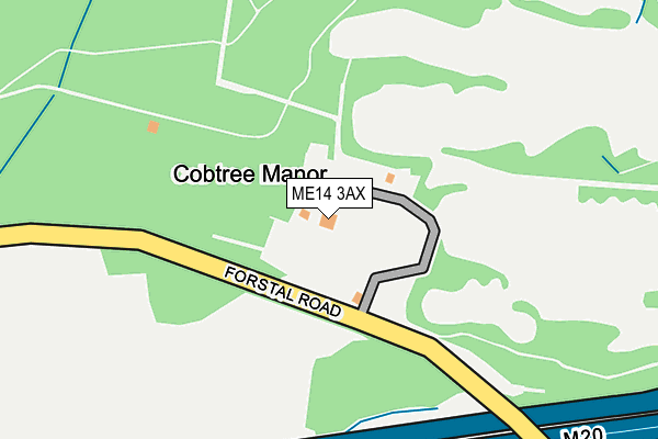
ME14 3AX lies on Forstal Road in Sandling, Maidstone. ME14 3AX is located in the Boxley electoral ward, within the local authority district of Maidstone and the English Parliamentary constituency of Faversham and Mid Kent. The Sub Integrated Care Board (ICB) Location is NHS Kent and Medway ICB - 91Q and the police force is Kent. This postcode has been in use since January 1980.


GetTheData
Source: OS OpenMap – Local (Ordnance Survey)
Source: OS VectorMap District (Ordnance Survey)
Licence: Open Government Licence (requires attribution)
| Easting | 574740 |
| Northing | 158669 |
| Latitude | 51.300326 |
| Longitude | 0.505183 |
GetTheData
Source: Open Postcode Geo
Licence: Open Government Licence
| Street | Forstal Road |
| Locality | Sandling |
| Town/City | Maidstone |
| Country | England |
| Postcode District | ME14 |
| ➜ ME14 open data dashboard ➜ See where ME14 is on a map | |
GetTheData
Source: Land Registry Price Paid Data
Licence: Open Government Licence
Elevation or altitude of ME14 3AX as distance above sea level:
| Metres | Feet | |
|---|---|---|
| Elevation | 30m | 98ft |
Elevation is measured from the approximate centre of the postcode, to the nearest point on an OS contour line from OS Terrain 50, which has contour spacing of ten vertical metres.
➜ How high above sea level am I? Find the elevation of your current position using your device's GPS.
GetTheData
Source: Open Postcode Elevation
Licence: Open Government Licence
| Ward | Boxley |
| Constituency | Faversham And Mid Kent |
GetTheData
Source: ONS Postcode Database
Licence: Open Government Licence
| June 2022 | Violence and sexual offences | On or near Lock Lane | 439m |
| June 2022 | Anti-social behaviour | On or near Lock Lane | 439m |
| June 2022 | Other theft | On or near Lock Lane | 439m |
| ➜ Forstal Road crime map and outcomes | |||
GetTheData
Source: data.police.uk
Licence: Open Government Licence
| Motorway Bridge (Forstal Road) | Aylesford | 123m |
| Motorway Bridge (Forstal Road) | Aylesford | 135m |
| Cobtree Country Park (Forstal Road) | Aylesford | 368m |
| Kent Life (Lock Lane) | Aylesford | 455m |
| Cobtree Country Park (Forstal Road) | Aylesford | 471m |
| Barming Station | 2.5km |
| Maidstone Barracks Station | 2.6km |
| Aylesford Station | 2.7km |
GetTheData
Source: NaPTAN
Licence: Open Government Licence
| Percentage of properties with Next Generation Access | 100.0% |
| Percentage of properties with Superfast Broadband | 100.0% |
| Percentage of properties with Ultrafast Broadband | 0.0% |
| Percentage of properties with Full Fibre Broadband | 0.0% |
Superfast Broadband is between 30Mbps and 300Mbps
Ultrafast Broadband is > 300Mbps
| Percentage of properties unable to receive 2Mbps | 0.0% |
| Percentage of properties unable to receive 5Mbps | 0.0% |
| Percentage of properties unable to receive 10Mbps | 0.0% |
| Percentage of properties unable to receive 30Mbps | 0.0% |
GetTheData
Source: Ofcom
Licence: Ofcom Terms of Use (requires attribution)
GetTheData
Source: ONS Postcode Database
Licence: Open Government Licence


➜ Get more ratings from the Food Standards Agency
GetTheData
Source: Food Standards Agency
Licence: FSA terms & conditions
| Last Collection | |||
|---|---|---|---|
| Location | Mon-Fri | Sat | Distance |
| Malta Inn | 17:30 | 09:00 | 538m |
| Tyland Lane | 17:45 | 09:00 | 819m |
| Forstall Road | 17:30 | 09:00 | 844m |
GetTheData
Source: Dracos
Licence: Creative Commons Attribution-ShareAlike
| Facility | Distance |
|---|---|
| Cobtree Manor Park Golf Club Chatham Road, Sandling, Maidstone Golf | 636m |
| Village Gym (Maidstone) Forstal Road, Sandling, Maidstone Swimming Pool, Health and Fitness Gym, Studio | 690m |
| The Orchard Ground Castle Road, Maidstone Grass Pitches | 1.3km |
GetTheData
Source: Active Places
Licence: Open Government Licence
| School | Phase of Education | Distance |
|---|---|---|
| Allington Primary School Hildenborough Crescent, London Road, Maidstone, ME16 0PG | Primary | 1.6km |
| St Peter's Church of England Primary School Mount Pleasant, Aylesford, ME20 7BE | Primary | 1.7km |
| Palace Wood Primary School Ash Grove, Allington, Maidstone, ME16 0AB | Primary | 2km |
GetTheData
Source: Edubase
Licence: Open Government Licence
The below table lists the International Territorial Level (ITL) codes (formerly Nomenclature of Territorial Units for Statistics (NUTS) codes) and Local Administrative Units (LAU) codes for ME14 3AX:
| ITL 1 Code | Name |
|---|---|
| TLJ | South East (England) |
| ITL 2 Code | Name |
| TLJ4 | Kent |
| ITL 3 Code | Name |
| TLJ45 | Mid Kent |
| LAU 1 Code | Name |
| E07000110 | Maidstone |
GetTheData
Source: ONS Postcode Directory
Licence: Open Government Licence
The below table lists the Census Output Area (OA), Lower Layer Super Output Area (LSOA), and Middle Layer Super Output Area (MSOA) for ME14 3AX:
| Code | Name | |
|---|---|---|
| OA | E00123542 | |
| LSOA | E01024335 | Maidstone 001C |
| MSOA | E02005068 | Maidstone 001 |
GetTheData
Source: ONS Postcode Directory
Licence: Open Government Licence
| ME14 3AU | Lock Lane | 451m |
| ME14 3AS | Riverside Cottages | 524m |
| ME14 3AT | Forstal Road | 554m |
| ME14 3AR | Forstal Road | 557m |
| ME20 7AE | Forstal Road | 597m |
| ME20 7AF | Motorway Industrial Estate | 674m |
| ME14 3AY | Chatham Road | 734m |
| ME14 3BB | Chatham Road | 747m |
| ME20 7DT | Old Mill Lane | 770m |
| ME20 7AH | Forstal Road | 790m |
GetTheData
Source: Open Postcode Geo; Land Registry Price Paid Data
Licence: Open Government Licence