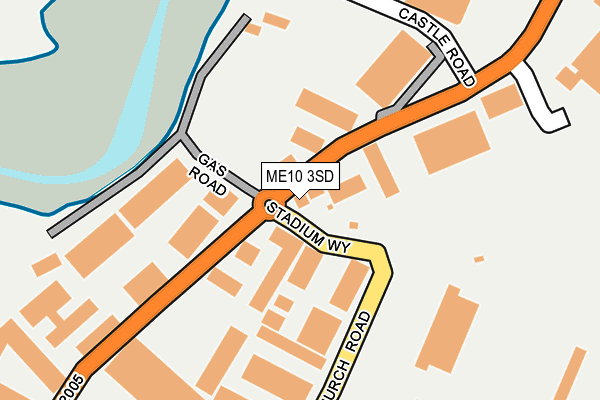
ME10 3SD is located in the Murston electoral ward, within the local authority district of Swale and the English Parliamentary constituency of Sittingbourne and Sheppey. The Sub Integrated Care Board (ICB) Location is NHS Kent and Medway ICB - 91Q and the police force is Kent. This postcode has been in use since October 2003.


GetTheData
Source: OS OpenMap – Local (Ordnance Survey)
Source: OS VectorMap District (Ordnance Survey)
Licence: Open Government Licence (requires attribution)
| Easting | 592034 |
| Northing | 164792 |
| Latitude | 51.349753 |
| Longitude | 0.756261 |
GetTheData
Source: Open Postcode Geo
Licence: Open Government Licence
| Country | England |
| Postcode District | ME10 |
| ➜ ME10 open data dashboard ➜ See where ME10 is on a map ➜ Where is Sittingbourne? | |
GetTheData
Source: Land Registry Price Paid Data
Licence: Open Government Licence
Elevation or altitude of ME10 3SD as distance above sea level:
| Metres | Feet | |
|---|---|---|
| Elevation | 10m | 33ft |
Elevation is measured from the approximate centre of the postcode, to the nearest point on an OS contour line from OS Terrain 50, which has contour spacing of ten vertical metres.
➜ How high above sea level am I? Find the elevation of your current position using your device's GPS.
GetTheData
Source: Open Postcode Elevation
Licence: Open Government Licence
| Ward | Murston |
| Constituency | Sittingbourne And Sheppey |
GetTheData
Source: ONS Postcode Database
Licence: Open Government Licence
| June 2022 | Burglary | On or near Stadium Way | 51m |
| June 2022 | Violence and sexual offences | On or near Sports/Recreation Area | 342m |
| May 2022 | Anti-social behaviour | On or near Hugh Price Close | 435m |
| ➜ Get more crime data in our Crime section | |||
GetTheData
Source: data.police.uk
Licence: Open Government Licence
| Chalkwell Depot (Church Road) | Murston | 268m |
| Broom Road (Oak Road) | Murston | 807m |
| Broom Road (Oak Road) | Murston | 814m |
| Church (Church Road) | Murston | 848m |
| Mulberry Way | Great Easthall | 865m |
| Sittingbourne Station | 1.7km |
| Kemsley Station | 2km |
| Teynham Station | 4km |
GetTheData
Source: NaPTAN
Licence: Open Government Licence
GetTheData
Source: ONS Postcode Database
Licence: Open Government Licence


➜ Get more ratings from the Food Standards Agency
GetTheData
Source: Food Standards Agency
Licence: FSA terms & conditions
| Last Collection | |||
|---|---|---|---|
| Location | Mon-Fri | Sat | Distance |
| Eurolink Estate | 18:30 | 11:45 | 859m |
| Eurolink Estate | 18:30 | 863m | |
| Murston Road Post Office | 18:15 | 11:45 | 1,023m |
GetTheData
Source: Dracos
Licence: Creative Commons Attribution-ShareAlike
| Facility | Distance |
|---|---|
| Central Park Stadium Church Road, Murston, Sittingbourne Grass Pitches | 198m |
| Murston Recreation Ground Church Road, Murston, Sittingbourne Grass Pitches, Outdoor Tennis Courts, Sports Hall | 348m |
| Murston Junior School (Closed) Sunnybank, Murston, Sittingbourne Grass Pitches | 723m |
GetTheData
Source: Active Places
Licence: Open Government Licence
| School | Phase of Education | Distance |
|---|---|---|
| Sunny Bank Primary School Sunny Bank, Murston, Sittingbourne, ME10 3QN | Primary | 725m |
| KITE College Unit 1-2 Eurolink Business Park, Bonham Drive, Sittingbourne, ME10 3RY | Not applicable | 763m |
| VTC Independent School Unit 2,, Centre 2000, St Michaels Road, Sittingbourne, ME10 3DZ | Not applicable | 1.3km |
GetTheData
Source: Edubase
Licence: Open Government Licence
The below table lists the International Territorial Level (ITL) codes (formerly Nomenclature of Territorial Units for Statistics (NUTS) codes) and Local Administrative Units (LAU) codes for ME10 3SD:
| ITL 1 Code | Name |
|---|---|
| TLJ | South East (England) |
| ITL 2 Code | Name |
| TLJ4 | Kent |
| ITL 3 Code | Name |
| TLJ43 | Kent Thames Gateway |
| LAU 1 Code | Name |
| E07000113 | Swale |
GetTheData
Source: ONS Postcode Directory
Licence: Open Government Licence
The below table lists the Census Output Area (OA), Lower Layer Super Output Area (LSOA), and Middle Layer Super Output Area (MSOA) for ME10 3SD:
| Code | Name | |
|---|---|---|
| OA | E00166799 | |
| LSOA | E01024591 | Swale 011A |
| MSOA | E02005125 | Swale 011 |
GetTheData
Source: ONS Postcode Directory
Licence: Open Government Licence
| ME10 3EU | Castle Road | 93m |
| ME10 3RW | Chapel Park | 104m |
| ME10 3AE | Anchor Business Park | 148m |
| ME10 3RS | Church Road Business Centre | 174m |
| ME10 3SH | Gas Road | 178m |
| ME10 3RH | D2 Trading Estate | 203m |
| ME10 3RL | Brickmakers Industrial Estate | 268m |
| ME10 3JP | Castle Road | 278m |
| ME10 3RZ | Castleacres Industrial Park | 312m |
| ME10 3AR | Hugh Price Close | 406m |
GetTheData
Source: Open Postcode Geo; Land Registry Price Paid Data
Licence: Open Government Licence