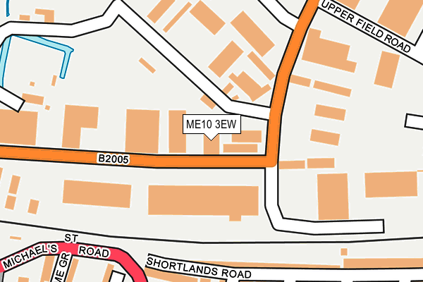
ME10 3EW is located in the Murston electoral ward, within the local authority district of Swale and the English Parliamentary constituency of Sittingbourne and Sheppey. The Sub Integrated Care Board (ICB) Location is NHS Kent and Medway ICB - 91Q and the police force is Kent. This postcode has been in use since December 1994.


GetTheData
Source: OS OpenMap – Local (Ordnance Survey)
Source: OS VectorMap District (Ordnance Survey)
Licence: Open Government Licence (requires attribution)
| Easting | 591399 |
| Northing | 163871 |
| Latitude | 51.341697 |
| Longitude | 0.746689 |
GetTheData
Source: Open Postcode Geo
Licence: Open Government Licence
| Country | England |
| Postcode District | ME10 |
➜ See where ME10 is on a map ➜ Where is Sittingbourne? | |
GetTheData
Source: Land Registry Price Paid Data
Licence: Open Government Licence
Elevation or altitude of ME10 3EW as distance above sea level:
| Metres | Feet | |
|---|---|---|
| Elevation | 10m | 33ft |
Elevation is measured from the approximate centre of the postcode, to the nearest point on an OS contour line from OS Terrain 50, which has contour spacing of ten vertical metres.
➜ How high above sea level am I? Find the elevation of your current position using your device's GPS.
GetTheData
Source: Open Postcode Elevation
Licence: Open Government Licence
| Ward | Murston |
| Constituency | Sittingbourne And Sheppey |
GetTheData
Source: ONS Postcode Database
Licence: Open Government Licence
| Centre 2000 (St Michael's Road) | Sittingbourne | 287m |
| Plaza Court (East Street) | Sittingbourne | 388m |
| Crown Quay Motors (St Michael's Road) | Sittingbourne | 398m |
| Co-op (Church Road) | Murston | 405m |
| Swale House (St Michael's Road) | Sittingbourne | 415m |
| Sittingbourne Station | 0.8km |
| Kemsley Station | 2.4km |
| Teynham Station | 4.3km |
GetTheData
Source: NaPTAN
Licence: Open Government Licence
| Median download speed | 79.2Mbps |
| Average download speed | 60.0Mbps |
| Maximum download speed | 80.00Mbps |
| Median upload speed | 20.0Mbps |
| Average upload speed | 14.6Mbps |
| Maximum upload speed | 20.00Mbps |
GetTheData
Source: Ofcom
Licence: Ofcom Terms of Use (requires attribution)
Estimated total energy consumption in ME10 3EW by fuel type, 2015.
| Consumption (kWh) | 26,143 |
|---|---|
| Meter count | 6 |
| Mean (kWh/meter) | 4,357 |
| Median (kWh/meter) | 1,072 |
GetTheData
Source: Postcode level gas estimates: 2015 (experimental)
Source: Postcode level electricity estimates: 2015 (experimental)
Licence: Open Government Licence
GetTheData
Source: ONS Postcode Database
Licence: Open Government Licence


➜ Get more ratings from the Food Standards Agency
GetTheData
Source: Food Standards Agency
Licence: FSA terms & conditions
| Last Collection | |||
|---|---|---|---|
| Location | Mon-Fri | Sat | Distance |
| Eurolink Estate | 18:30 | 11:45 | 265m |
| Eurolink Estate | 18:30 | 276m | |
| East Street Post Office | 18:15 | 11:45 | 377m |
GetTheData
Source: Dracos
Licence: Creative Commons Attribution-ShareAlike
| Risk of ME10 3EW flooding from rivers and sea | Medium |
| ➜ ME10 3EW flood map | |
GetTheData
Source: Open Flood Risk by Postcode
Licence: Open Government Licence
The below table lists the International Territorial Level (ITL) codes (formerly Nomenclature of Territorial Units for Statistics (NUTS) codes) and Local Administrative Units (LAU) codes for ME10 3EW:
| ITL 1 Code | Name |
|---|---|
| TLJ | South East (England) |
| ITL 2 Code | Name |
| TLJ4 | Kent |
| ITL 3 Code | Name |
| TLJ43 | Kent Thames Gateway |
| LAU 1 Code | Name |
| E07000113 | Swale |
GetTheData
Source: ONS Postcode Directory
Licence: Open Government Licence
The below table lists the Census Output Area (OA), Lower Layer Super Output Area (LSOA), and Middle Layer Super Output Area (MSOA) for ME10 3EW:
| Code | Name | |
|---|---|---|
| OA | E00124810 | |
| LSOA | E01024590 | Swale 010C |
| MSOA | E02005124 | Swale 010 |
GetTheData
Source: ONS Postcode Directory
Licence: Open Government Licence
| ME10 3TD | Castle Road | 102m |
| ME10 3JS | Shortlands Road | 198m |
| ME10 3JT | Shortlands Road | 201m |
| ME10 3DZ | Centre 2000 | 249m |
| ME10 3JQ | Crown Quay Lane | 260m |
| ME10 3AB | Shakespeare Road | 268m |
| ME10 3TU | West Lane | 275m |
| ME10 3JN | Crown Quay Lane | 288m |
| ME10 3AD | Bayford Road | 290m |
| ME10 3JR | Lime Grove | 292m |
GetTheData
Source: Open Postcode Geo; Land Registry Price Paid Data
Licence: Open Government Licence