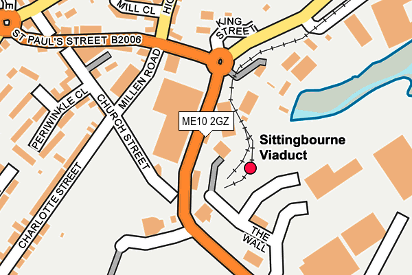
ME10 2GZ is located in the Chalkwell electoral ward, within the local authority district of Swale and the English Parliamentary constituency of Sittingbourne and Sheppey. The Sub Integrated Care Board (ICB) Location is NHS Kent and Medway ICB - 91Q and the police force is Kent. This postcode has been in use since November 2002.


GetTheData
Source: OS OpenMap – Local (Ordnance Survey)
Source: OS VectorMap District (Ordnance Survey)
Licence: Open Government Licence (requires attribution)
| Easting | 590434 |
| Northing | 164243 |
| Latitude | 51.345361 |
| Longitude | 0.733049 |
GetTheData
Source: Open Postcode Geo
Licence: Open Government Licence
| Country | England |
| Postcode District | ME10 |
➜ See where ME10 is on a map ➜ Where is Sittingbourne? | |
GetTheData
Source: Land Registry Price Paid Data
Licence: Open Government Licence
Elevation or altitude of ME10 2GZ as distance above sea level:
| Metres | Feet | |
|---|---|---|
| Elevation | 10m | 33ft |
Elevation is measured from the approximate centre of the postcode, to the nearest point on an OS contour line from OS Terrain 50, which has contour spacing of ten vertical metres.
➜ How high above sea level am I? Find the elevation of your current position using your device's GPS.
GetTheData
Source: Open Postcode Elevation
Licence: Open Government Licence
| Ward | Chalkwell |
| Constituency | Sittingbourne And Sheppey |
GetTheData
Source: ONS Postcode Database
Licence: Open Government Licence
| Morrisons (Mill Way) | Sittingbourne | 134m |
| Morrisons (Mill Way) | Sittingbourne | 161m |
| Eurolink Way (The Wall) | Sittingbourne | 170m |
| St Paul's Street | Chalkwell | 224m |
| St Paul's Street | Chalkwell | 233m |
| Sittingbourne Station | 0.4km |
| Kemsley Station | 1.9km |
| Newington Station | 4.6km |
GetTheData
Source: NaPTAN
Licence: Open Government Licence
GetTheData
Source: ONS Postcode Database
Licence: Open Government Licence


➜ Get more ratings from the Food Standards Agency
GetTheData
Source: Food Standards Agency
Licence: FSA terms & conditions
| Last Collection | |||
|---|---|---|---|
| Location | Mon-Fri | Sat | Distance |
| Church Street | 17:30 | 12:00 | 172m |
| Railway Station | 17:30 | 12:00 | 397m |
| Milton Regis Post Office | 17:15 | 12:00 | 507m |
GetTheData
Source: Dracos
Licence: Creative Commons Attribution-ShareAlike
| Risk of ME10 2GZ flooding from rivers and sea | Medium |
| ➜ ME10 2GZ flood map | |
GetTheData
Source: Open Flood Risk by Postcode
Licence: Open Government Licence
The below table lists the International Territorial Level (ITL) codes (formerly Nomenclature of Territorial Units for Statistics (NUTS) codes) and Local Administrative Units (LAU) codes for ME10 2GZ:
| ITL 1 Code | Name |
|---|---|
| TLJ | South East (England) |
| ITL 2 Code | Name |
| TLJ4 | Kent |
| ITL 3 Code | Name |
| TLJ43 | Kent Thames Gateway |
| LAU 1 Code | Name |
| E07000113 | Swale |
GetTheData
Source: ONS Postcode Directory
Licence: Open Government Licence
The below table lists the Census Output Area (OA), Lower Layer Super Output Area (LSOA), and Middle Layer Super Output Area (MSOA) for ME10 2GZ:
| Code | Name | |
|---|---|---|
| OA | E00124673 | |
| LSOA | E01024561 | Swale 009B |
| MSOA | E02005123 | Swale 009 |
GetTheData
Source: ONS Postcode Directory
Licence: Open Government Licence
| ME10 2JZ | Church Street | 217m |
| ME10 3EX | Milton Road | 221m |
| ME10 2JN | Charlotte Street | 227m |
| ME10 2JT | Periwinkle Close | 242m |
| ME10 2GX | Church Street | 249m |
| ME10 2AY | Kingsmill Close | 255m |
| ME10 2LA | St Pauls Street | 273m |
| ME10 2AD | High Street | 283m |
| ME10 2AQ | Pear Tree Alley | 296m |
| ME10 2AH | Crown Road | 307m |
GetTheData
Source: Open Postcode Geo; Land Registry Price Paid Data
Licence: Open Government Licence