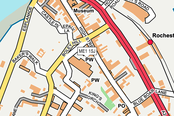
ME1 1SJ is located in the Rochester West & Borstal electoral ward, within the unitary authority of Medway and the English Parliamentary constituency of Rochester and Strood. The Sub Integrated Care Board (ICB) Location is NHS Kent and Medway ICB - 91Q and the police force is Kent. This postcode has been in use since January 1980.


GetTheData
Source: OS OpenMap – Local (Ordnance Survey)
Source: OS VectorMap District (Ordnance Survey)
Licence: Open Government Licence (requires attribution)
| Easting | 574298 |
| Northing | 168544 |
| Latitude | 51.389170 |
| Longitude | 0.503681 |
GetTheData
Source: Open Postcode Geo
Licence: Open Government Licence
| Country | England |
| Postcode District | ME1 |
| ➜ ME1 open data dashboard ➜ See where ME1 is on a map ➜ Where is Rochester? | |
GetTheData
Source: Land Registry Price Paid Data
Licence: Open Government Licence
Elevation or altitude of ME1 1SJ as distance above sea level:
| Metres | Feet | |
|---|---|---|
| Elevation | 10m | 33ft |
Elevation is measured from the approximate centre of the postcode, to the nearest point on an OS contour line from OS Terrain 50, which has contour spacing of ten vertical metres.
➜ How high above sea level am I? Find the elevation of your current position using your device's GPS.
GetTheData
Source: Open Postcode Elevation
Licence: Open Government Licence
| Ward | Rochester West & Borstal |
| Constituency | Rochester And Strood |
GetTheData
Source: ONS Postcode Database
Licence: Open Government Licence
| December 2023 | Violence and sexual offences | On or near Parking Area | 385m |
| November 2023 | Drugs | On or near Parking Area | 385m |
| October 2023 | Burglary | On or near Parking Area | 385m |
| ➜ Get more crime data in our Crime section | |||
GetTheData
Source: data.police.uk
Licence: Open Government Licence
| Baker's Walk (Boley Hill) | Rochester | 109m |
| Railway Station (Corporation Street) | Rochester | 128m |
| Railway Station (Corporation Street) | Rochester | 151m |
| Visitor Information Centre (Corporation Street) | Rochester | 159m |
| Rochester Guildhall Museum (Corporation Street) | Rochester | 212m |
| Rochester Station | 0.6km |
| Strood Station | 0.9km |
| Chatham Station | 1.6km |
GetTheData
Source: NaPTAN
Licence: Open Government Licence
| Percentage of properties with Next Generation Access | 100.0% |
| Percentage of properties with Superfast Broadband | 100.0% |
| Percentage of properties with Ultrafast Broadband | 0.0% |
| Percentage of properties with Full Fibre Broadband | 0.0% |
Superfast Broadband is between 30Mbps and 300Mbps
Ultrafast Broadband is > 300Mbps
| Percentage of properties unable to receive 2Mbps | 0.0% |
| Percentage of properties unable to receive 5Mbps | 0.0% |
| Percentage of properties unable to receive 10Mbps | 0.0% |
| Percentage of properties unable to receive 30Mbps | 0.0% |
GetTheData
Source: Ofcom
Licence: Ofcom Terms of Use (requires attribution)
GetTheData
Source: ONS Postcode Database
Licence: Open Government Licence


➜ Get more ratings from the Food Standards Agency
GetTheData
Source: Food Standards Agency
Licence: FSA terms & conditions
| Last Collection | |||
|---|---|---|---|
| Location | Mon-Fri | Sat | Distance |
| College Gate | 18:30 | 11:30 | 71m |
| Northgate | 18:30 | 11:30 | 154m |
| Guildhall | 18:30 | 11:30 | 199m |
GetTheData
Source: Dracos
Licence: Creative Commons Attribution-ShareAlike
| Facility | Distance |
|---|---|
| King's School - Rochester Boley Hill, Rochester Health and Fitness Gym, Grass Pitches, Sports Hall, Swimming Pool | 219m |
| Rochester Independent College Star Hill, Rochester Sports Hall | 668m |
| The Gym Group (Strood) Commercial Road, Rochester Health and Fitness Gym | 866m |
GetTheData
Source: Active Places
Licence: Open Government Licence
| School | Phase of Education | Distance |
|---|---|---|
| King's School, Rochester Satis House, Boley Hill, Rochester, ME1 1TE | Not applicable | 207m |
| Rochester Riverside Church of England Primary School Gas House Road, Rochester, ME1 1US | Primary | 260m |
| Sports Connect 62 Mierscourt Road, Banky Farm, Gillingham, ME8 8PH | Not applicable | 429m |
GetTheData
Source: Edubase
Licence: Open Government Licence
The below table lists the International Territorial Level (ITL) codes (formerly Nomenclature of Territorial Units for Statistics (NUTS) codes) and Local Administrative Units (LAU) codes for ME1 1SJ:
| ITL 1 Code | Name |
|---|---|
| TLJ | South East (England) |
| ITL 2 Code | Name |
| TLJ4 | Kent |
| ITL 3 Code | Name |
| TLJ41 | Medway |
| LAU 1 Code | Name |
| E06000035 | Medway |
GetTheData
Source: ONS Postcode Directory
Licence: Open Government Licence
The below table lists the Census Output Area (OA), Lower Layer Super Output Area (LSOA), and Middle Layer Super Output Area (MSOA) for ME1 1SJ:
| Code | Name | |
|---|---|---|
| OA | E00081542 | |
| LSOA | E01016130 | Medway 014C |
| MSOA | E02003327 | Medway 014 |
GetTheData
Source: ONS Postcode Directory
Licence: Open Government Licence
| ME1 1JY | High Street | 23m |
| ME1 1LX | High Street | 49m |
| ME1 1LS | Northgate | 79m |
| ME1 1SR | The Precinct | 107m |
| ME1 1ST | Minor Canon Row | 119m |
| ME1 1LD | High Street | 123m |
| ME1 1LN | High Street | 130m |
| ME1 1SX | The Precinct | 143m |
| ME1 1JS | High Street | 154m |
| ME1 1LA | Castle View Mews | 155m |
GetTheData
Source: Open Postcode Geo; Land Registry Price Paid Data
Licence: Open Government Licence