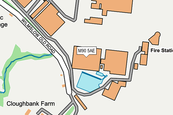
M90 5AE is located in the Woodhouse Park electoral ward, within the metropolitan district of Manchester and the English Parliamentary constituency of Wythenshawe and Sale East. The Sub Integrated Care Board (ICB) Location is NHS Greater Manchester ICB - 14L and the police force is Greater Manchester. This postcode has been in use since December 1996.


GetTheData
Source: OS OpenMap – Local (Ordnance Survey)
Source: OS VectorMap District (Ordnance Survey)
Licence: Open Government Licence (requires attribution)
| Easting | 381241 |
| Northing | 384493 |
| Latitude | 53.356996 |
| Longitude | -2.283309 |
GetTheData
Source: Open Postcode Geo
Licence: Open Government Licence
| Country | England |
| Postcode District | M90 |
| ➜ M90 open data dashboard ➜ See where M90 is on a map | |
GetTheData
Source: Land Registry Price Paid Data
Licence: Open Government Licence
Elevation or altitude of M90 5AE as distance above sea level:
| Metres | Feet | |
|---|---|---|
| Elevation | 70m | 230ft |
Elevation is measured from the approximate centre of the postcode, to the nearest point on an OS contour line from OS Terrain 50, which has contour spacing of ten vertical metres.
➜ How high above sea level am I? Find the elevation of your current position using your device's GPS.
GetTheData
Source: Open Postcode Elevation
Licence: Open Government Licence
| Ward | Woodhouse Park |
| Constituency | Wythenshawe And Sale East |
GetTheData
Source: ONS Postcode Database
Licence: Open Government Licence
| Aviation Viewing Park (Wilmslow Old Rd) | Manchester Airport | 120m |
| Wilmslow Rd/Sunbank Ln (Wilmslow Rd) | Manchester Airport | 451m |
| Argosy Dr/Cargo Ctr (Argosy Dr) | Manchester Airport | 473m |
| Wilmslow Rd/Sunbank Ln (Wilmslow Rd) | Manchester Airport | 479m |
| Viscount Dr/Cargo Centre (Viscount Dr) | Manchester Airport | 678m |
| Manchester Airport (Manchester Metrolink) (Terminal Road) | Manchester Airport | 1,177m |
| Manchester Airport Station | 1.1km |
| Styal Station | 3km |
| Heald Green Station | 3.4km |
GetTheData
Source: NaPTAN
Licence: Open Government Licence
GetTheData
Source: ONS Postcode Database
Licence: Open Government Licence


➜ Get more ratings from the Food Standards Agency
GetTheData
Source: Food Standards Agency
Licence: FSA terms & conditions
| Last Collection | |||
|---|---|---|---|
| Location | Mon-Fri | Sat | Distance |
| Terminal 3 Departures | 17:30 | 12:00 | 980m |
| Valley House | 17:15 | 11:45 | 1,662m |
| Warburton Green | 17:30 | 11:00 | 1,713m |
GetTheData
Source: Dracos
Licence: Creative Commons Attribution-ShareAlike
| Facility | Distance |
|---|---|
| Pace Health Club (Manchester) Chicago Avenue, Manchester Health and Fitness Gym, Swimming Pool | 1.1km |
| Marriott Leisure Club (Manchester Airport) Hale Road, Hale Barns, Altrincham Swimming Pool, Health and Fitness Gym, Studio | 1.3km |
| Clayton Hotel Manchester Airport Outwood Lane, Manchester Airport, Manchester Health and Fitness Gym | 1.3km |
GetTheData
Source: Active Places
Licence: Open Government Licence
| School | Phase of Education | Distance |
|---|---|---|
| Ringway Primary School Rossett Avenue, Cornishway, Wythenshawe, Manchester, M22 0WW | Primary | 2.1km |
| Elmridge Primary School Wilton Drive, Hale Barns, Altrincham, WA15 0JF | Primary | 2.1km |
| St Anthony's Catholic Primary School Dunkery Road, Woodhouse Park, Manchester, M22 0NT | Primary | 2.4km |
GetTheData
Source: Edubase
Licence: Open Government Licence
The below table lists the International Territorial Level (ITL) codes (formerly Nomenclature of Territorial Units for Statistics (NUTS) codes) and Local Administrative Units (LAU) codes for M90 5AE:
| ITL 1 Code | Name |
|---|---|
| TLD | North West (England) |
| ITL 2 Code | Name |
| TLD3 | Greater Manchester |
| ITL 3 Code | Name |
| TLD33 | Manchester |
| LAU 1 Code | Name |
| E08000003 | Manchester |
GetTheData
Source: ONS Postcode Directory
Licence: Open Government Licence
The below table lists the Census Output Area (OA), Lower Layer Super Output Area (LSOA), and Middle Layer Super Output Area (MSOA) for M90 5AE:
| Code | Name | |
|---|---|---|
| OA | E00026944 | |
| LSOA | E01005316 | Manchester 053D |
| MSOA | E02001097 | Manchester 053 |
GetTheData
Source: ONS Postcode Directory
Licence: Open Government Licence
| WA15 0PS | Sunbank Lane | 392m |
| WA15 0RE | Mill Lane | 1156m |
| WA15 8UT | Hasty Lane | 1200m |
| WA15 0PY | Sunbank Lane | 1279m |
| SK9 4LJ | Altrincham Road | 1335m |
| WA15 8XU | Hale Road | 1357m |
| WA15 8UU | Hasty Lane | 1388m |
| WA15 0SG | Burnside | 1418m |
| WA15 8XT | Hale Road | 1425m |
| WA15 0PZ | Sunbank Lane | 1461m |
GetTheData
Source: Open Postcode Geo; Land Registry Price Paid Data
Licence: Open Government Licence