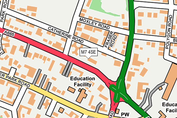
M7 4SE is located in the Crumpsall electoral ward, within the metropolitan district of Manchester and the English Parliamentary constituency of Blackley and Broughton. The Sub Integrated Care Board (ICB) Location is NHS Greater Manchester ICB - 14L and the police force is Greater Manchester. This postcode has been in use since April 2012.


GetTheData
Source: OS OpenMap – Local (Ordnance Survey)
Source: OS VectorMap District (Ordnance Survey)
Licence: Open Government Licence (requires attribution)
| Easting | 383462 |
| Northing | 402252 |
| Latitude | 53.516680 |
| Longitude | -2.250880 |
GetTheData
Source: Open Postcode Geo
Licence: Open Government Licence
| Country | England |
| Postcode District | M7 |
| ➜ M7 open data dashboard ➜ See where M7 is on a map ➜ Where is Manchester? | |
GetTheData
Source: Land Registry Price Paid Data
Licence: Open Government Licence
Elevation or altitude of M7 4SE as distance above sea level:
| Metres | Feet | |
|---|---|---|
| Elevation | 80m | 262ft |
Elevation is measured from the approximate centre of the postcode, to the nearest point on an OS contour line from OS Terrain 50, which has contour spacing of ten vertical metres.
➜ How high above sea level am I? Find the elevation of your current position using your device's GPS.
GetTheData
Source: Open Postcode Elevation
Licence: Open Government Licence
| Ward | Crumpsall |
| Constituency | Blackley And Broughton |
GetTheData
Source: ONS Postcode Database
Licence: Open Government Licence
| February 2022 | Other crime | On or near Eskrigge Close | 414m |
| February 2021 | Violence and sexual offences | On or near Holland Road | 464m |
| ➜ Get more crime data in our Crime section | |||
GetTheData
Source: data.police.uk
Licence: Open Government Licence
| Bury Old Rd/Half Way House (Bury Old Rd) | Cheetham Hill | 82m |
| Bury Old Rd/Half Way House (Bury Old Rd) | Cheetham Hill | 93m |
| Middleton Rd/Half Way House (Middleton Rd) | Cheetham Hill | 112m |
| Middleton Rd/Half Way House (Middleton Rd) | Cheetham Hill | 144m |
| Bury Old Rd/Bristol Ct (Bury Old Rd) | Broughton Park | 190m |
| Crumpsall (Manchester Metrolink) (Off Station Road) | Higher Crumpsall | 658m |
| Bowker Vale (Manchester Metrolink) (Middleton Road) | Bowker Vale | 884m |
| Abraham Moss (Manchester Metrolink) (Woodlands Road) | Cheetham Hill | 1,205m |
| Woodlands Road (Manchester Metrolink) (Off Woodlands Road) | Cheetham Hill | 1,475m |
| Manchester Victoria Station | 3.3km |
| Salford Crescent Station | 3.7km |
| Salford Central Station | 3.7km |
GetTheData
Source: NaPTAN
Licence: Open Government Licence
GetTheData
Source: ONS Postcode Database
Licence: Open Government Licence


➜ Get more ratings from the Food Standards Agency
GetTheData
Source: Food Standards Agency
Licence: FSA terms & conditions
| Last Collection | |||
|---|---|---|---|
| Location | Mon-Fri | Sat | Distance |
| Bury Old Road / Melton Road | 17:30 | 11:45 | 69m |
| Waterpark Road | 17:30 | 11:45 | 311m |
| Opp Crumpsall Station | 17:30 | 11:45 | 616m |
GetTheData
Source: Dracos
Licence: Creative Commons Attribution-ShareAlike
| Facility | Distance |
|---|---|
| Cheetham Hill Sports Club Catherine Road, Manchester Squash Courts, Grass Pitches | 240m |
| Park Swim School (Closed) Park Road, Manchester Swimming Pool | 313m |
| The King David High School Eaton Road, Manchester Health and Fitness Gym, Sports Hall, Grass Pitches, Swimming Pool | 377m |
GetTheData
Source: Active Places
Licence: Open Government Licence
| School | Phase of Education | Distance |
|---|---|---|
| Tashbar of Manchester 20 Upper Park Road, Salford, M7 4HL | Not applicable | 137m |
| OYY Lubavitch Boys School 4, Upper Park road, M7 4HL | Not applicable | 175m |
| Mechinoh School 13 Upper Park Road, Salford, M7 4HY | Not applicable | 200m |
GetTheData
Source: Edubase
Licence: Open Government Licence
The below table lists the International Territorial Level (ITL) codes (formerly Nomenclature of Territorial Units for Statistics (NUTS) codes) and Local Administrative Units (LAU) codes for M7 4SE:
| ITL 1 Code | Name |
|---|---|
| TLD | North West (England) |
| ITL 2 Code | Name |
| TLD3 | Greater Manchester |
| ITL 3 Code | Name |
| TLD33 | Manchester |
| LAU 1 Code | Name |
| E08000003 | Manchester |
GetTheData
Source: ONS Postcode Directory
Licence: Open Government Licence
The below table lists the Census Output Area (OA), Lower Layer Super Output Area (LSOA), and Middle Layer Super Output Area (MSOA) for M7 4SE:
| Code | Name | |
|---|---|---|
| OA | E00026151 | |
| LSOA | E01005162 | Manchester 004D |
| MSOA | E02001048 | Manchester 004 |
GetTheData
Source: ONS Postcode Directory
Licence: Open Government Licence
| M7 4QZ | Bury Old Road | 52m |
| M8 4HA | Catherine Road | 64m |
| M8 4HH | Fraser Road | 91m |
| M7 4QX | Bury Old Road | 96m |
| M8 4HJ | Moxley Road | 106m |
| M8 5DT | Middleton Road | 129m |
| M7 4GZ | Upper Park Road | 138m |
| M7 4QY | Bury Old Road | 158m |
| M7 4LQ | Cadogan Place | 158m |
| M8 4HG | Melton Road | 168m |
GetTheData
Source: Open Postcode Geo; Land Registry Price Paid Data
Licence: Open Government Licence