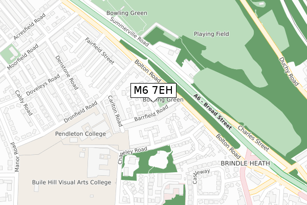
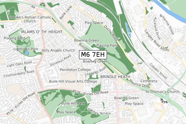
M6 7EH is located in the Claremont electoral ward, within the metropolitan district of Salford and the English Parliamentary constituency of Salford and Eccles. The Sub Integrated Care Board (ICB) Location is NHS Greater Manchester ICB - 01G and the police force is Greater Manchester. This postcode has been in use since May 1994.


GetTheData
Source: OS Open Zoomstack (Ordnance Survey)
Licence: Open Government Licence (requires attribution)
Attribution: Contains OS data © Crown copyright and database right 2024
Source: Open Postcode Geo
Licence: Open Government Licence (requires attribution)
Attribution: Contains OS data © Crown copyright and database right 2024; Contains Royal Mail data © Royal Mail copyright and database right 2024; Source: Office for National Statistics licensed under the Open Government Licence v.3.0
| Easting | 380192 |
| Northing | 399926 |
| Latitude | 53.495659 |
| Longitude | -2.300047 |
GetTheData
Source: Open Postcode Geo
Licence: Open Government Licence
| Country | England |
| Postcode District | M6 |
| ➜ M6 open data dashboard ➜ See where M6 is on a map ➜ Where is Salford? | |
GetTheData
Source: Land Registry Price Paid Data
Licence: Open Government Licence
Elevation or altitude of M6 7EH as distance above sea level:
| Metres | Feet | |
|---|---|---|
| Elevation | 70m | 230ft |
Elevation is measured from the approximate centre of the postcode, to the nearest point on an OS contour line from OS Terrain 50, which has contour spacing of ten vertical metres.
➜ How high above sea level am I? Find the elevation of your current position using your device's GPS.
GetTheData
Source: Open Postcode Elevation
Licence: Open Government Licence
| Ward | Claremont |
| Constituency | Salford And Eccles |
GetTheData
Source: ONS Postcode Database
Licence: Open Government Licence
| Bolton Rd/Barrfield Rd (Bolton Rd) | Pendleton | 65m |
| Bolton Rd/Barrfield Rd (Bolton Rd) | Pendleton | 76m |
| Bolton Rd/Langworthy Rd (Bolton Rd) | Pendleton | 238m |
| Doveleys Rd (Swbd) (Doveleys Road) | Irlams O' Th' Height | 269m |
| Bolton Rd/Langworthy Rd (Bolton Rd) | Pendleton | 283m |
| Weaste (Manchester Metrolink) (Eccles New Road) | Weaste | 1,556m |
| Salford Crescent Station | 1.9km |
| Eccles Station | 2.6km |
| Clifton (Manchester) Station | 3.1km |
GetTheData
Source: NaPTAN
Licence: Open Government Licence
GetTheData
Source: ONS Postcode Database
Licence: Open Government Licence


➜ Get more ratings from the Food Standards Agency
GetTheData
Source: Food Standards Agency
Licence: FSA terms & conditions
| Last Collection | |||
|---|---|---|---|
| Location | Mon-Fri | Sat | Distance |
| Cromwell Bridge P.o. | 17:30 | 12:00 | 572m |
| 34 Cresent/Hulme Place | 17:30 | 12:00 | 973m |
| Frederick Road / Winders Way | 18:30 | 1,089m | |
GetTheData
Source: Dracos
Licence: Creative Commons Attribution-ShareAlike
| Facility | Distance |
|---|---|
| Bolton Road Playing Fields Summerville Road, Salford Grass Pitches | 179m |
| Salford City College (Pendleton Sixth Form College)) Dronfield Road, Salford Grass Pitches, Sports Hall, Swimming Pool | 258m |
| Buile Hill Academy Eccles Old Road, Salford Sports Hall, Artificial Grass Pitch, Grass Pitches, Studio | 263m |
GetTheData
Source: Active Places
Licence: Open Government Licence
| School | Phase of Education | Distance |
|---|---|---|
| Salford City College Dronfield Road, Salford, M6 7FR | 16 plus | 258m |
| Buile Hill Academy Eccles Old Road, Salford, M6 8RD | Secondary | 395m |
| Summerville Primary School Summerville Road, Salford, M6 7HB | Primary | 496m |
GetTheData
Source: Edubase
Licence: Open Government Licence
The below table lists the International Territorial Level (ITL) codes (formerly Nomenclature of Territorial Units for Statistics (NUTS) codes) and Local Administrative Units (LAU) codes for M6 7EH:
| ITL 1 Code | Name |
|---|---|
| TLD | North West (England) |
| ITL 2 Code | Name |
| TLD3 | Greater Manchester |
| ITL 3 Code | Name |
| TLD34 | Greater Manchester South West |
| LAU 1 Code | Name |
| E08000006 | Salford |
GetTheData
Source: ONS Postcode Directory
Licence: Open Government Licence
The below table lists the Census Output Area (OA), Lower Layer Super Output Area (LSOA), and Middle Layer Super Output Area (MSOA) for M6 7EH:
| Code | Name | |
|---|---|---|
| OA | E00028494 | |
| LSOA | E01005628 | Salford 018D |
| MSOA | E02001174 | Salford 018 |
GetTheData
Source: ONS Postcode Directory
Licence: Open Government Licence
| M6 7FL | Beech Avenue | 37m |
| M6 7EL | Barrfield Road | 63m |
| M6 7DY | Eastfield | 80m |
| M6 7HW | Birch Avenue | 81m |
| M6 7NU | Bolton Road | 82m |
| M6 7EN | Beech Grove | 86m |
| M6 7DN | Westfield | 113m |
| M6 7DZ | Chaseley Road | 128m |
| M6 7EW | Carlton Road | 143m |
| M6 7FN | Dronfield Road | 157m |
GetTheData
Source: Open Postcode Geo; Land Registry Price Paid Data
Licence: Open Government Licence