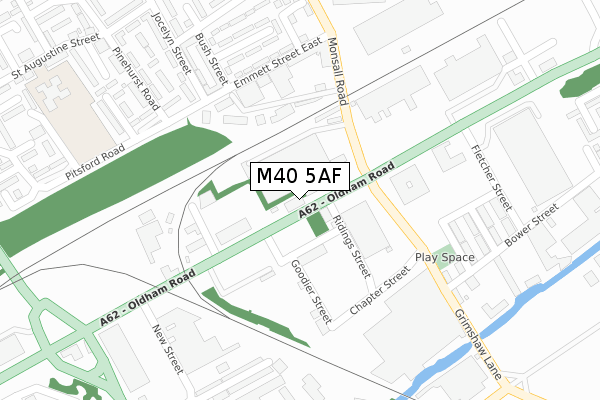
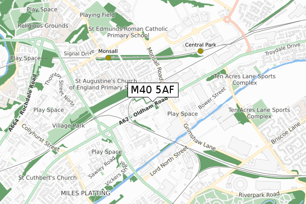
M40 5AF is located in the Miles Platting & Newton Heath electoral ward, within the metropolitan district of Manchester and the English Parliamentary constituency of Manchester Central. The Sub Integrated Care Board (ICB) Location is NHS Greater Manchester ICB - 14L and the police force is Greater Manchester. This postcode has been in use since May 1994.


GetTheData
Source: OS Open Zoomstack (Ordnance Survey)
Licence: Open Government Licence (requires attribution)
Attribution: Contains OS data © Crown copyright and database right 2024
Source: Open Postcode Geo
Licence: Open Government Licence (requires attribution)
Attribution: Contains OS data © Crown copyright and database right 2024; Contains Royal Mail data © Royal Mail copyright and database right 2024; Source: Office for National Statistics licensed under the Open Government Licence v.3.0
| Easting | 386495 |
| Northing | 400144 |
| Latitude | 53.497820 |
| Longitude | -2.205048 |
GetTheData
Source: Open Postcode Geo
Licence: Open Government Licence
| Country | England |
| Postcode District | M40 |
| ➜ M40 open data dashboard ➜ See where M40 is on a map ➜ Where is Manchester? | |
GetTheData
Source: Land Registry Price Paid Data
Licence: Open Government Licence
Elevation or altitude of M40 5AF as distance above sea level:
| Metres | Feet | |
|---|---|---|
| Elevation | 70m | 230ft |
Elevation is measured from the approximate centre of the postcode, to the nearest point on an OS contour line from OS Terrain 50, which has contour spacing of ten vertical metres.
➜ How high above sea level am I? Find the elevation of your current position using your device's GPS.
GetTheData
Source: Open Postcode Elevation
Licence: Open Government Licence
| Ward | Miles Platting & Newton Heath |
| Constituency | Manchester Central |
GetTheData
Source: ONS Postcode Database
Licence: Open Government Licence
| Oldham Rd/Grimshaw Ln (Oldham Rd) | Newton Heath | 80m |
| Oldham Rd/Grimshaw Ln (Oldham Rd) | Newton Heath | 193m |
| Emmett St East (Nebnd) (Emmett St East) | Monsall | 220m |
| Emmett St East (Swbnd) (Emmett St East) | Monsall | 235m |
| Jocelyn St (Nbnd) (Jocelyn St) | Monsall | 252m |
| Monsall (Manchester Metrolink) (Ruislip Avenue) | Monsall | 520m |
| Central Park (Manchester Metrolink) (The Gateway) | Newton Heath | 572m |
| Etihad Campus (Manchester Metrolink) (Joe Mercer Way) | Sportcity | 1,408m |
| Queens Road (Manchester Metrolink) (Queens Road) | Smedley | 1,497m |
| Newton Heath & Moston (Manchester Metrolink) (Dean Lane) | Newton Heath | 1,523m |
| Manchester Victoria Station | 2.7km |
| Manchester Piccadilly Station | 2.9km |
| Ashburys Station | 3km |
GetTheData
Source: NaPTAN
Licence: Open Government Licence
GetTheData
Source: ONS Postcode Database
Licence: Open Government Licence

➜ Get more ratings from the Food Standards Agency
GetTheData
Source: Food Standards Agency
Licence: FSA terms & conditions
| Last Collection | |||
|---|---|---|---|
| Location | Mon-Fri | Sat | Distance |
| Blandford Drive | 17:30 | 12:00 | 722m |
| New Moston | 17:30 | 12:00 | 1,026m |
| Smedley Lane P.o. | 17:30 | 12:00 | 1,568m |
GetTheData
Source: Dracos
Licence: Creative Commons Attribution-ShareAlike
| Facility | Distance |
|---|---|
| Manchester Communication Academy Pitches Lathbury Road, Harpurhey, Manchester Grass Pitches, Artificial Grass Pitch | 779m |
| Ten Acres Lane Sports Complex Ten Acres Lane, Manchester Sports Hall, Artificial Grass Pitch, Health and Fitness Gym, Studio | 817m |
| Miles Platting Swimming Pools (Closed) Varley Street, Manchester Swimming Pool, Health and Fitness Gym | 961m |
GetTheData
Source: Active Places
Licence: Open Government Licence
| School | Phase of Education | Distance |
|---|---|---|
| St Augustine's CofE Primary School St Augustine Street, Monsall, Manchester, M40 8PL | Primary | 451m |
| St Edmund's RC Primary School Upper Monsall Street, Miles Platting, Manchester, M40 8NG | Primary | 620m |
| Manchester Communication Academy Silchester Drive, Harpurhey, Manchester, M40 8NT | Secondary | 852m |
GetTheData
Source: Edubase
Licence: Open Government Licence
The below table lists the International Territorial Level (ITL) codes (formerly Nomenclature of Territorial Units for Statistics (NUTS) codes) and Local Administrative Units (LAU) codes for M40 5AF:
| ITL 1 Code | Name |
|---|---|
| TLD | North West (England) |
| ITL 2 Code | Name |
| TLD3 | Greater Manchester |
| ITL 3 Code | Name |
| TLD33 | Manchester |
| LAU 1 Code | Name |
| E08000003 | Manchester |
GetTheData
Source: ONS Postcode Directory
Licence: Open Government Licence
The below table lists the Census Output Area (OA), Lower Layer Super Output Area (LSOA), and Middle Layer Super Output Area (MSOA) for M40 5AF:
| Code | Name | |
|---|---|---|
| OA | E00026646 | |
| LSOA | E01005257 | Manchester 011B |
| MSOA | E02001055 | Manchester 011 |
GetTheData
Source: ONS Postcode Directory
Licence: Open Government Licence
| M40 5AE | Beckford Street | 178m |
| M40 8PD | Emmett Street East | 237m |
| M40 8QA | Jocelyn Street | 260m |
| M40 2AX | Grimshaw Lane | 276m |
| M40 8PE | Bush Street | 281m |
| M40 2AU | Douro Street | 284m |
| M40 8GT | Pitsford Road | 297m |
| M40 2AQ | Partington Street | 297m |
| M40 8PF | Canons Grove | 298m |
| M40 8PH | Sanderson Street | 316m |
GetTheData
Source: Open Postcode Geo; Land Registry Price Paid Data
Licence: Open Government Licence