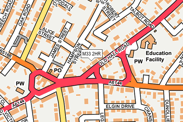
M33 2HR is located in the Sale Moor electoral ward, within the metropolitan district of Trafford and the English Parliamentary constituency of Wythenshawe and Sale East. The Sub Integrated Care Board (ICB) Location is NHS Greater Manchester ICB - 02A and the police force is Greater Manchester. This postcode has been in use since August 2004.


GetTheData
Source: OS OpenMap – Local (Ordnance Survey)
Source: OS VectorMap District (Ordnance Survey)
Licence: Open Government Licence (requires attribution)
| Easting | 380025 |
| Northing | 391559 |
| Latitude | 53.420448 |
| Longitude | -2.302029 |
GetTheData
Source: Open Postcode Geo
Licence: Open Government Licence
| Country | England |
| Postcode District | M33 |
| ➜ M33 open data dashboard ➜ See where M33 is on a map | |
GetTheData
Source: Land Registry Price Paid Data
Licence: Open Government Licence
Elevation or altitude of M33 2HR as distance above sea level:
| Metres | Feet | |
|---|---|---|
| Elevation | 30m | 98ft |
Elevation is measured from the approximate centre of the postcode, to the nearest point on an OS contour line from OS Terrain 50, which has contour spacing of ten vertical metres.
➜ How high above sea level am I? Find the elevation of your current position using your device's GPS.
GetTheData
Source: Open Postcode Elevation
Licence: Open Government Licence
| Ward | Sale Moor |
| Constituency | Wythenshawe And Sale East |
GetTheData
Source: ONS Postcode Database
Licence: Open Government Licence
| Old Hall Road/Legh Arms (Old Hall Road) | Sale Moor | 27m |
| Conway Road/Northenden Road (Conway Road) | Sale Moor | 153m |
| Marsland Road/Sale Moor Village (Marsland Road) | Sale Moor | 184m |
| Temple Rd (Nbd) (Temple Rd) | Sale Moor | 211m |
| Northenden Road/Marsland Road (Link Road) | Sale Moor | 215m |
| Northern Moor (Manchester Metrolink) (Sale Road) | Northern Moor | 1,131m |
| Sale Water Park (Manchester Metrolink) (Rifle Road) | Sale | 1,141m |
| Sale (Manchester Metrolink) (Off School Road) | Sale | 1,212m |
| Dane Road (Manchester Metrolink) (Dane Road) | Sale | 1,259m |
| Wythenshawe Park (Manchester Metrolink) (Wythenshawe Road) | Northern Moor | 1,485m |
| Trafford Park Station | 3.9km |
| Navigation Road Station | 3.9km |
| Humphrey Park Station | 3.9km |
GetTheData
Source: NaPTAN
Licence: Open Government Licence
GetTheData
Source: ONS Postcode Database
Licence: Open Government Licence


➜ Get more ratings from the Food Standards Agency
GetTheData
Source: Food Standards Agency
Licence: FSA terms & conditions
| Last Collection | |||
|---|---|---|---|
| Location | Mon-Fri | Sat | Distance |
| Sale Moor P.o. | 17:30 | 12:00 | 142m |
| Sale Green | 17:30 | 12:00 | 436m |
| Clarendon Road | 17:30 | 12:00 | 445m |
GetTheData
Source: Dracos
Licence: Creative Commons Attribution-ShareAlike
| Facility | Distance |
|---|---|
| Holy Family Catholic Primary School Old Hall Road, Sale Grass Pitches | 203m |
| Lime Tree Primary Academy Budworth Road, Sale Grass Pitches, Sports Hall | 424m |
| Moorlands Junior School Temple Road, Sale Grass Pitches | 435m |
GetTheData
Source: Active Places
Licence: Open Government Licence
| School | Phase of Education | Distance |
|---|---|---|
| Holy Family Catholic Primary School Old Hall Road, Sale, M33 2JA | Primary | 203m |
| Templemoor Infant and Nursery School Nursery Close, Off Temple Road, Sale, M33 2EG | Primary | 247m |
| Moorlands Junior School Temple Road, Sale, M33 2LP | Primary | 435m |
GetTheData
Source: Edubase
Licence: Open Government Licence
The below table lists the International Territorial Level (ITL) codes (formerly Nomenclature of Territorial Units for Statistics (NUTS) codes) and Local Administrative Units (LAU) codes for M33 2HR:
| ITL 1 Code | Name |
|---|---|
| TLD | North West (England) |
| ITL 2 Code | Name |
| TLD3 | Greater Manchester |
| ITL 3 Code | Name |
| TLD34 | Greater Manchester South West |
| LAU 1 Code | Name |
| E08000009 | Trafford |
GetTheData
Source: ONS Postcode Directory
Licence: Open Government Licence
The below table lists the Census Output Area (OA), Lower Layer Super Output Area (LSOA), and Middle Layer Super Output Area (MSOA) for M33 2HR:
| Code | Name | |
|---|---|---|
| OA | E00031304 | |
| LSOA | E01006178 | Trafford 014E |
| MSOA | E02001272 | Trafford 014 |
GetTheData
Source: ONS Postcode Directory
Licence: Open Government Licence
| M33 3JF | Alice Street | 38m |
| M33 3HL | Edward Street | 47m |
| M33 2JA | Old Hall Road | 60m |
| M33 2HH | Bertram Street | 81m |
| M33 2HP | Old Hall Road | 85m |
| M33 3HJ | Hampson Street | 90m |
| M33 2JB | Northenden Road | 91m |
| M33 2HS | Northenden Road | 92m |
| M33 3JH | Alice Street | 92m |
| M33 2SR | Northenden Road | 93m |
GetTheData
Source: Open Postcode Geo; Land Registry Price Paid Data
Licence: Open Government Licence