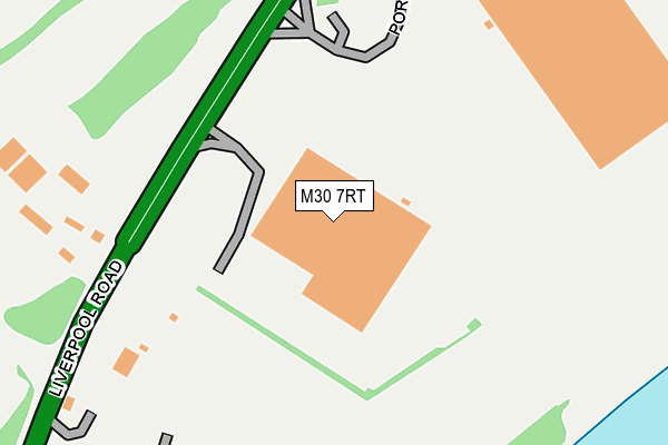
M30 7RT is located in the Higher Irlam & Peel Green electoral ward, within the metropolitan district of Salford and the English Parliamentary constituency of Worsley and Eccles South. The Sub Integrated Care Board (ICB) Location is NHS Greater Manchester ICB - 01G and the police force is Greater Manchester. This postcode has been in use since January 1980.


GetTheData
Source: OS OpenMap – Local (Ordnance Survey)
Source: OS VectorMap District (Ordnance Survey)
Licence: Open Government Licence (requires attribution)
| Easting | 373881 |
| Northing | 396337 |
| Latitude | 53.463124 |
| Longitude | -2.394874 |
GetTheData
Source: Open Postcode Geo
Licence: Open Government Licence
| Country | England |
| Postcode District | M30 |
| ➜ M30 open data dashboard ➜ See where M30 is on a map | |
GetTheData
Source: Land Registry Price Paid Data
Licence: Open Government Licence
Elevation or altitude of M30 7RT as distance above sea level:
| Metres | Feet | |
|---|---|---|
| Elevation | 20m | 66ft |
Elevation is measured from the approximate centre of the postcode, to the nearest point on an OS contour line from OS Terrain 50, which has contour spacing of ten vertical metres.
➜ How high above sea level am I? Find the elevation of your current position using your device's GPS.
GetTheData
Source: Open Postcode Elevation
Licence: Open Government Licence
| Ward | Higher Irlam & Peel Green |
| Constituency | Worsley And Eccles South |
GetTheData
Source: ONS Postcode Database
Licence: Open Government Licence
| Liverpool Rd/Boysnope Farm (Liverpool Rd) | Irlam | 269m |
| Liverpool Rd/Boysnope Farm (Liverpool Rd) | Irlam | 303m |
| Liverpool Rd/Barton Moss Rd (Liverpool Rd) | Barton Moss | 346m |
| Liverpool Rd/Barton Moss Rd (Liverpool Rd) | Barton Moss | 433m |
| Woodsend Road/Calderbank Avenue (Woodsend Road) | Calder Bank | 699m |
| Flixton Station | 2.3km |
| Chassen Road Station | 2.6km |
| Urmston Station | 3.2km |
GetTheData
Source: NaPTAN
Licence: Open Government Licence
GetTheData
Source: ONS Postcode Database
Licence: Open Government Licence


➜ Get more ratings from the Food Standards Agency
GetTheData
Source: Food Standards Agency
Licence: FSA terms & conditions
| Last Collection | |||
|---|---|---|---|
| Location | Mon-Fri | Sat | Distance |
| Eddisbury Avenue | 17:30 | 11:30 | 650m |
| Bent Lane | 17:30 | 11:30 | 969m |
| 190 Daveyhulme Road / Lowood Ave | 17:30 | 11:30 | 1,261m |
GetTheData
Source: Dracos
Licence: Creative Commons Attribution-ShareAlike
| Facility | Distance |
|---|---|
| Boysnope Park Golf Club (Closed) Liverpool Road, Eccles, Manchester Golf | 227m |
| Afc Urmston Meadowside Davyhulme Road, Urmston, Manchester Grass Pitches | 893m |
| Valley Road Valley Road, Urmston, Manchester Grass Pitches | 960m |
GetTheData
Source: Active Places
Licence: Open Government Licence
| School | Phase of Education | Distance |
|---|---|---|
| Fiddlers Lane Community Primary School Fiddlers Lane, Irlam, Salford, M44 6QE | Primary | 1.5km |
| Acre Hall Primary School Irlam Road, Flixton, Urmston, Manchester, M41 6NA | Primary | 1.6km |
| Woodhouse Primary School Nursery Road, Davyhulme, Urmston, Manchester, M41 7WW | Primary | 1.7km |
GetTheData
Source: Edubase
Licence: Open Government Licence
The below table lists the International Territorial Level (ITL) codes (formerly Nomenclature of Territorial Units for Statistics (NUTS) codes) and Local Administrative Units (LAU) codes for M30 7RT:
| ITL 1 Code | Name |
|---|---|
| TLD | North West (England) |
| ITL 2 Code | Name |
| TLD3 | Greater Manchester |
| ITL 3 Code | Name |
| TLD34 | Greater Manchester South West |
| LAU 1 Code | Name |
| E08000006 | Salford |
GetTheData
Source: ONS Postcode Directory
Licence: Open Government Licence
The below table lists the Census Output Area (OA), Lower Layer Super Output Area (LSOA), and Middle Layer Super Output Area (MSOA) for M30 7RT:
| Code | Name | |
|---|---|---|
| OA | E00028572 | |
| LSOA | E01005640 | Salford 029B |
| MSOA | E02001185 | Salford 029 |
GetTheData
Source: ONS Postcode Directory
Licence: Open Government Licence
| M30 7SF | Port Salford Way | 280m |
| M30 7RF | Liverpool Road | 352m |
| M30 7RJ | Liverpool Road | 396m |
| M41 8GP | Daresbury Avenue | 468m |
| M41 8GL | Daresbury Avenue | 504m |
| M41 8GJ | Daresbury Avenue | 544m |
| M41 8QJ | Eddisbury Avenue | 574m |
| M41 8QL | Daresbury Avenue | 595m |
| M41 8GE | Eddisbury Avenue | 603m |
| M41 8QN | Woodsend Road | 639m |
GetTheData
Source: Open Postcode Geo; Land Registry Price Paid Data
Licence: Open Government Licence