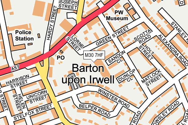
M30 7HF lies on Peel Green Trading Estate in Eccles, Manchester. M30 7HF is located in the Higher Irlam & Peel Green electoral ward, within the metropolitan district of Salford and the English Parliamentary constituency of Worsley and Eccles South. The Sub Integrated Care Board (ICB) Location is NHS Greater Manchester ICB - 01G and the police force is Greater Manchester. This postcode has been in use since January 1980.


GetTheData
Source: OS OpenMap – Local (Ordnance Survey)
Source: OS VectorMap District (Ordnance Survey)
Licence: Open Government Licence (requires attribution)
| Easting | 375860 |
| Northing | 397887 |
| Latitude | 53.477167 |
| Longitude | -2.365185 |
GetTheData
Source: Open Postcode Geo
Licence: Open Government Licence
| Street | Peel Green Trading Estate |
| Locality | Eccles |
| Town/City | Manchester |
| Country | England |
| Postcode District | M30 |
➜ See where M30 is on a map ➜ Where is Eccles? | |
GetTheData
Source: Land Registry Price Paid Data
Licence: Open Government Licence
Elevation or altitude of M30 7HF as distance above sea level:
| Metres | Feet | |
|---|---|---|
| Elevation | 20m | 66ft |
Elevation is measured from the approximate centre of the postcode, to the nearest point on an OS contour line from OS Terrain 50, which has contour spacing of ten vertical metres.
➜ How high above sea level am I? Find the elevation of your current position using your device's GPS.
GetTheData
Source: Open Postcode Elevation
Licence: Open Government Licence
| Ward | Higher Irlam & Peel Green |
| Constituency | Worsley And Eccles South |
GetTheData
Source: ONS Postcode Database
Licence: Open Government Licence
ZENITH HOUSE UNIT 1, PEEL GREEN TRADING ESTATE, ECCLES, MANCHESTER, M30 7HF 2004 15 DEC £251,000 |
UNIT 2, PEEL GREEN TRADING ESTATE, ECCLES, MANCHESTER, M30 7HF 2004 15 DEC £251,000 |
UNIT 9, PEEL GREEN TRADING ESTATE, ECCLES, MANCHESTER, M30 7HF 2003 3 JUN £115,000 |
GetTheData
Source: HM Land Registry Price Paid Data
Licence: Contains HM Land Registry data © Crown copyright and database right 2025. This data is licensed under the Open Government Licence v3.0.
| Peel Green Rd/Liverpool Rd (Peel Green Rd) | Peel Green | 162m |
| Peel Green Rd/Unicorn St (Peel Green Rd) | Peel Green | 164m |
| Liverpool Rd/Grapes Hotel (Liverpool Rd) | Peel Green | 172m |
| Liverpool Rd/Grapes Hotel (Liverpool Rd) | Peel Green | 176m |
| Liverpool Rd/Peel Green Rd (Liverpool Rd) | Peel Green | 180m |
| Patricroft Station | 1km |
| Eccles Station | 2.2km |
| Urmston Station | 3.3km |
GetTheData
Source: NaPTAN
Licence: Open Government Licence
GetTheData
Source: ONS Postcode Database
Licence: Open Government Licence


➜ Get more ratings from the Food Standards Agency
GetTheData
Source: Food Standards Agency
Licence: FSA terms & conditions
| Last Collection | |||
|---|---|---|---|
| Location | Mon-Fri | Sat | Distance |
| Winton P.o. | 17:30 | 12:00 | 975m |
| Montonfields | 17:30 | 12:00 | 994m |
| Westwood Park P.o. | 17:30 | 12:00 | 1,683m |
GetTheData
Source: Dracos
Licence: Creative Commons Attribution-ShareAlike
| Risk of M30 7HF flooding from rivers and sea | Low |
| ➜ M30 7HF flood map | |
GetTheData
Source: Open Flood Risk by Postcode
Licence: Open Government Licence
The below table lists the International Territorial Level (ITL) codes (formerly Nomenclature of Territorial Units for Statistics (NUTS) codes) and Local Administrative Units (LAU) codes for M30 7HF:
| ITL 1 Code | Name |
|---|---|
| TLD | North West (England) |
| ITL 2 Code | Name |
| TLD3 | Greater Manchester |
| ITL 3 Code | Name |
| TLD34 | Greater Manchester South West |
| LAU 1 Code | Name |
| E08000006 | Salford |
GetTheData
Source: ONS Postcode Directory
Licence: Open Government Licence
The below table lists the Census Output Area (OA), Lower Layer Super Output Area (LSOA), and Middle Layer Super Output Area (MSOA) for M30 7HF:
| Code | Name | |
|---|---|---|
| OA | E00028332 | |
| LSOA | E01005605 | Salford 027C |
| MSOA | E02001183 | Salford 027 |
GetTheData
Source: ONS Postcode Directory
Licence: Open Government Licence
| M30 7BF | Green Street | 76m |
| M30 7HR | Clifford Street | 91m |
| M30 7DP | Winster Road | 104m |
| M30 7BT | Liverpool Road | 116m |
| M30 7HE | Clifford Street | 133m |
| M30 7HY | Liverpool Road | 141m |
| M30 7JA | Liverpool Road | 142m |
| M30 7HT | Scotta Road | 142m |
| M30 7BU | Peel Green Road | 147m |
| M30 7DG | Belper Road | 156m |
GetTheData
Source: Open Postcode Geo; Land Registry Price Paid Data
Licence: Open Government Licence