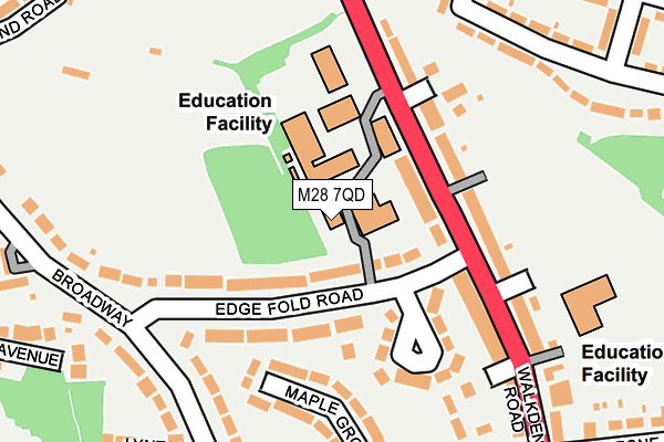
M28 7QD is located in the Walkden South electoral ward, within the metropolitan district of Salford and the English Parliamentary constituency of Worsley and Eccles South. The Sub Integrated Care Board (ICB) Location is NHS Greater Manchester ICB - 01G and the police force is Greater Manchester. This postcode has been in use since May 1994.


GetTheData
Source: OS OpenMap – Local (Ordnance Survey)
Source: OS VectorMap District (Ordnance Survey)
Licence: Open Government Licence (requires attribution)
| Easting | 373816 |
| Northing | 402307 |
| Latitude | 53.516797 |
| Longitude | -2.396351 |
GetTheData
Source: Open Postcode Geo
Licence: Open Government Licence
| Country | England |
| Postcode District | M28 |
| ➜ M28 open data dashboard ➜ See where M28 is on a map ➜ Where is Walkden? | |
GetTheData
Source: Land Registry Price Paid Data
Licence: Open Government Licence
Elevation or altitude of M28 7QD as distance above sea level:
| Metres | Feet | |
|---|---|---|
| Elevation | 70m | 230ft |
Elevation is measured from the approximate centre of the postcode, to the nearest point on an OS contour line from OS Terrain 50, which has contour spacing of ten vertical metres.
➜ How high above sea level am I? Find the elevation of your current position using your device's GPS.
GetTheData
Source: Open Postcode Elevation
Licence: Open Government Licence
| Ward | Walkden South |
| Constituency | Worsley And Eccles South |
GetTheData
Source: ONS Postcode Database
Licence: Open Government Licence
| February 2022 | Vehicle crime | On or near Stanley Road | 376m |
| ➜ Get more crime data in our Crime section | |||
GetTheData
Source: data.police.uk
Licence: Open Government Licence
| Walkden Rd/Salford College (Walkden Rd) | Parr Fold | 45m |
| Walkden Rd/Salford College (Walkden Rd) | Parr Fold | 115m |
| Birch Rd/Lime Gr (Birch Rd) | Parr Fold | 174m |
| Birch Rd/Lime Gr (Birch Rd) | Parr Fold | 205m |
| Walkden Rd/Shaving Ln (Walkden Rd) | Parr Fold | 249m |
| Walkden Station | 0.3km |
| Moorside Station | 3km |
| Kearsley Station | 3.4km |
GetTheData
Source: NaPTAN
Licence: Open Government Licence
GetTheData
Source: ONS Postcode Database
Licence: Open Government Licence


➜ Get more ratings from the Food Standards Agency
GetTheData
Source: Food Standards Agency
Licence: FSA terms & conditions
| Last Collection | |||
|---|---|---|---|
| Location | Mon-Fri | Sat | Distance |
| Walkden Rd/Edgefold Road | 17:30 | 12:00 | 88m |
| Walkden Road | 17:30 | 12:00 | 251m |
| Valdene Drive | 17:30 | 12:00 | 421m |
GetTheData
Source: Dracos
Licence: Creative Commons Attribution-ShareAlike
| Facility | Distance |
|---|---|
| Walkden Sixth Form Centre (Closed) Walkden Road, Worsley, Manchester Health and Fitness Gym, Sports Hall | 103m |
| Mesne Lea Primary School Walkden Road, Worsley, Manchester Grass Pitches | 231m |
| Parr Fold Park Rutland Road, Worsley, Manchester Outdoor Tennis Courts | 251m |
GetTheData
Source: Active Places
Licence: Open Government Licence
| School | Phase of Education | Distance |
|---|---|---|
| Mesne Lea Primary School Walkden Road, Walkden, Worsley, Manchester, M28 7FG | Primary | 231m |
| James Brindley Community Primary School Parr Fold Avenue, Walkden, Worsley, Manchester, M28 7HE | Primary | 569m |
| Christ The King RC Primary School Holly Avenue, Worsley, Manchester, M28 3DW | Primary | 697m |
GetTheData
Source: Edubase
Licence: Open Government Licence
The below table lists the International Territorial Level (ITL) codes (formerly Nomenclature of Territorial Units for Statistics (NUTS) codes) and Local Administrative Units (LAU) codes for M28 7QD:
| ITL 1 Code | Name |
|---|---|
| TLD | North West (England) |
| ITL 2 Code | Name |
| TLD3 | Greater Manchester |
| ITL 3 Code | Name |
| TLD34 | Greater Manchester South West |
| LAU 1 Code | Name |
| E08000006 | Salford |
GetTheData
Source: ONS Postcode Directory
Licence: Open Government Licence
The below table lists the Census Output Area (OA), Lower Layer Super Output Area (LSOA), and Middle Layer Super Output Area (MSOA) for M28 7QD:
| Code | Name | |
|---|---|---|
| OA | E00028927 | |
| LSOA | E01005715 | Salford 007E |
| MSOA | E02001163 | Salford 007 |
GetTheData
Source: ONS Postcode Directory
Licence: Open Government Licence
| M28 7FQ | Walkden Road | 82m |
| M28 7DN | Parkside Avenue | 102m |
| M28 7QE | Walkden Road | 107m |
| M28 7QF | Edge Fold Road | 167m |
| M28 7EH | Ash Grove | 182m |
| M28 7FE | Birch Road | 185m |
| M28 7FZ | Lime Grove | 204m |
| M28 7GE | Edge Fold Road | 210m |
| M28 7FG | Walkden Road | 216m |
| M28 7DP | Walkden Road | 249m |
GetTheData
Source: Open Postcode Geo; Land Registry Price Paid Data
Licence: Open Government Licence