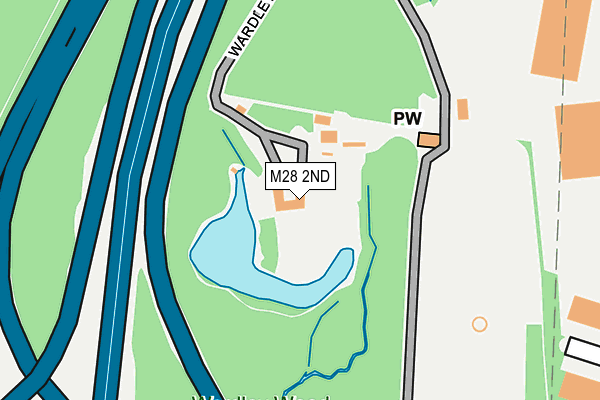
M28 2ND is located in the Swinton & Wardley electoral ward, within the metropolitan district of Salford and the English Parliamentary constituency of Salford and Eccles. The Sub Integrated Care Board (ICB) Location is NHS Greater Manchester ICB - 01G and the police force is Greater Manchester. This postcode has been in use since May 1994.


GetTheData
Source: OS OpenMap – Local (Ordnance Survey)
Source: OS VectorMap District (Ordnance Survey)
Licence: Open Government Licence (requires attribution)
| Easting | 375777 |
| Northing | 402183 |
| Latitude | 53.515760 |
| Longitude | -2.366770 |
GetTheData
Source: Open Postcode Geo
Licence: Open Government Licence
| Country | England |
| Postcode District | M28 |
| ➜ M28 open data dashboard ➜ See where M28 is on a map ➜ Where is Swinton? | |
GetTheData
Source: Land Registry Price Paid Data
Licence: Open Government Licence
Elevation or altitude of M28 2ND as distance above sea level:
| Metres | Feet | |
|---|---|---|
| Elevation | 70m | 230ft |
Elevation is measured from the approximate centre of the postcode, to the nearest point on an OS contour line from OS Terrain 50, which has contour spacing of ten vertical metres.
➜ How high above sea level am I? Find the elevation of your current position using your device's GPS.
GetTheData
Source: Open Postcode Elevation
Licence: Open Government Licence
| Ward | Swinton & Wardley |
| Constituency | Salford And Eccles |
GetTheData
Source: ONS Postcode Database
Licence: Open Government Licence
| East Lancs Rd/Park & Ride (East Lancs Rd) | Roe Green | 348m |
| East Lancs Park & Ride (Park & Ride) | Roe Green | 352m |
| East Lancs Park & Ride (Park & Ride) | Wardley | 368m |
| East Lancs Rd/Park & Ride (East Lancs Rd) | Roe Green | 401m |
| Manchester Rd/Larch Gr (Manchester Rd) | Wardley | 443m |
| Moorside Station | 1km |
| Swinton (Manchester) Station | 1.9km |
| Walkden Station | 2km |
GetTheData
Source: NaPTAN
Licence: Open Government Licence
| Percentage of properties with Next Generation Access | 0.0% |
| Percentage of properties with Superfast Broadband | 0.0% |
| Percentage of properties with Ultrafast Broadband | 0.0% |
| Percentage of properties with Full Fibre Broadband | 0.0% |
Superfast Broadband is between 30Mbps and 300Mbps
Ultrafast Broadband is > 300Mbps
| Percentage of properties unable to receive 2Mbps | 0.0% |
| Percentage of properties unable to receive 5Mbps | 100.0% |
| Percentage of properties unable to receive 10Mbps | 100.0% |
| Percentage of properties unable to receive 30Mbps | 100.0% |
GetTheData
Source: Ofcom
Licence: Ofcom Terms of Use (requires attribution)
GetTheData
Source: ONS Postcode Database
Licence: Open Government Licence


➜ Get more ratings from the Food Standards Agency
GetTheData
Source: Food Standards Agency
Licence: FSA terms & conditions
| Last Collection | |||
|---|---|---|---|
| Location | Mon-Fri | Sat | Distance |
| Roe Green P.o. | 17:30 | 12:00 | 864m |
| Broad Oak Road | 17:30 | 12:00 | 1,087m |
| The Station | 17:30 | 12:00 | 1,426m |
GetTheData
Source: Dracos
Licence: Creative Commons Attribution-ShareAlike
| Facility | Distance |
|---|---|
| St Ambrose Barlow Rc High School Ash Drive, Wardley, Swinton, Manchester Sports Hall, Grass Pitches, Studio, Artificial Grass Pitch | 763m |
| Jj's Gym (Closed) Albion Business Park, Priestley Road, Wardley Industrial Estate, Worsley, Manchester Health and Fitness Gym | 810m |
| Ellesmere Golf Club Old Clough Lane, Worsley, Manchester Golf | 1km |
GetTheData
Source: Active Places
Licence: Open Government Licence
| School | Phase of Education | Distance |
|---|---|---|
| St Ambrose Barlow RC High School 37 Ash Drive, Wardley, Swinton, Manchester, M27 9QP | Secondary | 759m |
| St Charles' RC Primary School Emlyn Street, Moorside Road, Swinton, Manchester, M27 9PD | Primary | 1.1km |
| Co-op Academy Walkden Old Clough Lane, Walkden, Worsley, Manchester, M28 7JB | Secondary | 1.3km |
GetTheData
Source: Edubase
Licence: Open Government Licence
The below table lists the International Territorial Level (ITL) codes (formerly Nomenclature of Territorial Units for Statistics (NUTS) codes) and Local Administrative Units (LAU) codes for M28 2ND:
| ITL 1 Code | Name |
|---|---|
| TLD | North West (England) |
| ITL 2 Code | Name |
| TLD3 | Greater Manchester |
| ITL 3 Code | Name |
| TLD34 | Greater Manchester South West |
| LAU 1 Code | Name |
| E08000006 | Salford |
GetTheData
Source: ONS Postcode Directory
Licence: Open Government Licence
The below table lists the Census Output Area (OA), Lower Layer Super Output Area (LSOA), and Middle Layer Super Output Area (MSOA) for M28 2ND:
| Code | Name | |
|---|---|---|
| OA | E00028798 | |
| LSOA | E01005687 | Salford 009A |
| MSOA | E02001165 | Salford 009 |
GetTheData
Source: ONS Postcode Directory
Licence: Open Government Licence
| M27 9QD | Larch Grove | 369m |
| M27 9QB | Elm Grove | 376m |
| M27 9QE | Wardley Hall Road | 400m |
| M27 9GL | Glynrene Drive | 417m |
| M27 9QN | Manchester Road | 422m |
| M28 2LA | Holloway Drive | 440m |
| M27 9GD | Bellam Court | 487m |
| M27 9BA | Manchester Road | 497m |
| M27 9QL | Manchester Road | 527m |
| M27 9BB | Manchester Road | 533m |
GetTheData
Source: Open Postcode Geo; Land Registry Price Paid Data
Licence: Open Government Licence