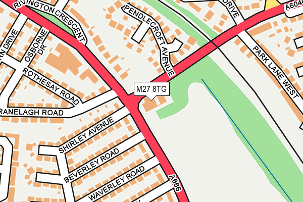
M27 8TG is located in the Swinton Park electoral ward, within the metropolitan district of Salford and the English Parliamentary constituency of Salford and Eccles. The Sub Integrated Care Board (ICB) Location is NHS Greater Manchester ICB - 01G and the police force is Greater Manchester. This postcode has been in use since May 1994.


GetTheData
Source: OS OpenMap – Local (Ordnance Survey)
Source: OS VectorMap District (Ordnance Survey)
Licence: Open Government Licence (requires attribution)
| Easting | 379388 |
| Northing | 401321 |
| Latitude | 53.508184 |
| Longitude | -2.312257 |
GetTheData
Source: Open Postcode Geo
Licence: Open Government Licence
| Country | England |
| Postcode District | M27 |
| ➜ M27 open data dashboard ➜ See where M27 is on a map ➜ Where is Pendlebury? | |
GetTheData
Source: Land Registry Price Paid Data
Licence: Open Government Licence
Elevation or altitude of M27 8TG as distance above sea level:
| Metres | Feet | |
|---|---|---|
| Elevation | 70m | 230ft |
Elevation is measured from the approximate centre of the postcode, to the nearest point on an OS contour line from OS Terrain 50, which has contour spacing of ten vertical metres.
➜ How high above sea level am I? Find the elevation of your current position using your device's GPS.
GetTheData
Source: Open Postcode Elevation
Licence: Open Government Licence
| Ward | Swinton Park |
| Constituency | Salford And Eccles |
GetTheData
Source: ONS Postcode Database
Licence: Open Government Licence
| May 2021 | Violence and sexual offences | On or near Agecroft Road | 418m |
| ➜ Get more crime data in our Crime section | |||
GetTheData
Source: data.police.uk
Licence: Open Government Licence
| Bolton Rd/Agecroft Rd (Bolton Rd) | Pendlebury | 66m |
| Bolton Rd/Agecroft Rd (Bolton Rd) | Pendlebury | 131m |
| Bolton Rd/Westwood Dr (Bolton Rd) | Pendlebury | 213m |
| Bolton Rd/Rivington Cres (Bolton Rd) | Pendlebury | 232m |
| Bolton Rd/Westwood Dr (Bolton Rd) | Pendlebury | 246m |
| Clifton (Manchester) Station | 1.6km |
| Swinton (Manchester) Station | 1.8km |
| Moorside Station | 2.8km |
GetTheData
Source: NaPTAN
Licence: Open Government Licence
GetTheData
Source: ONS Postcode Database
Licence: Open Government Licence


➜ Get more ratings from the Food Standards Agency
GetTheData
Source: Food Standards Agency
Licence: FSA terms & conditions
| Last Collection | |||
|---|---|---|---|
| Location | Mon-Fri | Sat | Distance |
| Agecroft Road | 17:30 | 12:00 | 456m |
| Temple Drive | 17:30 | 12:00 | 943m |
| Swinton P.o. | 18:15 | 12:00 | 1,248m |
GetTheData
Source: Dracos
Licence: Creative Commons Attribution-ShareAlike
| Facility | Distance |
|---|---|
| Rabbit Hills Playing Fields Bolton Road, Pendlebury, Swinton, Manchester Grass Pitches | 296m |
| St Augustines School Playing Field Birch Drive, Pendlebury, Swinton, Manchester Grass Pitches | 648m |
| Langworthy Reds Arlfc Swinton Park Road, Salford Grass Pitches | 778m |
GetTheData
Source: Active Places
Licence: Open Government Licence
| School | Phase of Education | Distance |
|---|---|---|
| St John's CofE Primary School Daisy Bank Avenue, Swinton, Manchester, M27 5FU | Primary | 644m |
| St Augustine's CofE Primary School 380 Bolton Road, Pendlebury, Swinton, Manchester, M27 8UX | Primary | 734m |
| Grosvenor Road Primary School Parkgate Drive, Swinton, Manchester, M27 5LN | Primary | 821m |
GetTheData
Source: Edubase
Licence: Open Government Licence
The below table lists the International Territorial Level (ITL) codes (formerly Nomenclature of Territorial Units for Statistics (NUTS) codes) and Local Administrative Units (LAU) codes for M27 8TG:
| ITL 1 Code | Name |
|---|---|
| TLD | North West (England) |
| ITL 2 Code | Name |
| TLD3 | Greater Manchester |
| ITL 3 Code | Name |
| TLD34 | Greater Manchester South West |
| LAU 1 Code | Name |
| E08000006 | Salford |
GetTheData
Source: ONS Postcode Directory
Licence: Open Government Licence
The below table lists the Census Output Area (OA), Lower Layer Super Output Area (LSOA), and Middle Layer Super Output Area (MSOA) for M27 8TG:
| Code | Name | |
|---|---|---|
| OA | E00028736 | |
| LSOA | E01005673 | Salford 008A |
| MSOA | E02001164 | Salford 008 |
GetTheData
Source: ONS Postcode Directory
Licence: Open Government Licence
| M27 8ST | Frankby Close | 126m |
| M27 8SY | Bolton Road | 135m |
| M27 8TH | Pendlecroft Avenue | 135m |
| M27 8SQ | Pensby Close | 148m |
| M27 8XA | Bolton Road | 152m |
| M27 4HX | Shirley Avenue | 182m |
| M27 4HY | Beverley Road | 193m |
| M27 4HU | Rothesay Road | 208m |
| M27 8TQ | Rivington Crescent | 210m |
| M27 4HZ | Beverley Road | 213m |
GetTheData
Source: Open Postcode Geo; Land Registry Price Paid Data
Licence: Open Government Licence