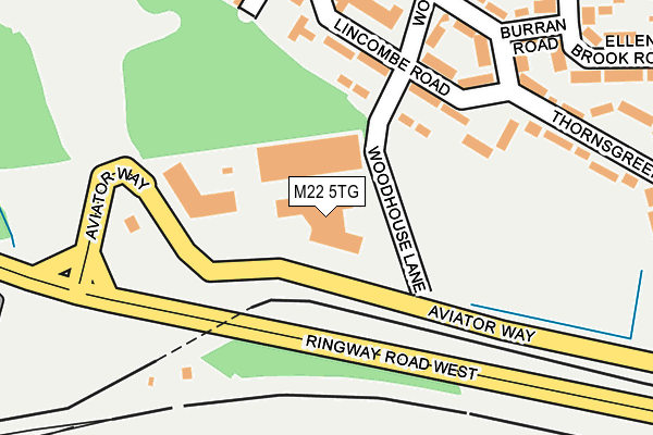
M22 5TG lies on Aviator Way in Manchester. M22 5TG is located in the Woodhouse Park electoral ward, within the metropolitan district of Manchester and the English Parliamentary constituency of Wythenshawe and Sale East. The Sub Integrated Care Board (ICB) Location is NHS Greater Manchester ICB - 14L and the police force is Greater Manchester. This postcode has been in use since June 2002.


GetTheData
Source: OS OpenMap – Local (Ordnance Survey)
Source: OS VectorMap District (Ordnance Survey)
Licence: Open Government Licence (requires attribution)
| Easting | 382457 |
| Northing | 385637 |
| Latitude | 53.367305 |
| Longitude | -2.265104 |
GetTheData
Source: Open Postcode Geo
Licence: Open Government Licence
| Street | Aviator Way |
| Town/City | Manchester |
| Country | England |
| Postcode District | M22 |
| ➜ M22 open data dashboard ➜ See where M22 is on a map ➜ Where is Wythenshawe? | |
GetTheData
Source: Land Registry Price Paid Data
Licence: Open Government Licence
Elevation or altitude of M22 5TG as distance above sea level:
| Metres | Feet | |
|---|---|---|
| Elevation | 70m | 230ft |
Elevation is measured from the approximate centre of the postcode, to the nearest point on an OS contour line from OS Terrain 50, which has contour spacing of ten vertical metres.
➜ How high above sea level am I? Find the elevation of your current position using your device's GPS.
GetTheData
Source: Open Postcode Elevation
Licence: Open Government Licence
| Ward | Woodhouse Park |
| Constituency | Wythenshawe And Sale East |
GetTheData
Source: ONS Postcode Database
Licence: Open Government Licence
| Cornishway/The Red Beret (Cornishway) | Woodhouse Park | 290m |
| Cornishway/The Red Beret (Cornishway) | Woodhouse Park | 313m |
| Cornishway/Brean Walk (Cornishway) | Woodhouse Park | 384m |
| Cornishway/Hilary Rd (Cornishway) | Woodhouse Park | 463m |
| Ringway Rd/Airport Hotel (Ringway Rd) | Manchester Airport | 559m |
| Manchester Airport (Manchester Metrolink) (Terminal Road) | Manchester Airport | 536m |
| Shadowmoss (Manchester Metrolink) (Shadow Moss Road) | Woodhouse Park | 838m |
| Robinswood Road (Manchester Metrolink) (Simonsway) | Wythenshawe | 1,092m |
| Peel Hall (Manchester Metrolink) (Simonsway) | Peel Hall | 1,208m |
| Wythenshawe Town Centre (Manchester Metrolink) (Ainley Road) | Wythenshawe | 1,416m |
| Manchester Airport Station | 0.6km |
| Heald Green Station | 1.9km |
| Styal Station | 2.7km |
GetTheData
Source: NaPTAN
Licence: Open Government Licence
GetTheData
Source: ONS Postcode Database
Licence: Open Government Licence


➜ Get more ratings from the Food Standards Agency
GetTheData
Source: Food Standards Agency
Licence: FSA terms & conditions
| Last Collection | |||
|---|---|---|---|
| Location | Mon-Fri | Sat | Distance |
| Cornishway/Hilary Road | 17:30 | 12:00 | 448m |
| Woodhouse Park P.o. | 17:30 | 12:00 | 583m |
| Terminal 3 Departures | 17:30 | 12:00 | 805m |
GetTheData
Source: Dracos
Licence: Creative Commons Attribution-ShareAlike
| Facility | Distance |
|---|---|
| Livingwell Express Club (Manchester Airport) Outwood Lane, Manchester Airport, Manchester Health and Fitness Gym, Swimming Pool | 374m |
| Crowne Plaza Manchester Airport Ringway Road, Manchester Airport, Manchester Swimming Pool, Health and Fitness Gym | 388m |
| Clayton Hotel Manchester Airport Outwood Lane, Manchester Airport, Manchester Health and Fitness Gym | 400m |
GetTheData
Source: Active Places
Licence: Open Government Licence
| School | Phase of Education | Distance |
|---|---|---|
| Ringway Primary School Rossett Avenue, Cornishway, Wythenshawe, Manchester, M22 0WW | Primary | 437m |
| St Anthony's Catholic Primary School Dunkery Road, Woodhouse Park, Manchester, M22 0NT | Primary | 742m |
| The Willows Primary School Tayfield Road, Woodhouse Park, Manchester, M22 1BQ | Primary | 928m |
GetTheData
Source: Edubase
Licence: Open Government Licence
The below table lists the International Territorial Level (ITL) codes (formerly Nomenclature of Territorial Units for Statistics (NUTS) codes) and Local Administrative Units (LAU) codes for M22 5TG:
| ITL 1 Code | Name |
|---|---|
| TLD | North West (England) |
| ITL 2 Code | Name |
| TLD3 | Greater Manchester |
| ITL 3 Code | Name |
| TLD33 | Manchester |
| LAU 1 Code | Name |
| E08000003 | Manchester |
GetTheData
Source: ONS Postcode Directory
Licence: Open Government Licence
The below table lists the Census Output Area (OA), Lower Layer Super Output Area (LSOA), and Middle Layer Super Output Area (MSOA) for M22 5TG:
| Code | Name | |
|---|---|---|
| OA | E00026937 | |
| LSOA | E01005318 | Manchester 053E |
| MSOA | E02001097 | Manchester 053 |
GetTheData
Source: ONS Postcode Directory
Licence: Open Government Licence
| M22 1QF | Bretton Walk | 117m |
| M22 1QA | Dentdale Walk | 122m |
| M22 1GE | Lenham Walk | 173m |
| M22 1PY | Lincombe Road | 174m |
| M22 1GA | Lincombe Road | 174m |
| M22 1QD | Thornsgreen Road | 197m |
| M22 1PZ | Woodhouse Road | 207m |
| M22 1GB | Thornsgreen Road | 233m |
| M22 1PT | Thaxted Walk | 261m |
| M22 1PX | Felskirk Road | 262m |
GetTheData
Source: Open Postcode Geo; Land Registry Price Paid Data
Licence: Open Government Licence