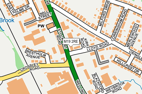
M19 2RE lies on Stockport Road in Manchester. M19 2RE is located in the Levenshulme electoral ward, within the metropolitan district of Manchester and the English Parliamentary constituency of Manchester, Gorton. The Sub Integrated Care Board (ICB) Location is NHS Greater Manchester ICB - 14L and the police force is Greater Manchester. This postcode has been in use since January 1980.


GetTheData
Source: OS OpenMap – Local (Ordnance Survey)
Source: OS VectorMap District (Ordnance Survey)
Licence: Open Government Licence (requires attribution)
| Easting | 387860 |
| Northing | 393263 |
| Latitude | 53.436004 |
| Longitude | -2.184203 |
GetTheData
Source: Open Postcode Geo
Licence: Open Government Licence
| Street | Stockport Road |
| Town/City | Manchester |
| Country | England |
| Postcode District | M19 |
| ➜ M19 open data dashboard ➜ See where M19 is on a map ➜ Where is Manchester? | |
GetTheData
Source: Land Registry Price Paid Data
Licence: Open Government Licence
Elevation or altitude of M19 2RE as distance above sea level:
| Metres | Feet | |
|---|---|---|
| Elevation | 60m | 197ft |
Elevation is measured from the approximate centre of the postcode, to the nearest point on an OS contour line from OS Terrain 50, which has contour spacing of ten vertical metres.
➜ How high above sea level am I? Find the elevation of your current position using your device's GPS.
GetTheData
Source: Open Postcode Elevation
Licence: Open Government Licence
| Ward | Levenshulme |
| Constituency | Manchester, Gorton |
GetTheData
Source: ONS Postcode Database
Licence: Open Government Licence
| Lloyd Rd/Stockport Rd (Lloyd Rd) | Levenshulme | 43m |
| Stockport Rd/Lloyd Rd (Stockport Rd) | Levenshulme | 67m |
| Crossley Rd/Wellington Rd Nth (Crossley Rd) | Heaton Chapel | 109m |
| Stockport Road | Levenshulme | 114m |
| Wellington Rd North/Mcvities (Wellington Rd N) | Heaton Chapel | 132m |
| Levenshulme Station | 1.1km |
| Heaton Chapel Station | 1.2km |
| Reddish South Station | 1.7km |
GetTheData
Source: NaPTAN
Licence: Open Government Licence
| Median download speed | 46.6Mbps |
| Average download speed | 47.2Mbps |
| Maximum download speed | 80.00Mbps |
| Median upload speed | 11.2Mbps |
| Average upload speed | 11.2Mbps |
| Maximum upload speed | 20.00Mbps |
GetTheData
Source: Ofcom
Licence: Ofcom Terms of Use (requires attribution)
GetTheData
Source: ONS Postcode Database
Licence: Open Government Licence


➜ Get more ratings from the Food Standards Agency
GetTheData
Source: Food Standards Agency
Licence: FSA terms & conditions
| Last Collection | |||
|---|---|---|---|
| Location | Mon-Fri | Sat | Distance |
| 30 Lloyd Road / Cringle Road | 17:30 | 12:00 | 173m |
| Roxton Road | 17:30 | 12:00 | 407m |
| South Levenshulme P.o. | 17:30 | 12:00 | 414m |
GetTheData
Source: Dracos
Licence: Creative Commons Attribution-ShareAlike
| Facility | Distance |
|---|---|
| Jetts Levenshulme Stockport Road, Manchester Health and Fitness Gym | 56m |
| Cringle Park & Playing Fields Crossley Road, Heaton Chapel, Stockport Grass Pitches, Outdoor Tennis Courts | 531m |
| Marbury Road (Closed) Marbury Road, Stockport Grass Pitches | 697m |
GetTheData
Source: Active Places
Licence: Open Government Licence
| School | Phase of Education | Distance |
|---|---|---|
| St Andrew's CofE Primary School Broom Avenue, Levenshulme, Manchester, M19 2UH | Primary | 550m |
| St Mary's RC Primary School Manchester Clare Road, Levenshulme, Manchester, M19 2QW | Primary | 627m |
| Levenshulme High School Crossley Road, Levenshulme, Manchester, M19 1FS | Secondary | 768m |
GetTheData
Source: Edubase
Licence: Open Government Licence
The below table lists the International Territorial Level (ITL) codes (formerly Nomenclature of Territorial Units for Statistics (NUTS) codes) and Local Administrative Units (LAU) codes for M19 2RE:
| ITL 1 Code | Name |
|---|---|
| TLD | North West (England) |
| ITL 2 Code | Name |
| TLD3 | Greater Manchester |
| ITL 3 Code | Name |
| TLD33 | Manchester |
| LAU 1 Code | Name |
| E08000003 | Manchester |
GetTheData
Source: ONS Postcode Directory
Licence: Open Government Licence
The below table lists the Census Output Area (OA), Lower Layer Super Output Area (LSOA), and Middle Layer Super Output Area (MSOA) for M19 2RE:
| Code | Name | |
|---|---|---|
| OA | E00026437 | |
| LSOA | E01005215 | Manchester 034C |
| MSOA | E02001078 | Manchester 034 |
GetTheData
Source: ONS Postcode Directory
Licence: Open Government Licence
| M19 2RH | Kirk Road | 37m |
| M19 2RA | Stockport Road | 58m |
| SK4 5BA | Wellington Road North | 69m |
| M19 2RN | Cringle Road | 88m |
| M19 2QB | Lloyd Road | 96m |
| M19 2QX | Lloyd Road | 114m |
| M19 2RF | Lloyd Road | 121m |
| M19 2RP | Cringle Road | 132m |
| M19 2QZ | Lloyd Road | 138m |
| SK4 5BE | Westholm Avenue | 140m |
GetTheData
Source: Open Postcode Geo; Land Registry Price Paid Data
Licence: Open Government Licence