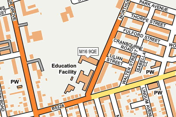
M16 9QE is located in the Old Trafford electoral ward, within the metropolitan district of Trafford and the English Parliamentary constituency of Stretford and Urmston. The Sub Integrated Care Board (ICB) Location is NHS Greater Manchester ICB - 02A and the police force is Greater Manchester. This postcode has been in use since January 1980.


GetTheData
Source: OS OpenMap – Local (Ordnance Survey)
Source: OS VectorMap District (Ordnance Survey)
Licence: Open Government Licence (requires attribution)
| Easting | 382026 |
| Northing | 395840 |
| Latitude | 53.458999 |
| Longitude | -2.272167 |
GetTheData
Source: Open Postcode Geo
Licence: Open Government Licence
| Country | England |
| Postcode District | M16 |
| ➜ M16 open data dashboard ➜ See where M16 is on a map ➜ Where is Old Trafford? | |
GetTheData
Source: Land Registry Price Paid Data
Licence: Open Government Licence
Elevation or altitude of M16 9QE as distance above sea level:
| Metres | Feet | |
|---|---|---|
| Elevation | 30m | 98ft |
Elevation is measured from the approximate centre of the postcode, to the nearest point on an OS contour line from OS Terrain 50, which has contour spacing of ten vertical metres.
➜ How high above sea level am I? Find the elevation of your current position using your device's GPS.
GetTheData
Source: Open Postcode Elevation
Licence: Open Government Licence
| Ward | Old Trafford |
| Constituency | Stretford And Urmston |
GetTheData
Source: ONS Postcode Database
Licence: Open Government Licence
| February 2022 | Violence and sexual offences | On or near Thorpe Street | 242m |
| November 2021 | Violence and sexual offences | On or near Talbot Place | 377m |
| ➜ Get more crime data in our Crime section | |||
GetTheData
Source: data.police.uk
Licence: Open Government Licence
| Seymour Grove/Trafford Plaza (Seymour Grove) | Firswood | 223m |
| Seymour Grove/Ayres Road (Seymour Grove) | Firswood | 238m |
| Seymour Grove/Ayres Road (Seymour Grove) | Firswood | 287m |
| Seymour Grove/Paragon House (Seymour Grove) | Firswood | 294m |
| Seymour Grove/Trafford Bar (Seymour Grove) | Trafford Bar | 361m |
| Trafford Bar (Manchester Metrolink) (Seymour Grove) | Trafford Bar | 449m |
| Pomona (Manchester Metrolink) (Pomona Strand) | Salford Quays | 795m |
| Old Trafford (Manchester Metrolink) (Trafford Park Road) | Old Trafford | 906m |
| Firswood Station (Manchester Metrolink) (Rye Bank Road) | Firswood | 935m |
| Exchange Quay (Manchester Metrolink) (Exchange Quay) | Salford Quays | 1,143m |
| Manchester United FC Station | 1.3km |
| Deansgate Station | 2.2km |
| Trafford Park Station | 2.6km |
GetTheData
Source: NaPTAN
Licence: Open Government Licence
GetTheData
Source: ONS Postcode Database
Licence: Open Government Licence


➜ Get more ratings from the Food Standards Agency
GetTheData
Source: Food Standards Agency
Licence: FSA terms & conditions
| Last Collection | |||
|---|---|---|---|
| Location | Mon-Fri | Sat | Distance |
| Seymour Grove / Tennis Street | 17:30 | 11:45 | 318m |
| Ayres Road P.o. | 17:30 | 12:00 | 372m |
| Seymour Grove | 17:30 | 12:00 | 492m |
GetTheData
Source: Dracos
Licence: Creative Commons Attribution-ShareAlike
| Facility | Distance |
|---|---|
| Seymour Park Seymour Grove, Old Trafford Grass Pitches | 92m |
| Old Trafford Sports Barn St Hildas Road, Old Trafford Sports Hall, Artificial Grass Pitch | 172m |
| Kings Road Primary School Kings Road, Kings Road, Old Trafford, Manchester Grass Pitches | 722m |
GetTheData
Source: Active Places
Licence: Open Government Licence
| School | Phase of Education | Distance |
|---|---|---|
| Seymour Park Community Primary School Northumberland Road, Old Trafford, Manchester, M16 9QE | Primary | 72m |
| Afifah School 86 Clifton Street, Old Trafford, Manchester, M16 9GN | Not applicable | 719m |
| Kings Road Primary School Kings Road, Firswood, Manchester, M16 0GR | Primary | 722m |
GetTheData
Source: Edubase
Licence: Open Government Licence
The below table lists the International Territorial Level (ITL) codes (formerly Nomenclature of Territorial Units for Statistics (NUTS) codes) and Local Administrative Units (LAU) codes for M16 9QE:
| ITL 1 Code | Name |
|---|---|
| TLD | North West (England) |
| ITL 2 Code | Name |
| TLD3 | Greater Manchester |
| ITL 3 Code | Name |
| TLD34 | Greater Manchester South West |
| LAU 1 Code | Name |
| E08000009 | Trafford |
GetTheData
Source: ONS Postcode Directory
Licence: Open Government Licence
The below table lists the Census Output Area (OA), Lower Layer Super Output Area (LSOA), and Middle Layer Super Output Area (MSOA) for M16 9QE:
| Code | Name | |
|---|---|---|
| OA | E00031376 | |
| LSOA | E01006188 | Trafford 001F |
| MSOA | E02001259 | Trafford 001 |
GetTheData
Source: ONS Postcode Directory
Licence: Open Government Licence
| M16 9GD | Northumberland Road | 67m |
| M16 9PY | Northumberland Road | 111m |
| M16 9QD | Lillian Street | 111m |
| M16 9QF | Ayres Road | 115m |
| M16 9WR | Ayres Road | 148m |
| M16 9QA | Cranbourne Road | 150m |
| M16 9GB | Walter Street | 155m |
| M16 9GE | Ayres Road | 159m |
| M16 9NR | Ayres Road | 177m |
| M16 9PZ | Cranbourne Road | 179m |
GetTheData
Source: Open Postcode Geo; Land Registry Price Paid Data
Licence: Open Government Licence