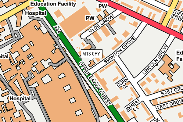
M13 0FY is located in the Ardwick electoral ward, within the metropolitan district of Manchester and the English Parliamentary constituency of Manchester Central. The Sub Integrated Care Board (ICB) Location is NHS Greater Manchester ICB - 14L and the police force is Greater Manchester. This postcode has been in use since January 1980.


GetTheData
Source: OS OpenMap – Local (Ordnance Survey)
Source: OS VectorMap District (Ordnance Survey)
Licence: Open Government Licence (requires attribution)
| Easting | 385271 |
| Northing | 396212 |
| Latitude | 53.462444 |
| Longitude | -2.223313 |
GetTheData
Source: Open Postcode Geo
Licence: Open Government Licence
| Country | England |
| Postcode District | M13 |
| ➜ M13 open data dashboard ➜ See where M13 is on a map ➜ Where is Manchester? | |
GetTheData
Source: Land Registry Price Paid Data
Licence: Open Government Licence
Elevation or altitude of M13 0FY as distance above sea level:
| Metres | Feet | |
|---|---|---|
| Elevation | 40m | 131ft |
Elevation is measured from the approximate centre of the postcode, to the nearest point on an OS contour line from OS Terrain 50, which has contour spacing of ten vertical metres.
➜ How high above sea level am I? Find the elevation of your current position using your device's GPS.
GetTheData
Source: Open Postcode Elevation
Licence: Open Government Licence
| Ward | Ardwick |
| Constituency | Manchester Central |
GetTheData
Source: ONS Postcode Database
Licence: Open Government Licence
| May 2022 | Violence and sexual offences | On or near Upper Brook Street | 378m |
| ➜ Get more crime data in our Crime section | |||
GetTheData
Source: data.police.uk
Licence: Open Government Licence
| Upper Brook St/Swinton Gr (Upper Brook St) | Chorlton Upon Medlock | 41m |
| Upper Brook St/Swinton Gr (Upper Brook St) | Chorlton Upon Medlock | 60m |
| Plymouth Gr/Hyde Gr (Plymouth Gr) | Chorlton Upon Medlock | 193m |
| Plymouth Gr/Hyde Gr (Plymouth Gr) | Chorlton Upon Medlock | 205m |
| Upper Brook St/Grafton St (Upper Brook St) | Chorlton Upon Medlock | 214m |
| Ardwick Station | 1.2km |
| Manchester Piccadilly Station | 1.7km |
| Manchester Oxford Road Station | 1.8km |
GetTheData
Source: NaPTAN
Licence: Open Government Licence
| Percentage of properties with Next Generation Access | 100.0% |
| Percentage of properties with Superfast Broadband | 100.0% |
| Percentage of properties with Ultrafast Broadband | 0.0% |
| Percentage of properties with Full Fibre Broadband | 0.0% |
Superfast Broadband is between 30Mbps and 300Mbps
Ultrafast Broadband is > 300Mbps
| Percentage of properties unable to receive 2Mbps | 0.0% |
| Percentage of properties unable to receive 5Mbps | 0.0% |
| Percentage of properties unable to receive 10Mbps | 0.0% |
| Percentage of properties unable to receive 30Mbps | 0.0% |
GetTheData
Source: Ofcom
Licence: Ofcom Terms of Use (requires attribution)
GetTheData
Source: ONS Postcode Database
Licence: Open Government Licence


➜ Get more ratings from the Food Standards Agency
GetTheData
Source: Food Standards Agency
Licence: FSA terms & conditions
| Last Collection | |||
|---|---|---|---|
| Location | Mon-Fri | Sat | Distance |
| Lorne Street | 17:30 | 12:00 | 65m |
| York Place | 17:30 | 12:00 | 237m |
| Carmoor Road | 17:30 | 12:00 | 300m |
GetTheData
Source: Dracos
Licence: Creative Commons Attribution-ShareAlike
| Facility | Distance |
|---|---|
| Momentum Leisure Club (Manchester) (Closed) Hathersage Road, Manchester Swimming Pool, Health and Fitness Gym | 436m |
| Victoria Baths Hathersage Road, Manchester Swimming Pool | 528m |
| Manchester Academy Moss Lane East, Manchester Sports Hall, Artificial Grass Pitch, Grass Pitches | 755m |
GetTheData
Source: Active Places
Licence: Open Government Licence
| School | Phase of Education | Distance |
|---|---|---|
| St Chrysostom's CofE Primary School Lincoln Grove, Chorlton-on-Medlock, Manchester, M13 0DX | Primary | 227m |
| Manchester Hospital School 3rd Floor School, Royal Manchester Children's Hospital, Oxford Road, Manchester, M13 9WL | Not applicable | 237m |
| Xaverian College Lower Park Road, Manchester, M14 5RB | 16 plus | 778m |
GetTheData
Source: Edubase
Licence: Open Government Licence
The below table lists the International Territorial Level (ITL) codes (formerly Nomenclature of Territorial Units for Statistics (NUTS) codes) and Local Administrative Units (LAU) codes for M13 0FY:
| ITL 1 Code | Name |
|---|---|
| TLD | North West (England) |
| ITL 2 Code | Name |
| TLD3 | Greater Manchester |
| ITL 3 Code | Name |
| TLD33 | Manchester |
| LAU 1 Code | Name |
| E08000003 | Manchester |
GetTheData
Source: ONS Postcode Directory
Licence: Open Government Licence
The below table lists the Census Output Area (OA), Lower Layer Super Output Area (LSOA), and Middle Layer Super Output Area (MSOA) for M13 0FY:
| Code | Name | |
|---|---|---|
| OA | E00025633 | |
| LSOA | E01033652 | Manchester 022F |
| MSOA | E02001066 | Manchester 022 |
GetTheData
Source: ONS Postcode Directory
Licence: Open Government Licence
| M13 0FU | Swinton Grove | 59m |
| M13 0HL | Upper Brook Street | 86m |
| M13 0EU | Swinton Grove | 102m |
| M13 9LQ | Hyde Grove | 115m |
| M13 0EB | Corn Close | 138m |
| M13 0DY | Carmoor Road | 166m |
| M13 0ED | Wheat Close | 220m |
| M13 9EE | Radlett Walk | 228m |
| M13 9EF | Dulford Walk | 240m |
| M13 0EA | Carmoor Road | 243m |
GetTheData
Source: Open Postcode Geo; Land Registry Price Paid Data
Licence: Open Government Licence