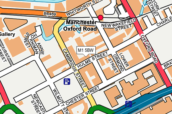
M1 5BW is located in the Deansgate electoral ward, within the metropolitan district of Manchester and the English Parliamentary constituency of Manchester Central. The Sub Integrated Care Board (ICB) Location is NHS Greater Manchester ICB - 14L and the police force is Greater Manchester. This postcode has been in use since June 2005.


GetTheData
Source: OS OpenMap – Local (Ordnance Survey)
Source: OS VectorMap District (Ordnance Survey)
Licence: Open Government Licence (requires attribution)
| Easting | 383976 |
| Northing | 397344 |
| Latitude | 53.472598 |
| Longitude | -2.242874 |
GetTheData
Source: Open Postcode Geo
Licence: Open Government Licence
| Country | England |
| Postcode District | M1 |
➜ See where M1 is on a map ➜ Where is Manchester? | |
GetTheData
Source: Land Registry Price Paid Data
Licence: Open Government Licence
Elevation or altitude of M1 5BW as distance above sea level:
| Metres | Feet | |
|---|---|---|
| Elevation | 30m | 98ft |
Elevation is measured from the approximate centre of the postcode, to the nearest point on an OS contour line from OS Terrain 50, which has contour spacing of ten vertical metres.
➜ How high above sea level am I? Find the elevation of your current position using your device's GPS.
GetTheData
Source: Open Postcode Elevation
Licence: Open Government Licence
| Ward | Deansgate |
| Constituency | Manchester Central |
GetTheData
Source: ONS Postcode Database
Licence: Open Government Licence
| Cambridge St/Chester St (Cambridge St) | Manchester City Centre | 76m |
| Cambridge St/Hulme St (Cambridge St) | Manchester City Centre | 108m |
| Chester St/Oxford Rd (Chester St) | Manchester City Centre | 135m |
| Whitworth St/Gloucester St (Whitworth St We) | Manchester City Centre | 193m |
| Oxford Road Stn (Oxford Road) | Manchester City Centre | 198m |
| Deansgate-castlefield (Manchester Metrolink) (Whitworth Street West) | Manchester City Centre | 610m |
| St Peters Square (Manchester Metrolink) (Peter Street) | Manchester City Centre | 625m |
| Piccadilly (Manchester Metrolink) (London Road) | Manchester City Centre | 913m |
| Piccadilly Gardens (Manchester Metrolink) (Portland Street) | Piccadilly Gardens | 932m |
| Market Street (Manchester Metrolink) (Market Street) | Manchester City Centre | 1,069m |
| Manchester Oxford Road Station | 0.2km |
| Deansgate Station | 0.6km |
| Manchester Piccadilly Station | 1km |
GetTheData
Source: NaPTAN
Licence: Open Government Licence
| Percentage of properties with Next Generation Access | 100.0% |
| Percentage of properties with Superfast Broadband | 100.0% |
| Percentage of properties with Ultrafast Broadband | 0.0% |
| Percentage of properties with Full Fibre Broadband | 0.0% |
Superfast Broadband is between 30Mbps and 300Mbps
Ultrafast Broadband is > 300Mbps
| Percentage of properties unable to receive 2Mbps | 0.0% |
| Percentage of properties unable to receive 5Mbps | 0.0% |
| Percentage of properties unable to receive 10Mbps | 0.0% |
| Percentage of properties unable to receive 30Mbps | 0.0% |
GetTheData
Source: Ofcom
Licence: Ofcom Terms of Use (requires attribution)
GetTheData
Source: ONS Postcode Database
Licence: Open Government Licence


➜ Get more ratings from the Food Standards Agency
GetTheData
Source: Food Standards Agency
Licence: FSA terms & conditions
| Last Collection | |||
|---|---|---|---|
| Location | Mon-Fri | Sat | Distance |
| Hulme Street/Oxford Street | 19:00 | 12:00 | 204m |
| Oxford Road Station | 19:00 | 12:00 | 245m |
| City Road East | 17:30 | 12:00 | 383m |
GetTheData
Source: Dracos
Licence: Creative Commons Attribution-ShareAlike
| Risk of M1 5BW flooding from rivers and sea | Low |
| ➜ M1 5BW flood map | |
GetTheData
Source: Open Flood Risk by Postcode
Licence: Open Government Licence
The below table lists the International Territorial Level (ITL) codes (formerly Nomenclature of Territorial Units for Statistics (NUTS) codes) and Local Administrative Units (LAU) codes for M1 5BW:
| ITL 1 Code | Name |
|---|---|
| TLD | North West (England) |
| ITL 2 Code | Name |
| TLD3 | Greater Manchester |
| ITL 3 Code | Name |
| TLD33 | Manchester |
| LAU 1 Code | Name |
| E08000003 | Manchester |
GetTheData
Source: ONS Postcode Directory
Licence: Open Government Licence
The below table lists the Census Output Area (OA), Lower Layer Super Output Area (LSOA), and Middle Layer Super Output Area (MSOA) for M1 5BW:
| Code | Name | |
|---|---|---|
| OA | E00176062 | |
| LSOA | E01033662 | Manchester 057C |
| MSOA | E02006914 | Manchester 057 |
GetTheData
Source: ONS Postcode Directory
Licence: Open Government Licence
| M1 5BY | Cambridge Street | 39m |
| M1 5BZ | Cambridge Street | 39m |
| M1 5TF | Lower Chatham Street | 51m |
| M1 5GL | Hulme Street | 58m |
| M1 5AL | Great Marlborough Street | 60m |
| M1 5BG | River Street | 82m |
| M1 5QG | Lower Ormond Street | 85m |
| M1 5BB | River Street | 94m |
| M1 5GF | Cambridge Street | 99m |
| M1 5GG | Cambridge Street | 102m |
GetTheData
Source: Open Postcode Geo; Land Registry Price Paid Data
Licence: Open Government Licence