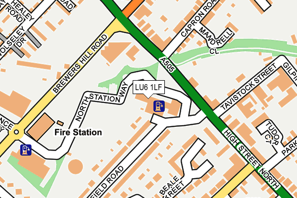
LU6 1LF is located in the Dunstable North electoral ward, within the unitary authority of Central Bedfordshire and the English Parliamentary constituency of South West Bedfordshire. The Sub Integrated Care Board (ICB) Location is NHS Bedfordshire, Luton and Milton Keynes ICB - M1J4Y and the police force is Bedfordshire. This postcode has been in use since January 1980.


GetTheData
Source: OS OpenMap – Local (Ordnance Survey)
Source: OS VectorMap District (Ordnance Survey)
Licence: Open Government Licence (requires attribution)
| Easting | 501160 |
| Northing | 222568 |
| Latitude | 51.892502 |
| Longitude | -0.531355 |
GetTheData
Source: Open Postcode Geo
Licence: Open Government Licence
| Country | England |
| Postcode District | LU6 |
| ➜ LU6 open data dashboard ➜ See where LU6 is on a map ➜ Where is Dunstable? | |
GetTheData
Source: Land Registry Price Paid Data
Licence: Open Government Licence
Elevation or altitude of LU6 1LF as distance above sea level:
| Metres | Feet | |
|---|---|---|
| Elevation | 140m | 459ft |
Elevation is measured from the approximate centre of the postcode, to the nearest point on an OS contour line from OS Terrain 50, which has contour spacing of ten vertical metres.
➜ How high above sea level am I? Find the elevation of your current position using your device's GPS.
GetTheData
Source: Open Postcode Elevation
Licence: Open Government Licence
| Ward | Dunstable North |
| Constituency | South West Bedfordshire |
GetTheData
Source: ONS Postcode Database
Licence: Open Government Licence
| January 2024 | Vehicle crime | On or near Parking Area | 76m |
| January 2024 | Violence and sexual offences | On or near Tudor Court | 253m |
| December 2023 | Vehicle crime | On or near Parking Area | 76m |
| ➜ Get more crime data in our Crime section | |||
GetTheData
Source: data.police.uk
Licence: Open Government Licence
| District Council Offices (High Street North) | Dunstable | 80m |
| Park Street (High Street North) | Dunstable | 152m |
| Northfields (Houghton Road) | Dunstable | 241m |
| Park Street (High Street North) | Dunstable | 288m |
| Northfields (Houghton Road) | Dunstable | 313m |
| Leagrave Station | 5.2km |
GetTheData
Source: NaPTAN
Licence: Open Government Licence
GetTheData
Source: ONS Postcode Database
Licence: Open Government Licence


➜ Get more ratings from the Food Standards Agency
GetTheData
Source: Food Standards Agency
Licence: FSA terms & conditions
| Last Collection | |||
|---|---|---|---|
| Location | Mon-Fri | Sat | Distance |
| High Street North | 16:15 | 12:00 | 85m |
| Chiltern Road | 17:00 | 11:30 | 229m |
| George Street | 16:30 | 11:45 | 353m |
GetTheData
Source: Dracos
Licence: Creative Commons Attribution-ShareAlike
| Facility | Distance |
|---|---|
| Olma Road (Closed) Olma Road, Dunstable Grass Pitches | 310m |
| Ashton Middle School (Closed) High Street North, Dunstable Swimming Pool, Sports Hall, Artificial Grass Pitch | 510m |
| Creasey Park Community Football Centre Creasey Park Drive, Dunstable Grass Pitches, Artificial Grass Pitch, Cycling | 535m |
GetTheData
Source: Active Places
Licence: Open Government Licence
| School | Phase of Education | Distance |
|---|---|---|
| All Saints Academy Dunstable Houghton Road, Dunstable, LU5 5AB | Secondary | 420m |
| Westfield Nursery School Westfield Road, Dunstable, LU6 1DL | Nursery | 654m |
| Beecroft Academy Westfield Road, Dunstable, LU6 1DW | Primary | 716m |
GetTheData
Source: Edubase
Licence: Open Government Licence
The below table lists the International Territorial Level (ITL) codes (formerly Nomenclature of Territorial Units for Statistics (NUTS) codes) and Local Administrative Units (LAU) codes for LU6 1LF:
| ITL 1 Code | Name |
|---|---|
| TLH | East |
| ITL 2 Code | Name |
| TLH2 | Bedfordshire and Hertfordshire |
| ITL 3 Code | Name |
| TLH25 | Central Bedfordshire |
| LAU 1 Code | Name |
| E06000056 | Central Bedfordshire |
GetTheData
Source: ONS Postcode Directory
Licence: Open Government Licence
The below table lists the Census Output Area (OA), Lower Layer Super Output Area (LSOA), and Middle Layer Super Output Area (MSOA) for LU6 1LF:
| Code | Name | |
|---|---|---|
| OA | E00088835 | |
| LSOA | E01017599 | Central Bedfordshire 028F |
| MSOA | E02003646 | Central Bedfordshire 028 |
GetTheData
Source: ONS Postcode Directory
Licence: Open Government Licence
| LU6 1AT | High Street North | 102m |
| LU6 1LZ | Beale Street | 140m |
| LU6 1LB | Beale Street | 145m |
| LU6 1AU | High Street North | 149m |
| LU6 1DN | Westfield Road | 152m |
| LU6 1DH | Westfield Road | 158m |
| LU6 1FN | High Street North | 200m |
| LU6 1ND | Cross Street North | 201m |
| LU5 5GL | Mandrell Close | 201m |
| LU6 1HP | The Parade | 205m |
GetTheData
Source: Open Postcode Geo; Land Registry Price Paid Data
Licence: Open Government Licence