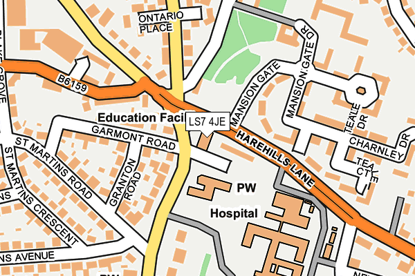
LS7 4JE is located in the Chapel Allerton electoral ward, within the metropolitan district of Leeds and the English Parliamentary constituency of Leeds North East. The Sub Integrated Care Board (ICB) Location is NHS West Yorkshire ICB - 15F and the police force is West Yorkshire. This postcode has been in use since January 1980.


GetTheData
Source: OS OpenMap – Local (Ordnance Survey)
Source: OS VectorMap District (Ordnance Survey)
Licence: Open Government Licence (requires attribution)
| Easting | 430950 |
| Northing | 436507 |
| Latitude | 53.823934 |
| Longitude | -1.531319 |
GetTheData
Source: Open Postcode Geo
Licence: Open Government Licence
| Country | England |
| Postcode District | LS7 |
| ➜ LS7 open data dashboard ➜ See where LS7 is on a map ➜ Where is Leeds? | |
GetTheData
Source: Land Registry Price Paid Data
Licence: Open Government Licence
Elevation or altitude of LS7 4JE as distance above sea level:
| Metres | Feet | |
|---|---|---|
| Elevation | 80m | 262ft |
Elevation is measured from the approximate centre of the postcode, to the nearest point on an OS contour line from OS Terrain 50, which has contour spacing of ten vertical metres.
➜ How high above sea level am I? Find the elevation of your current position using your device's GPS.
GetTheData
Source: Open Postcode Elevation
Licence: Open Government Licence
| Ward | Chapel Allerton |
| Constituency | Leeds North East |
GetTheData
Source: ONS Postcode Database
Licence: Open Government Licence
| November 2023 | Criminal damage and arson | On or near Methley Lane | 432m |
| November 2023 | Vehicle crime | On or near St Martins Drive | 446m |
| August 2023 | Violence and sexual offences | On or near Hospital | 174m |
| ➜ Get more crime data in our Crime section | |||
GetTheData
Source: data.police.uk
Licence: Open Government Licence
| Harehills Lane Harrogate Rd (Harehills Lane) | Chapel Allerton | 60m |
| Chapel Allerton Hospital (Chapeltown Road) | Chapeltown | 161m |
| Chapel Allerton Hospital (Chapeltown Road) | Chapeltown | 165m |
| Harrogate Road Potternewton Ln (Harrogate Road) | Chapel Allerton | 192m |
| Harrogate Rd Potternewton Lane (Harrogate Road) | Chapel Allerton | 228m |
| Burley Park Station | 3.3km |
| Leeds Station | 3.3km |
| Headingley Station | 4.2km |
GetTheData
Source: NaPTAN
Licence: Open Government Licence
GetTheData
Source: ONS Postcode Database
Licence: Open Government Licence


➜ Get more ratings from the Food Standards Agency
GetTheData
Source: Food Standards Agency
Licence: FSA terms & conditions
| Last Collection | |||
|---|---|---|---|
| Location | Mon-Fri | Sat | Distance |
| Newton View/Chapeltown Road | 17:30 | 12:00 | 220m |
| Woodlands | 17:30 | 11:15 | 363m |
| Alberta Avenue | 17:30 | 11:15 | 379m |
GetTheData
Source: Dracos
Licence: Creative Commons Attribution-ShareAlike
| Facility | Distance |
|---|---|
| New Horizon Community School Newton Hill Road, Leeds Sports Hall | 0m |
| Southerns Stadium Roxholme Road, Chapel Allerton, Leeds Grass Pitches, Artificial Grass Pitch | 605m |
| Chapel Allerton Methodist Church Town Street, Chapel Allerton, Leeds Sports Hall | 682m |
GetTheData
Source: Active Places
Licence: Open Government Licence
| School | Phase of Education | Distance |
|---|---|---|
| Al Kauthar Girls Academy Newton Hill House, Newton Hill Road, Leeds, LS7 4JE | Not applicable | 0m |
| Bracken Edge Primary School Bracken Edge Primary School, Newton Garth, Off Newton Road, Leeds, LS7 4HE | Primary | 482m |
| Chapel Allerton Primary School Harrogate Road, Leeds, LS7 3PD | Primary | 528m |
GetTheData
Source: Edubase
Licence: Open Government Licence
The below table lists the International Territorial Level (ITL) codes (formerly Nomenclature of Territorial Units for Statistics (NUTS) codes) and Local Administrative Units (LAU) codes for LS7 4JE:
| ITL 1 Code | Name |
|---|---|
| TLE | Yorkshire and The Humber |
| ITL 2 Code | Name |
| TLE4 | West Yorkshire |
| ITL 3 Code | Name |
| TLE42 | Leeds |
| LAU 1 Code | Name |
| E08000035 | Leeds |
GetTheData
Source: ONS Postcode Directory
Licence: Open Government Licence
The below table lists the Census Output Area (OA), Lower Layer Super Output Area (LSOA), and Middle Layer Super Output Area (MSOA) for LS7 4JE:
| Code | Name | |
|---|---|---|
| OA | E00057198 | |
| LSOA | E01011356 | Leeds 042A |
| MSOA | E02002371 | Leeds 042 |
GetTheData
Source: ONS Postcode Directory
Licence: Open Government Licence
| LS7 4EY | Harehills Lane | 42m |
| LS7 3LN | Harrogate Road | 107m |
| LS7 3LL | Chapeltown Road | 111m |
| LS7 3LZ | Granton Road | 117m |
| LS7 4SX | Mansion Gate | 135m |
| LS7 4SZ | Oldfield Court | 147m |
| LS7 4SY | Mansion Gate Drive | 158m |
| LS7 3LY | Garmont Road | 165m |
| LS7 4SW | Teale Drive | 205m |
| LS7 4LL | Ontario Place | 206m |
GetTheData
Source: Open Postcode Geo; Land Registry Price Paid Data
Licence: Open Government Licence