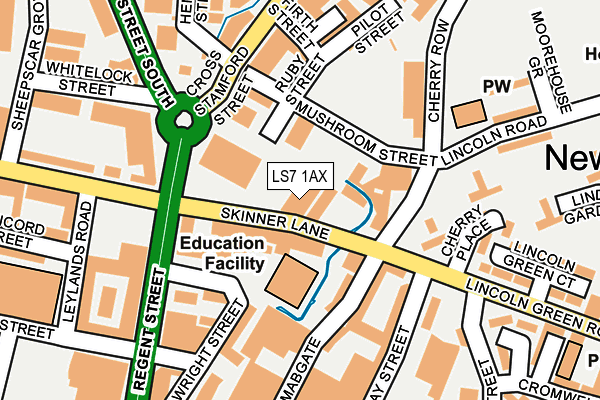
LS7 1AX is located in the Little London & Woodhouse electoral ward, within the metropolitan district of Leeds and the English Parliamentary constituency of Leeds Central. The Sub Integrated Care Board (ICB) Location is NHS West Yorkshire ICB - 15F and the police force is West Yorkshire. This postcode has been in use since January 1980.


GetTheData
Source: OS OpenMap – Local (Ordnance Survey)
Source: OS VectorMap District (Ordnance Survey)
Licence: Open Government Licence (requires attribution)
| Easting | 431007 |
| Northing | 434256 |
| Latitude | 53.803699 |
| Longitude | -1.530679 |
GetTheData
Source: Open Postcode Geo
Licence: Open Government Licence
| Country | England |
| Postcode District | LS7 |
➜ See where LS7 is on a map ➜ Where is Leeds? | |
GetTheData
Source: Land Registry Price Paid Data
Licence: Open Government Licence
Elevation or altitude of LS7 1AX as distance above sea level:
| Metres | Feet | |
|---|---|---|
| Elevation | 30m | 98ft |
Elevation is measured from the approximate centre of the postcode, to the nearest point on an OS contour line from OS Terrain 50, which has contour spacing of ten vertical metres.
➜ How high above sea level am I? Find the elevation of your current position using your device's GPS.
GetTheData
Source: Open Postcode Elevation
Licence: Open Government Licence
| Ward | Little London & Woodhouse |
| Constituency | Leeds Central |
GetTheData
Source: ONS Postcode Database
Licence: Open Government Licence
| Lincoln Green Rd Macauley Street (Lincoln Green Road) | Mabgate | 141m |
| Lincoln Green Rd Cromwell Street (Lincoln Green Road) | Mabgate | 219m |
| Cross Stamford Street Benson St (Cross Stamford Street) | Mabgate | 220m |
| Cross Stamford Street Benson St (Cross Stamford Street) | Mabgate | 221m |
| Byron Street Regent St (Byron Street) | Mabgate | 248m |
| Leeds Station | 1.5km |
| Burley Park Station | 3.2km |
| Headingley Station | 4.5km |
GetTheData
Source: NaPTAN
Licence: Open Government Licence
GetTheData
Source: ONS Postcode Database
Licence: Open Government Licence


➜ Get more ratings from the Food Standards Agency
GetTheData
Source: Food Standards Agency
Licence: FSA terms & conditions
| Last Collection | |||
|---|---|---|---|
| Location | Mon-Fri | Sat | Distance |
| Cherry Row/Lincoln Road | 18:00 | 11:15 | 163m |
| Golden Cross | 18:30 | 11:30 | 294m |
| Benson Street | 300m | ||
GetTheData
Source: Dracos
Licence: Creative Commons Attribution-ShareAlike
| Risk of LS7 1AX flooding from rivers and sea | High |
| ➜ LS7 1AX flood map | |
GetTheData
Source: Open Flood Risk by Postcode
Licence: Open Government Licence
The below table lists the International Territorial Level (ITL) codes (formerly Nomenclature of Territorial Units for Statistics (NUTS) codes) and Local Administrative Units (LAU) codes for LS7 1AX:
| ITL 1 Code | Name |
|---|---|
| TLE | Yorkshire and The Humber |
| ITL 2 Code | Name |
| TLE4 | West Yorkshire |
| ITL 3 Code | Name |
| TLE42 | Leeds |
| LAU 1 Code | Name |
| E08000035 | Leeds |
GetTheData
Source: ONS Postcode Directory
Licence: Open Government Licence
The below table lists the Census Output Area (OA), Lower Layer Super Output Area (LSOA), and Middle Layer Super Output Area (MSOA) for LS7 1AX:
| Code | Name | |
|---|---|---|
| OA | E00170046 | |
| LSOA | E01033031 | Leeds 064E |
| MSOA | E02002393 | Leeds 064 |
GetTheData
Source: ONS Postcode Directory
Licence: Open Government Licence
| LS7 1BE | Skinner Lane | 41m |
| LS7 1BF | Skinner Lane | 45m |
| LS7 1BD | Skinner Lane | 54m |
| LS7 1BB | Skinner Lane | 78m |
| LS7 1BH | Skinner Lane | 82m |
| LS9 7LY | Cherry Row | 98m |
| LS2 7QQ | Millwright Street | 123m |
| LS9 7DR | Mabgate | 131m |
| LS2 7QP | Millwright Street | 134m |
| LS2 7NA | Byron Street | 185m |
GetTheData
Source: Open Postcode Geo; Land Registry Price Paid Data
Licence: Open Government Licence