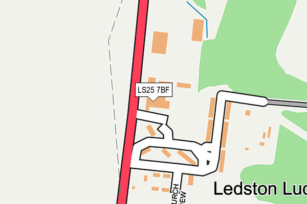
LS25 7BF is located in the Kippax & Methley electoral ward, within the metropolitan district of Leeds and the English Parliamentary constituency of Elmet and Rothwell. The Sub Integrated Care Board (ICB) Location is NHS West Yorkshire ICB - 15F and the police force is West Yorkshire. This postcode has been in use since January 1993.


GetTheData
Source: OS OpenMap – Local (Ordnance Survey)
Source: OS VectorMap District (Ordnance Survey)
Licence: Open Government Licence (requires attribution)
| Easting | 442933 |
| Northing | 430749 |
| Latitude | 53.771320 |
| Longitude | -1.350090 |
GetTheData
Source: Open Postcode Geo
Licence: Open Government Licence
| Country | England |
| Postcode District | LS25 |
| ➜ LS25 open data dashboard ➜ See where LS25 is on a map ➜ Where is Ledston Luck? | |
GetTheData
Source: Land Registry Price Paid Data
Licence: Open Government Licence
Elevation or altitude of LS25 7BF as distance above sea level:
| Metres | Feet | |
|---|---|---|
| Elevation | 80m | 262ft |
Elevation is measured from the approximate centre of the postcode, to the nearest point on an OS contour line from OS Terrain 50, which has contour spacing of ten vertical metres.
➜ How high above sea level am I? Find the elevation of your current position using your device's GPS.
GetTheData
Source: Open Postcode Elevation
Licence: Open Government Licence
| Ward | Kippax & Methley |
| Constituency | Elmet And Rothwell |
GetTheData
Source: ONS Postcode Database
Licence: Open Government Licence
| May 2022 | Violence and sexual offences | On or near Church View | 161m |
| May 2022 | Violence and sexual offences | On or near Church View | 161m |
| May 2022 | Public order | On or near Church View | 161m |
| ➜ Get more crime data in our Crime section | |||
GetTheData
Source: data.police.uk
Licence: Open Government Licence
| Ridge Road Villas (Ridge Road) | Ledston Luck | 91m |
| Ridge Road Villas (Ridge Road) | Ledston Luck | 94m |
| Ridge Road (Ledston Luck) | Ledston Luck | 122m |
| Ridge Road (Ledston Luck) | Ledston Luck | 128m |
| Ledston Luck Cottages | Ledston Luck | 128m |
| Micklefield Station | 2.5km |
| East Garforth Station | 2.7km |
| Garforth Station | 3.5km |
GetTheData
Source: NaPTAN
Licence: Open Government Licence
| Median download speed | 2.0Mbps |
| Average download speed | 2.0Mbps |
| Maximum download speed | 2.91Mbps |
| Median upload speed | 0.6Mbps |
| Average upload speed | 0.6Mbps |
| Maximum upload speed | 0.70Mbps |
GetTheData
Source: Ofcom
Licence: Ofcom Terms of Use (requires attribution)
GetTheData
Source: ONS Postcode Database
Licence: Open Government Licence


➜ Get more ratings from the Food Standards Agency
GetTheData
Source: Food Standards Agency
Licence: FSA terms & conditions
| Last Collection | |||
|---|---|---|---|
| Location | Mon-Fri | Sat | Distance |
| Ledston | 16:15 | 11:00 | 2,195m |
| Ninelands P.o. | 17:30 | 11:45 | 2,398m |
| Micklefield Station | 17:00 | 11:15 | 2,423m |
GetTheData
Source: Dracos
Licence: Creative Commons Attribution-ShareAlike
| Facility | Distance |
|---|---|
| Kippax Welfare Sports & Social Club Longdike Lane, Kippax, Leeds Grass Pitches | 927m |
| Kippax Ash Tree Primary School Gibson Lane, Kippax, Leeds Grass Pitches | 1.1km |
| St Marys Church Hall Church Lane, Kippax, Leeds Sports Hall | 1.4km |
GetTheData
Source: Active Places
Licence: Open Government Licence
| School | Phase of Education | Distance |
|---|---|---|
| Kippax Ash Tree Primary School Gibson Lane, Kippax, Leeds, LS25 7JL | Primary | 1.1km |
| Kippax Greenfield Primary School Ebor Mount, Kippax, Leeds, LS25 7PA | Primary | 1.5km |
| Lady Elizabeth Hastings CofE Primary School Green Lane, Ledston, Castleford, WF10 2BD | Primary | 2km |
GetTheData
Source: Edubase
Licence: Open Government Licence
The below table lists the International Territorial Level (ITL) codes (formerly Nomenclature of Territorial Units for Statistics (NUTS) codes) and Local Administrative Units (LAU) codes for LS25 7BF:
| ITL 1 Code | Name |
|---|---|
| TLE | Yorkshire and The Humber |
| ITL 2 Code | Name |
| TLE4 | West Yorkshire |
| ITL 3 Code | Name |
| TLE42 | Leeds |
| LAU 1 Code | Name |
| E08000035 | Leeds |
GetTheData
Source: ONS Postcode Directory
Licence: Open Government Licence
The below table lists the Census Output Area (OA), Lower Layer Super Output Area (LSOA), and Middle Layer Super Output Area (MSOA) for LS25 7BF:
| Code | Name | |
|---|---|---|
| OA | E00056960 | |
| LSOA | E01011299 | Leeds 088B |
| MSOA | E02002417 | Leeds 088 |
GetTheData
Source: ONS Postcode Directory
Licence: Open Government Licence
| LS25 7BT | The Bungalows | 49m |
| LS25 7BU | Ledston Luck Villas | 108m |
| LS25 7BX | Ledston Luck Cottages | 146m |
| LS25 7NR | Merton Close | 606m |
| LS25 7PZ | Sandgate Rise | 621m |
| LS25 7EY | Sandgate Drive | 662m |
| LS25 7EZ | Keble Garth | 671m |
| LS25 7EX | Sandgate Drive | 710m |
| LS25 7PY | Lincoln Walk | 738m |
| LS25 7NP | Pembroke Rise | 770m |
GetTheData
Source: Open Postcode Geo; Land Registry Price Paid Data
Licence: Open Government Licence