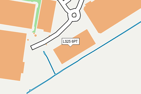
LS25 6PT is located in the Sherburn in Elmet electoral ward, within the unitary authority of North Yorkshire and the English Parliamentary constituency of Selby and Ainsty. The Sub Integrated Care Board (ICB) Location is NHS Humber and North Yorkshire ICB - 03Q and the police force is North Yorkshire. This postcode has been in use since October 2010.


GetTheData
Source: OS OpenMap – Local (Ordnance Survey)
Source: OS VectorMap District (Ordnance Survey)
Licence: Open Government Licence (requires attribution)
| Easting | 451409 |
| Northing | 432820 |
| Latitude | 53.789185 |
| Longitude | -1.221162 |
GetTheData
Source: Open Postcode Geo
Licence: Open Government Licence
| Country | England |
| Postcode District | LS25 |
| ➜ LS25 open data dashboard ➜ See where LS25 is on a map | |
GetTheData
Source: Land Registry Price Paid Data
Licence: Open Government Licence
Elevation or altitude of LS25 6PT as distance above sea level:
| Metres | Feet | |
|---|---|---|
| Elevation | 10m | 33ft |
Elevation is measured from the approximate centre of the postcode, to the nearest point on an OS contour line from OS Terrain 50, which has contour spacing of ten vertical metres.
➜ How high above sea level am I? Find the elevation of your current position using your device's GPS.
GetTheData
Source: Open Postcode Elevation
Licence: Open Government Licence
| Ward | Sherburn In Elmet |
| Constituency | Selby And Ainsty |
GetTheData
Source: ONS Postcode Database
Licence: Open Government Licence
| First Avenue (Aviation Road) | Sherburn In Elmet | 727m |
| Industrial Estate (Aviation Road) | Sherburn In Elmet | 917m |
| The Nurseries (Bishopdyke Road) | Sherburn In Elmet | 951m |
| Mayfield (B1222) | Sherburn In Elmet | 1,031m |
| Maltkiln Cottages (Fenton Lane) | Sherburn In Elmet | 1,149m |
| Sherburn-in-Elmet Station | 1.2km |
| South Milford Station | 2.1km |
| Church Fenton Station | 4.2km |
GetTheData
Source: NaPTAN
Licence: Open Government Licence
GetTheData
Source: ONS Postcode Database
Licence: Open Government Licence


➜ Get more ratings from the Food Standards Agency
GetTheData
Source: Food Standards Agency
Licence: FSA terms & conditions
| Last Collection | |||
|---|---|---|---|
| Location | Mon-Fri | Sat | Distance |
| Common Lane/Mill Lane | 16:15 | 09:45 | 2,000m |
| Highfields | 17:00 | 09:00 | 2,209m |
| South Milford P.o. | 17:30 | 11:00 | 2,350m |
GetTheData
Source: Dracos
Licence: Creative Commons Attribution-ShareAlike
| Facility | Distance |
|---|---|
| Fitness Motion Aviation Road, Sherburn In Elmet, Leeds Health and Fitness Gym, Studio | 721m |
| South Milford Cricket Club Mill Lane, South Milford, Selby Grass Pitches | 1.9km |
| South Milford Afc Mill Lane, South Milford Grass Pitches | 1.9km |
GetTheData
Source: Active Places
Licence: Open Government Licence
| School | Phase of Education | Distance |
|---|---|---|
| Sherburn in Elmet, Athelstan Community Primary School Milford Road, Sherburn-in-Elmet, Leeds, LS25 6QN | Primary | 2km |
| Sherburn Hungate Primary School North Crescent, Sherburn-in-Elmet, Leeds, LS25 6DD | Primary | 2.3km |
| Sherburn High School Garden Lane, Sherburn-in-Elmet, Leeds, LS25 6AS | Secondary | 2.4km |
GetTheData
Source: Edubase
Licence: Open Government Licence
The below table lists the International Territorial Level (ITL) codes (formerly Nomenclature of Territorial Units for Statistics (NUTS) codes) and Local Administrative Units (LAU) codes for LS25 6PT:
| ITL 1 Code | Name |
|---|---|
| TLE | Yorkshire and The Humber |
| ITL 2 Code | Name |
| TLE2 | North Yorkshire |
| ITL 3 Code | Name |
| TLE22 | North Yorkshire CC |
| LAU 1 Code | Name |
| E07000169 | Selby |
GetTheData
Source: ONS Postcode Directory
Licence: Open Government Licence
The below table lists the Census Output Area (OA), Lower Layer Super Output Area (LSOA), and Middle Layer Super Output Area (MSOA) for LS25 6PT:
| Code | Name | |
|---|---|---|
| OA | E00142225 | |
| LSOA | E01027917 | Selby 004E |
| MSOA | E02005812 | Selby 004 |
GetTheData
Source: ONS Postcode Directory
Licence: Open Government Licence
| LS25 6NG | Swordfish Way | 491m |
| LS25 6NW | Spitfire Way | 606m |
| LS25 6ES | Moor Lane Trading Estate | 614m |
| LS25 6NB | Aviation Road | 639m |
| LS25 6PD | First Avenue | 640m |
| LS25 6NF | Blackburn Industrial Estate | 786m |
| LS25 6JE | Lennerton Lane | 806m |
| LS25 6FB | Moxon Way | 892m |
| LS25 6JL | Bishopdyke Road | 1015m |
| LS25 6EW | Bishopdyke Road | 1162m |
GetTheData
Source: Open Postcode Geo; Land Registry Price Paid Data
Licence: Open Government Licence